
Map of The First Mexican Empire At Its Greatest Extent 1821-23
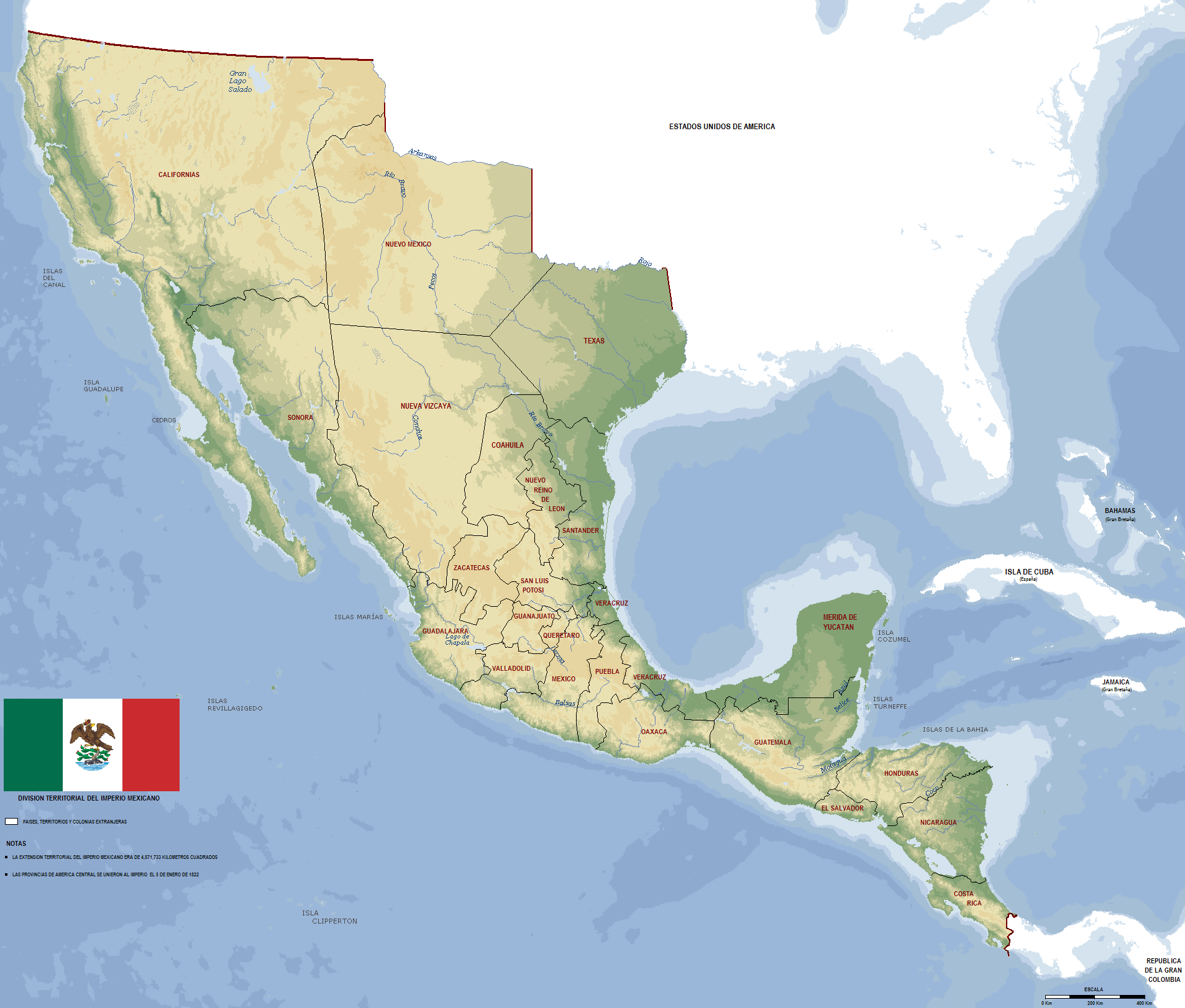
The map above shows the short lived First Mexican Empire [Imperio Mexicano (Spanish) / Imperium Mexicanum (Latin)] at its greatest extent between 1821 and 1823.
Not only did it include modern day Mexico, but also the area now occupied by some or all of California, Texas, Nevada, Utah, Arizona, New Mexico, Colorado, Wyoming, Oklahoma and Kansas.
And the following Central American countries: Guatemala, El Salvador, Honduras, Nicaragua and Costa Rica.
Here’s a breif history of the First Mexican Empire (1821–1823):
Mexico Safety Travel Advisories From The US Department of State (2024)

The colors represent different levels of caution:
- Green: Normal Caution
- Yellow: Increased Caution
- Orange: Reconsider Travel
- Red: Do Not Travel
It was accurate at the time of publication (June 2024), but advisories may have since changed. For the latest visit the official Mexico Travel Advisory page here.
Here’s what the Department of State has to say about their reasons: