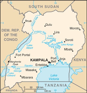
Uganda Location Map
Uganda Facts
Full Official Name: Republic of Uganda
Demonym: Ugandan
Flag:
Area
Total Area: 241,038 km²
Total Land Area: 197,100 km²
Total Water Area: 43,938 km²
Demographics
Population: 49,283,041
Population Growth Rate: 3.18% (2024 est.)
Largest City: Kampala (Population: 1,680,600)
Ethnic Groups: Baganda 16.5%, Banyankole 9.6%, Basoga 8.8%, Bakiga 7.1%, Iteso 7%, Langi 6.3%, Bagisu 4.9%, Acholi 4.4%, Lugbara 3.3%, other 32.1% (2014 est.)
Languages: English (official), Ganda or Luganda (most widely used of the Niger-Congo languages and the language used most often in the capital), other Niger-Congo languages, Nilo-Saharan languages, Swahili (official), Arabic
Religions: Protestant 45.1% (Anglican 32.0%, Pentecostal/Born Again/Evangelical 11.1%, Seventh Day Adventist 1.7%, Baptist .3%), Roman Catholic 39.3%, Muslim 13.7%, other 1.6%, none 0.2% (2014 est.)
Economy
Currency: Ugandan shilling
Real GDP at Purchasing Power Parity ($ PPP): $135.668 billion (2023 est.)
GDP per capita (PPP): $2,800 (2023 est.)
Exports Value Per Year: $6.115 billion (2022 est.)
Biggest Export Partners: UAE 31%, India 12%, Hong Kong 9%, Kenya 8%, Italy 7% (2022)
Imports Value Per Year: $11.145 billion (2022 est.)
Biggest Import Partners: China 23%, Kenya 15%, India 13%, UAE 7%, Tanzania 6% (2022)
Government
Type: presidential republic
Capital City: Kampala (Population: 1,680,600)
Other Facts
Time Zone: UTC+3 (EAT)
Country Code: UG
Internet TLD: .ug
Climate Map of Uganda

Climate: tropical; generally rainy with two dry seasons (December to February, June to August); semiarid in northeast
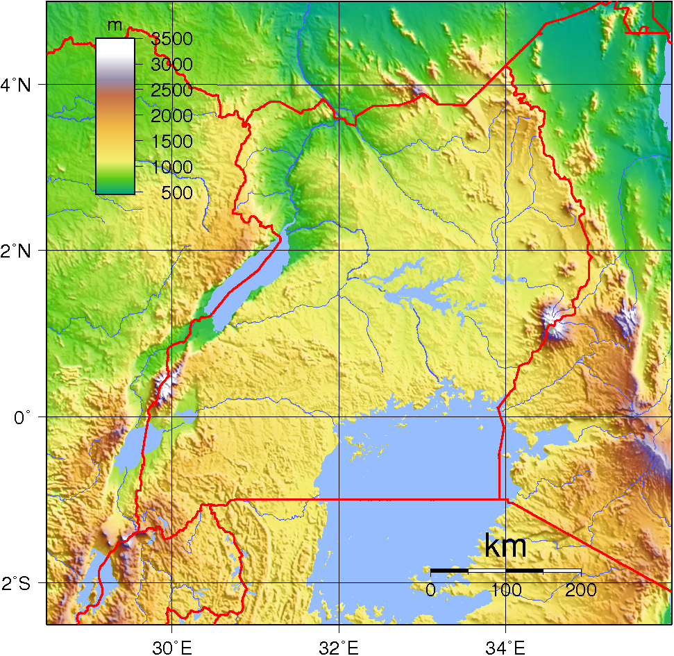
Topographic Map of Uganda