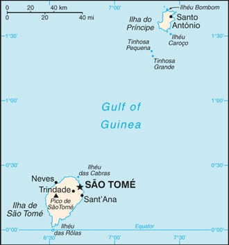
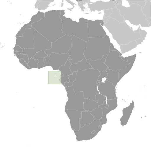
Sao Tome and Principe Location Map
Sao Tome and Principe Facts
Full Official Name: Democratic Republic of São Tomé and Príncipe
Demonym: São Toméan (Sao Tomean), Santomean
Flag:
Area
Total Area: 964 km²
Total Land Area: 964 km²
Total Water Area: 0 km²
Demographics
Population: 223,561
Population Growth Rate: 1.42% (2024 est.)
Largest City: São Tomé (Population: 71,868)
Ethnic Groups: Mestico, Angolares (descendants of Angolan slaves), Forros (descendants of freed slaves), Servicais (contract laborers from Angola, Mozambique, and Cabo Verde), Tongas (children of servicais born on the islands), Europeans (primarily Portuguese), Asians (mostly Chinese)
Languages: Portuguese 98.4% (official), Forro 36.2%, Cabo Verdian 8.5%, French 6.8%, Angolar 6.6%, English 4.9%, Lunguie 1%, other (including sign language) 2.4%; other Portuguese-based Creoles are also spoken (2012 est.)
Religions: Catholic 55.7%, Adventist 4.1%, Assembly of God 3.4%, New Apostolic 2.9%, Mana 2.3%, Universal Kingdom of God 2%, Jehovah’s Witness 1.2%, other 6.2%, none 21.2%, unspecified 1% (2012 est.)
Economy
Currency: Dobra
Real GDP at Purchasing Power Parity ($ PPP): $1.267 billion (2023 est.)
GDP per capita (PPP): $5,500 (2023 est.)
Exports Value Per Year: $96.977 million (2022 est.)
Biggest Export Partners: Netherlands 26%, France 11%, Belgium 11%, Portugal 8%, Angola 6% (2022)
Imports Value Per Year: $219.322 million (2022 est.)
Biggest Import Partners: Portugal 35%, Angola 18%, Togo 13%, China 6%, Italy 5% (2022)
Government
Type: semi-presidential republic
Capital City: Sao Tome (Population: 71,868)
Other Facts
Time Zone: UTC (GMT)
Country Code: ST
Internet TLD: .st
Climate Map of Sao Tome and Principe

Climate: tropical; hot, humid; one rainy season (October to May)
Topographic Map of Sao Tome and Principe