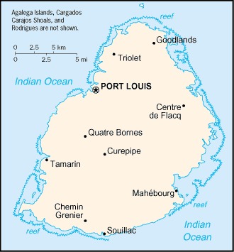
Mauritius Location Map

Mauritius Facts
Full Official Name: Republic of Mauritius
Demonym: Mauritian
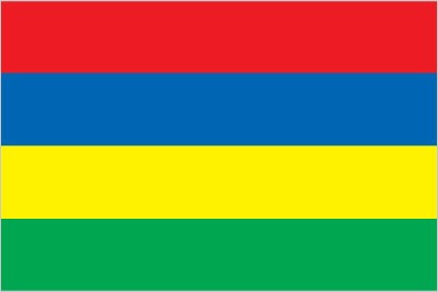
Flag:
Area
Total Area: 2,040 km²
Total Land Area: 2,030 km²
Total Water Area: 10 km²
Demographics
Population: 1,310,504
Population Growth Rate: 0.07% (2024 est.)
Largest City: Port Louis (Population: 147,066)
Ethnic Groups: Indo-Mauritian (compose approximately two thirds of the total population), Creole, Sino-Mauritian, Franco-Mauritian
Languages: Creole 86.5%, Bhojpuri 5.3%, French 4.1%, two languages 1.4%, other 2.6% (includes English, one of the two official languages of the National Assembly, which is spoken by less than 1% of the population), unspecified 0.1% (2011 est.)
Religions: Hindu 48.5%, Roman Catholic 26.3%, Muslim 17.3%, other Christian 6.4%, other 0.6%, none 0.7%, unspecified 0.1% (2011 est.)
Economy
Currency: Mauritian rupee
Real GDP at Purchasing Power Parity ($ PPP): $33.53 billion (2023 est.)
GDP per capita (PPP): $26,600 (2023 est.)
Exports Value Per Year: $5.499 billion (2023 est.)
Biggest Export Partners: Zimbabwe 11%, South Africa 11%, France 10%, Madagascar 8%, US 7% (2022)
Imports Value Per Year: $8.038 billion (2023 est.)
Biggest Import Partners: China 16%, South Africa 10%, UAE 9%, India 9%, Oman 8% (2022)
Government
Type: parliamentary republic
Capital City: Port Louis (Population: 147,066)
Other Facts
Time Zone: UTC+4:00 (MUT)
Country Code: MU
Internet TLD: .mu
Climate Map of Mauritius

Climate: tropical, modified by southeast trade winds; warm, dry winter (May to November); hot, wet, humid summer (November to May)
Topographic Map of Mauritius