One of CIA’s oldest and most recognizable intelligence publications, The World Factbook, has sunset. The World Factbook served the Intelligence Community and the general public as a longstanding, one-stop basic reference about countries and communities around the globe.
Link to the History of The World Factbook.
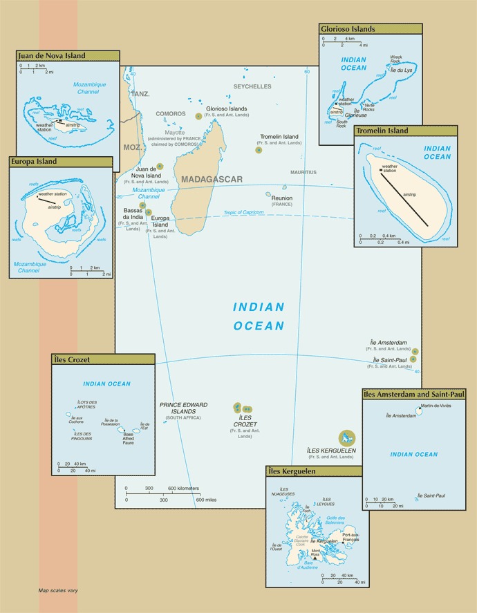
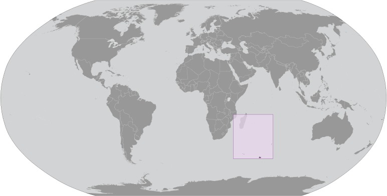
Where Are The French Southern and Antarctic Lands? Location Map
French Southern and Antarctic Lands Borders
- Madagascar (sea): 2,326 km (1,445 miles)
- Mozambique (sea): 1,455 km (904 miles)
- Mauritius (sea): 965 km (600 miles)
- Heard Island and McDonald Islands (sea): 729 km (453 miles)
- France (sea): 502 km (312 miles)
- Seychelles (sea): 368 km (229 miles)
- Coastline: 28 km (17.4 miles)
French Southern and Antarctic Lands Facts
Full Official Name: French Southern and Antarctic Lands
Demonym: N/A
Flag:
Area
Total Area: Ile Amsterdam (Ile Amsterdam et Ile Saint-Paul): total – 55 sq km; Ile Saint-Paul (Ile Amsterdam et Ile Saint-Paul): total – 7 sq km; Iles Crozet: total – 352 sq km; Iles Kerguelen: total – 7,215 sq km; Bassas da India (Iles Eparses): total – 80 sq km; Europa Island (Iles Eparses): total – 28 sq km; Glorioso Islands (Iles Eparses): total – 5 sq km; Juan de Nova Island (Iles Eparses): total – 4.4 sq km; Tromelin Island (Iles Eparses): total – 1 sq km km²
Total Land Area: Ile Amsterdam (Ile Amsterdam et Ile Saint-Paul): land – 55 sq km; Ile Saint-Paul (Ile Amsterdam et Ile Saint-Paul): land – 7 sq km; Iles Crozet: land – 352 sq km; Iles Kerguelen: land – 7,215 sq km; Bassas da India (Iles Eparses): land – 0.2 sq km; Europa Island (Iles Eparses): land – 28 sq km; Glorioso Islands (Iles Eparses): land – 5 sq km; Juan de Nova Island (Iles Eparses): land – 4.4 sq km; Tromelin Island (Iles Eparses): land – 1 sq km km²
Total Water Area: Ile Amsterdam (Ile Amsterdam et Ile Saint-Paul): water – 0 sq km; Ile Saint-Paul (Ile Amsterdam et Ile Saint-Paul): water – 0 sq km; Iles Crozet: total – water – 0 sq km; Iles Kerguelen: water – 0 sq km; Bassas da India (Iles Eparses): water – 79.8 sq km (lagoon); Europa Island (Iles Eparses): water – 0 sq km; Glorioso Islands (Iles Eparses): water – 0 sq km; Juan de Nova Island (Iles Eparses): water – 0 sq km; Tromelin Island (Iles Eparses): water – 0 sq km km²
Demographics
Population: no indigenous inhabitants
Population Growth Rate: N/A
Largest City: Port-aux-Français (Population: 120 (Summer), 45 (Winter))
Ethnic Groups: N/A
Languages: N/A
Religions: N/A
Economy
Currency: Euro
Real GDP at Purchasing Power Parity ($ PPP): N/A
GDP per capita (PPP): N/A
Exports Value Per Year: N/A
Biggest Export Partners: France 80%, Singapore 5%, Belgium 5%, Poland 3%, Czechia 2% (2022)
Imports Value Per Year: N/A
Biggest Import Partners: France 23%, US 13%, Netherlands 12%, Poland 11%, Germany 9% (2022)
Government
Type: N/A
Capital City: N/A (Population: 84,077)
Other Facts
Time Zone: UTC+04:00, UTC+05:00, UTC+10:00
Country Code: TF, FR-TF
Internet TLD: .tf
Climate: Ile Amsterdam et Ile Saint-Paul: oceanic with persistent westerly winds and high humidity; Iles Crozet: windy, cold, wet, and cloudy; Iles Kerguelen: oceanic, cold, overcast, windy; Iles Eparses: tropical