The map of Bangladesh above comes from the CIA World Factbook which has now been taken offline with the following statement:
One of CIA’s oldest and most recognizable intelligence publications, The World Factbook, has sunset. The World Factbook served the Intelligence Community and the general public as a longstanding, one-stop basic reference about countries and communities around the globe.
Link to the History of The World Factbook.
Where Is Bangladesh? Location Map

List of Land & Sea Borders For Bangladesh
- India (Land + Sea): 4,142 km (2,574 miles) land / 638 km (396 miles) sea
- Myanmar (Land + Sea): 271 km (168 miles) land / 453 km (281 miles) sea
Bangladesh Facts
Full Official Name: People’s Republic of Bangladesh
Demonym: Bangladeshi
Flag:

Area
Total Area: 148,460 km²
Total Land Area: 130,170 km²
Total Water Area: 18290 km²
Demographics
Population: 168,697,184
Population Growth Rate: 0.89% (2024 est.)
Largest City: Dhaka (Population: 23,935,652)
Ethnic Groups: Bengali at least 99%, other indigenous ethnic groups 1% (2022 est.)
Languages: Bangla 98.8% (official, also known as Bengali), other 1.2% (2011 est.)
Religions: Muslim 91%, Hindu 8%, other 1% (2022 est.)
Economy
Currency: Taka
Real GDP at Purchasing Power Parity ($ PPP): $1.413 trillion (2023 est.)
GDP per capita (PPP): $8,200 (2023 est.)
Exports Value Per Year: $58.885 billion (2023 est.)
Biggest Export Partners: US 18%, Germany 16%, UK 8%, Spain 7%, Poland 6% (2022)
Imports Value Per Year: $73.172 billion (2023 est.)
Biggest Import Partners: China 32%, India 17%, Singapore 6%, Malaysia 5%, Indonesia 5% (2022)
Government
Type: parliamentary republic
Capital City: Dhaka (Population: 23,935,652)
Other Facts
Time Zone: UTC+6 (BST)
Country Code: BD
Internet TLD: .bd
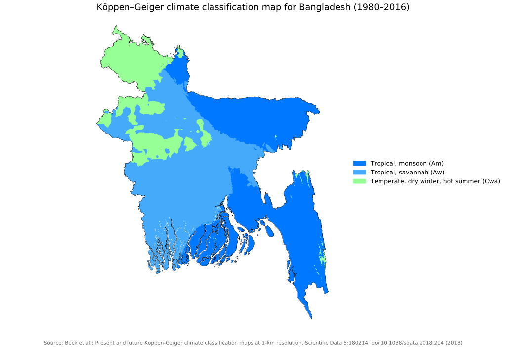
Climate Map of Bangladesh