
However, what it really reminds me of is a shopping mall map, including all the island countries as those small kiosks you find selling sun glasses and iPhone cases.
More about the map itself below:
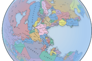
A topological map is a type of map that focuses on the relationships and connectivity between different points or areas, rather than representing precise distances, scales, or geographic accuracy.
Key Features:
- Simplified layout: Shapes, distances, and angles are often distorted or ignored.
- Preserves connections: What matters is how things are connected, not where they are in physical space.
- Used for networks: Commonly used to represent systems like subway/train lines, electrical circuits, or computer networks.
Classic Example:
- The London Underground map is a famous topological map. It shows how the train lines connect and intersect, not the exact geographic locations of the stations.
As for why some countries appear bigger or smaller than they really are: “In a topological map the only important characteristics are the borders, not areas, position or shapes.”
And as for Hawaii is not included: “I only designed parts of countries that are exclaves (e.g. Alaska, parts of Azerbaijan and Angola) or have borders with other countries (european turkey, african spain, gibraltar, etc.). In this map, Hawaii and Guam and many others are included in USA itself.”
And here’s another similar map:
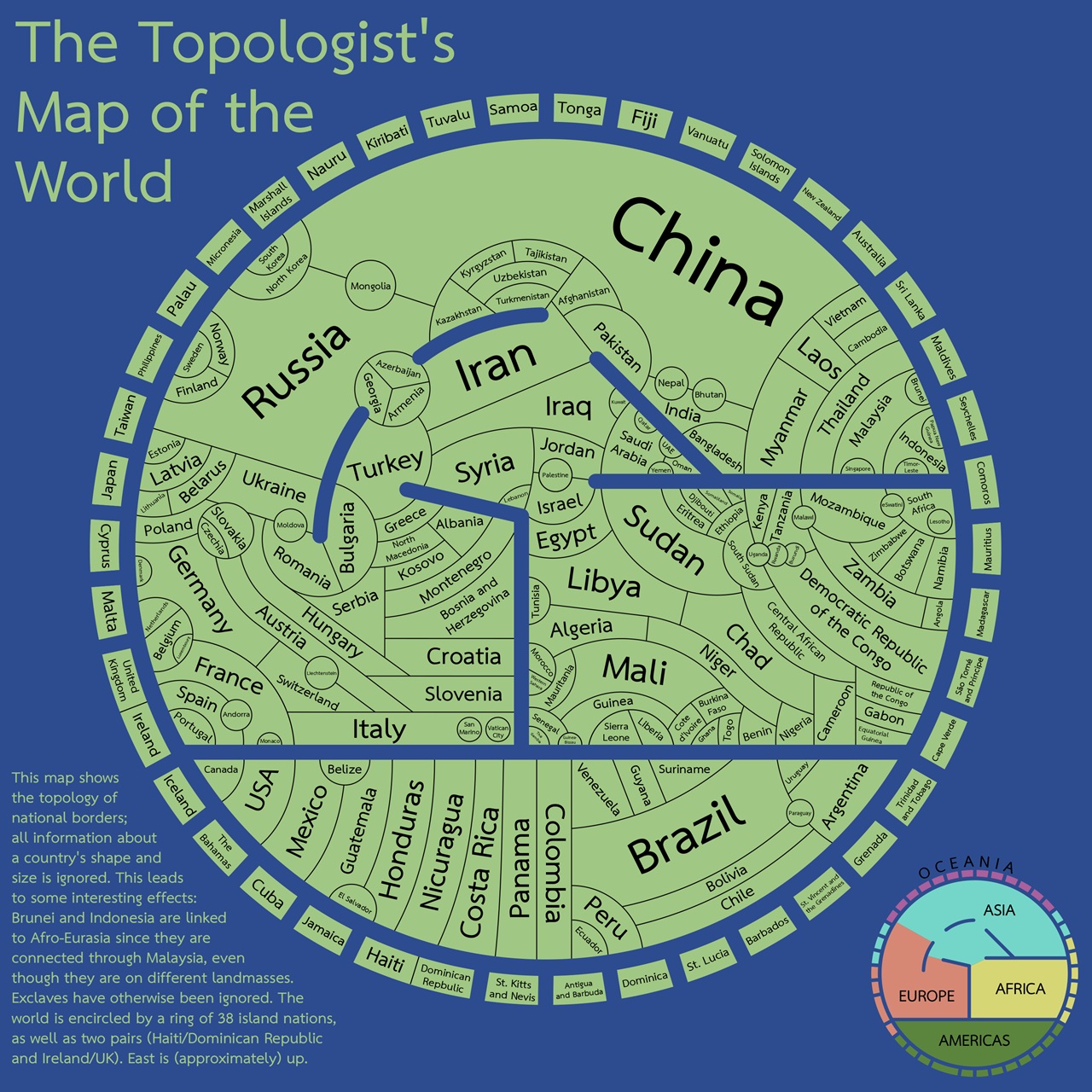
This leads to some interesting effects: Brunei and Indonesia are linked to Afro-Eurasia since they are connected through Malaysia, even though they are on different landmasses.
Exclaves have otherwise been ignored. The world is encircled by a ring of 38 island nations, as well as two pairs (Haiti/Dominican Republic and Ireland/UK). East is (approximately) up.
As to how the map was made the author explains that:
Inspired by this map of the USA (by Sian Zelbo), I decided to make a world map in a similar style. Countries are shaped and positioned according only to which countries (and seas) they border.
If you’d like a challenge, here’s a version without country labels, and if you’d like a slightly smaller challenge, here’s one with only a few labels.
I made this in Inkscape, and put a brief write-up here, if you’re interested. Please let me know if you find any errors/typos.
A few caveats: I had to ignore a few exclaves and territories to make this map at all feasible. Most notably, Russia’s Kaliningrad Oblast, the Spanish exclaves in Morocco, the Angolan exclave that borders the Republic of the Congo, the British Mediterranean exclaves (Gibraltar and the two on Cyprus), and – the biggest and baddest – French Guyana.
Edit: Here’s an updated version with the Bolivia/Paraguay/Argentina/Chile area fixed – thanks, u/agcuevas
And another, having fixed the South Sudan/Ethiopia/Kenya/Uganda border – thanks, u/qpalks
u/Zaragoza23 pointed out that Bahrain is missing, but that’ll take a while to fix
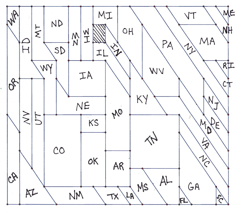
And finally a map of the US (without labels) from Sian Zelbo:
from the author:
To a topologist, two shapes are “the same” if one can be stretched, twisted, and distorted into the other shape without breaking or tearing it. Shape, angle, size, distance, and position can be completely different, and yet the two shapes are topologically equivalent.
This is a topologist’s map of the 48 contiguous United States. While the states are not recognizable, you can work out which is which by how the states are connected to each other.
read the full post here.
And the solution:
What do you think?


Leave a Reply