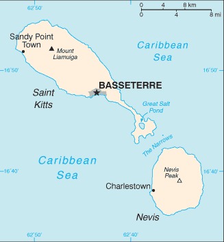
Saint Kitts and Nevis Location Map

Saint Kitts and Nevis Facts
Full Official Name: Federation of Saint Christopher and Nevis
Demonym: Kittitian, Nevisian
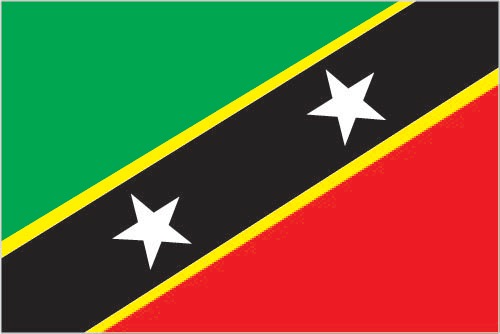
Flag:
Area
Total Area: 261 km²
Total Land Area: 261 km²
Total Water Area: 0 km²
Demographics
Population: 55,133
Population Growth Rate: 0.56% (2024 est.)
Largest City: Basseterre (Population: 16,696)
Ethnic Groups: African descent 92.5%, mixed 3%, White 2.1%, East Indian 1.5%, other 0.6%, unspecified 0.3% (2001 est.)
Languages: English (official)
Religions: Protestant 75.6% (includes Anglican 16.6%, Methodist 15.8%, Pentecostal 10.8%, Church of God 7.4%, Baptist 5.4%, Seventh Day Adventist 5.4%, Wesleyan Holiness 5.3%, Moravian 4.8%, Evangelical 2.1%, Brethren 1.7%, Presbyterian 0.3%), Roman Catholic 5.9%, Hindu 1.8%, Jehovah’s Witness 1.4%, Rastafarian 1.3%, other 5%, none 8.8%, unspecified 0.1% (2011 est.)
Economy
Currency: East Caribbean dollar
Real GDP at Purchasing Power Parity ($ PPP): $1.438 billion (2023 est.)
GDP per capita (PPP): $30,100 (2023 est.)
Exports Value Per Year: $577.568 million (2023 est.)
Biggest Export Partners: US 61%, India 7%, Trinidad and Tobago 5%, Germany 4%, Canada 3% (2022)
Imports Value Per Year: $674.134 million (2023 est.)
Biggest Import Partners: US 47%, Italy 9%, Turkey 6%, Trinidad and Tobago 6%, China 5% (2022)
Government
Type: federal parliamentary democracy under a constitutional monarchy; a Commonwealth realm
Capital City: Basseterre (Population: 16,696)
Other Facts
Time Zone: UTC-4 (AST)
Country Code: KN
Internet TLD: .kn
Climate Map of Saint Kitts and Nevis

Climate: tropical, tempered by constant sea breezes; little seasonal temperature variation; rainy season (May to November)
Topographic Map of Saint Kitts and Nevis