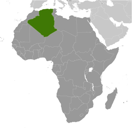
Algeria Location Map
Algeria Facts
Full Official Name: People’s Democratic Republic of Algeria
Demonym: Algerian
Flag:
Area
Total Area: 2,381,740 km²
Total Land Area: 2,381,740 km²
Total Water Area: 0 km²
Demographics
Population: 47,022,473
Population Growth Rate: 1.54% (2024 est.)
Largest City: Algiers (Population: 4,510,000)
Ethnic Groups: Arab-Amazigh 99%, European less than 1%
Languages: Arabic (official), French (lingua franca), Tamazight (official) (dialects include Kabyle (Taqbaylit), Shawiya (Tacawit), Mzab, Tuareg (Tamahaq))
Religions: Muslim (official; predominantly Sunni) 99%, other (includes Christian, Jewish, Ahmadi Muslim, Shia Muslim, Ibadi Muslim) <1% (2012 est.)
Economy
Currency: Algerian dinar
Real GDP at Purchasing Power Parity ($ PPP): $699.947 billion (2023 est.)
GDP per capita (PPP): $15,300 (2023 est.)
Exports Value Per Year: $58.816 billion (2023 est.)
Biggest Export Partners: Italy 29%, Spain 12%, France 12%, US 5%, South Korea 5% (2022)
Imports Value Per Year: $51.516 billion (2023 est.)
Biggest Import Partners: China 18%, France 14%, Italy 7%, Turkey 6%, Brazil 6% (2022)
Government
Type: presidential republic
Capital City: Algiers (Population: 4,510,000)
Other Facts
Time Zone: UTC+1 (CET)
Country Code: DZ
Internet TLD: .dz
Climate Map of Algeria
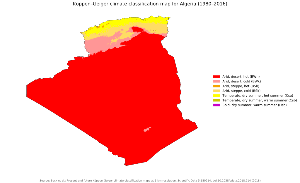
Climate: arid to semiarid; mild, wet winters with hot, dry summers along coast; drier with cold winters and hot summers on high plateau; sirocco is a hot, dust/sand-laden wind especially common in summer
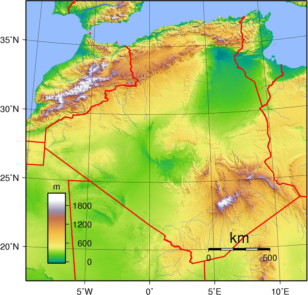
Topographic Map of Algeria