
In 2020, Amazon’s U.S. retail fulfillment network experienced rapid growth, prompting an “operational pivot”to handle soaring demand.
The effort, known as regionalization, reorganized the company’s national network of fulfillment centers (FCs), sorting centers, and delivery hubs into eight largely self-sufficient regions.
This was done to ensure faster deliveries, reduced transportation costs, and increased network efficiency, while still providing nationwide coverage.
Focusing on the Map: Eight Regional Networks
The map of the United States above illustrates these eight newly created regions.
Key takeaways from the map:
- Reduced Complexity: Instead of each FC shipping to customers nationwide, FCs now focus on serving customers in their designated region.
- Closer Inventory: By having the needed products readily available within each region, customer orders travel shorter distances, speeding up delivery times.
- Eight Regions, One Network: Even though the country is subdivided, these regions still connect cohesively, maintaining national coverage.
The Challenge and Rationale
Previously, Amazon’s approach relied on sending products from wherever they were in stock, sometimes resulting in sprawling, cross-country shipments.
With the network growing rapidly, this strategy risked becoming unwieldy and costly, especially under surging pandemic demand.
The “distant FC” problem meant more trucks, more miles, and longer delivery times.
Why Eight Regions?
Amazon’s research scientists and planning teams used state-of-the-art optimization models to simulate various regional configurations.
They balanced:
- Delivery Speed: Smaller regions mean faster delivery, but each region needs enough inventory breadth to meet demand.
- Transport Costs: More regions reduce cross-country routes but risk requiring extra movement if certain products aren’t kept in the right places.
- Inventory Breadth: Customers expect access to a wide range of products—each region must carry a significant portion of Amazon’s catalog.
Modeling revealed that eight regions struck the best balance between shorter shipping distances and maintaining high in-region product availability.
Key Benefits of Regionalization
- Speedier Deliveries: With most orders now fulfilled locally, packages travel shorter distances, boosting delivery speed.
- Higher Truck Fill Rates: Fewer, more direct routes mean trucks carry more packages on each trip, improving efficiency.
- Simplified Operations: Reducing the number of cross-country trucking lanes makes it easier to plan, manage, and optimize the network.
- Immediate Impact: Overnight switchover in early 2023 led to a jump in local fulfillment (from 62% to 76%) and faster shipping times.
So all very cool, just not sure about the names. Is Michigan more Midwest than Great Lakes? Or Northern California really part of the South West?
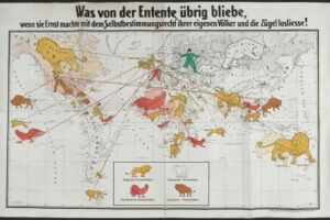
In any case if it gets me my stuff faster I’m all for it, and really the naming isn’t any worse than this.




Leave a Reply