Door County is a peninsula in northeastern Wisconsin that separates Green Bay from Lake Michigan, known for its limestone shoreline, cherry orchards, fish boils and small harbour towns. Visit Cana Island Light and Eagle Bluff Light, hike Potawatomi State Park near Sturgeon Bay, and take the ferry across Porte des Morts to Washington Island to see its Norwegian-style Stavkirke.
Tap a picture for details or zoom in to explore.
Map data © OpenStreetMap, Natural Earth
List of all 12 things to do in Door County and where to find them
- Porte des Morts Wikipedia
- Washington Island Stavkirke Website Wikipedia
- Cana Island Light Wikipedia
- Björklunden Website Wikipedia
- F. J. King Wikipedia
- Pottawatomie Light Wikipedia
- Potawatomi State Park Website Wikipedia
- Wisconsin v. Michigan Wikipedia
- Baileys Harbor Range Lights Wikipedia
- Pilot Island Light Wikipedia
- Eagle Bluff Light Wikipedia
- Detroit Harbor, Wisconsin Wikipedia
Official websites and travel guides
- Official Door County website: www.co.door.wi.gov
- Door County travel guide: Wikivoyage
- Door County on Wikipedia
- All Door County tours and activities on Viator
Where To Stay In Door County: Interactive Door County Hotel Map
Fish Creek, Ephraim and Sister Bay on the Green Bay side are the classic bases with inns and restaurants; Sturgeon Bay is larger and cheaper at the southern end. Compare hotels on the map below.
Top Things To Do In Door County Today
Download The Illustrated Door County Tourist Map
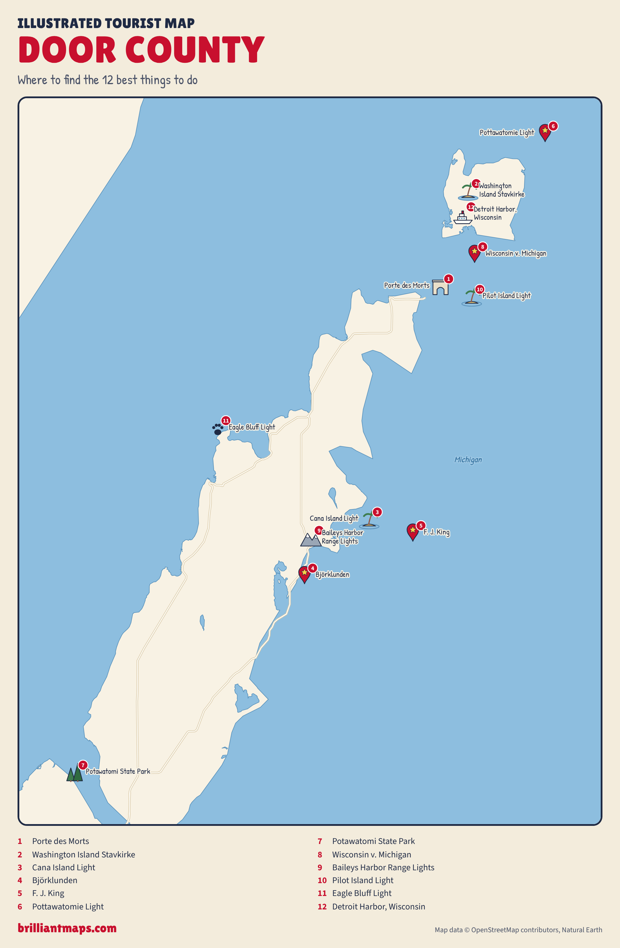
Download the Door County map (PNG)
More Tourist Maps Near Door County
Door County is part of: