One of CIA’s oldest and most recognizable intelligence publications, The World Factbook, has sunset. The World Factbook served the Intelligence Community and the general public as a longstanding, one-stop basic reference about countries and communities around the globe.
Link to the History of The World Factbook.
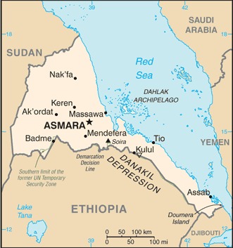
Where is Eritrea? Location Map
More maps of Eritrea from the CIA (2022):
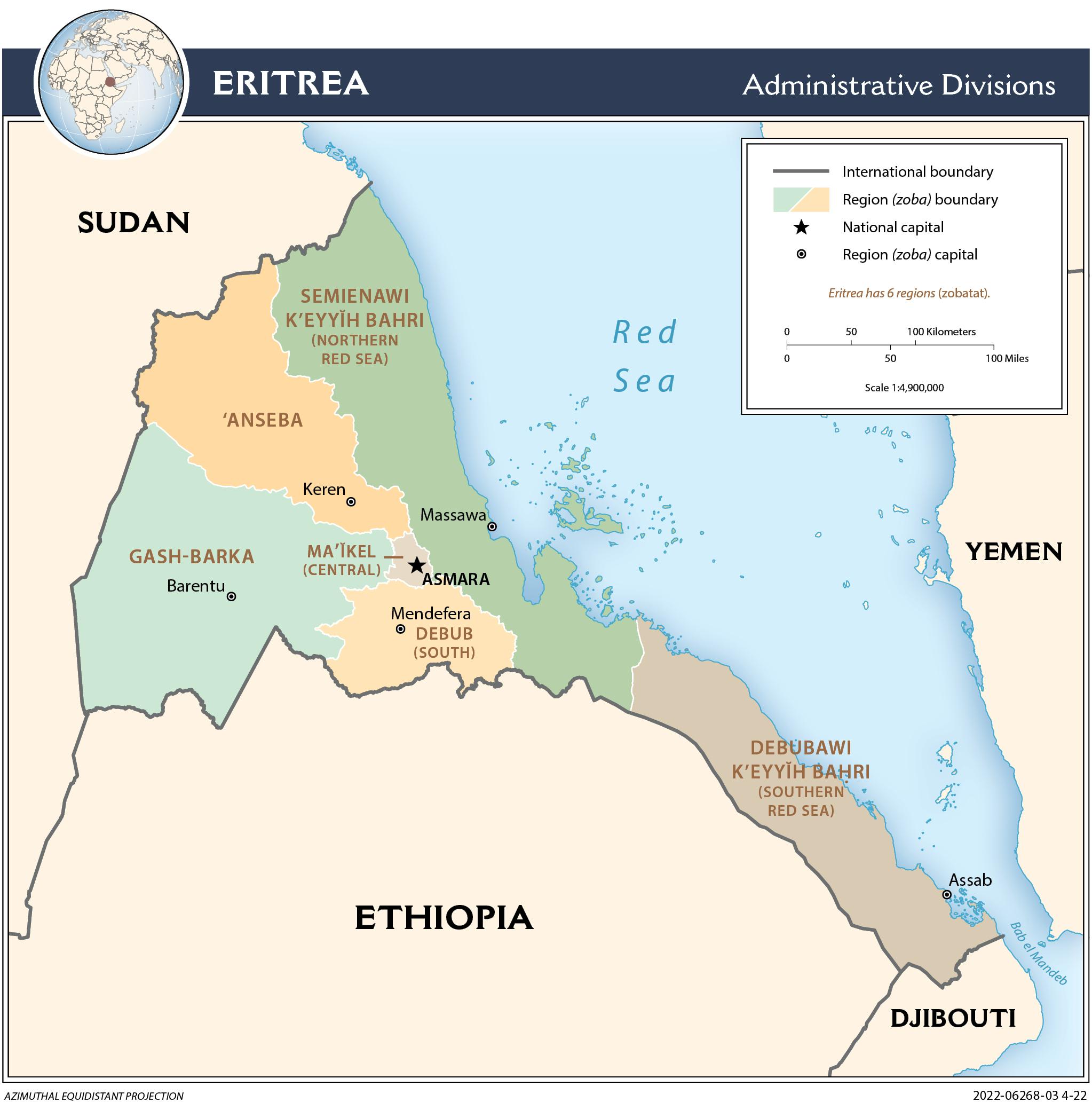
Administrative Map Of Eritrea
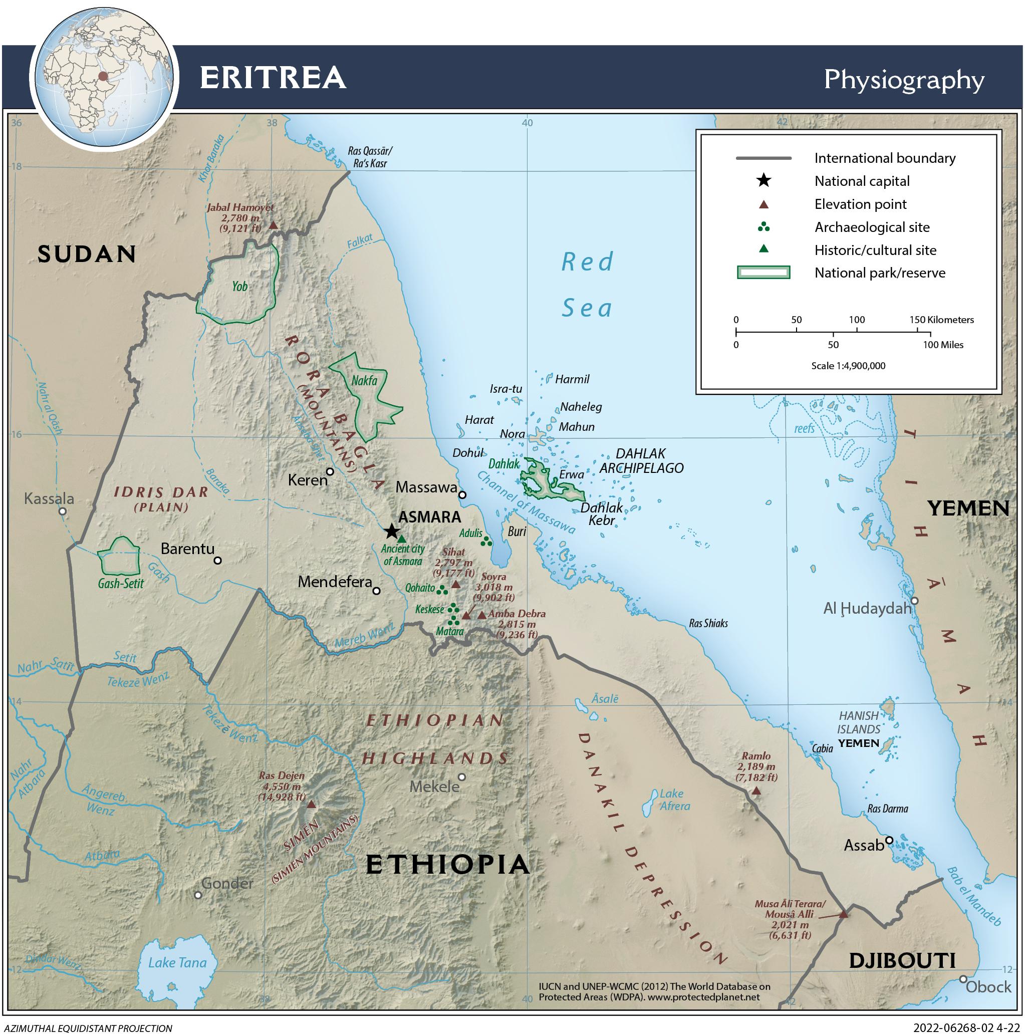
Eritrea Physiography Map
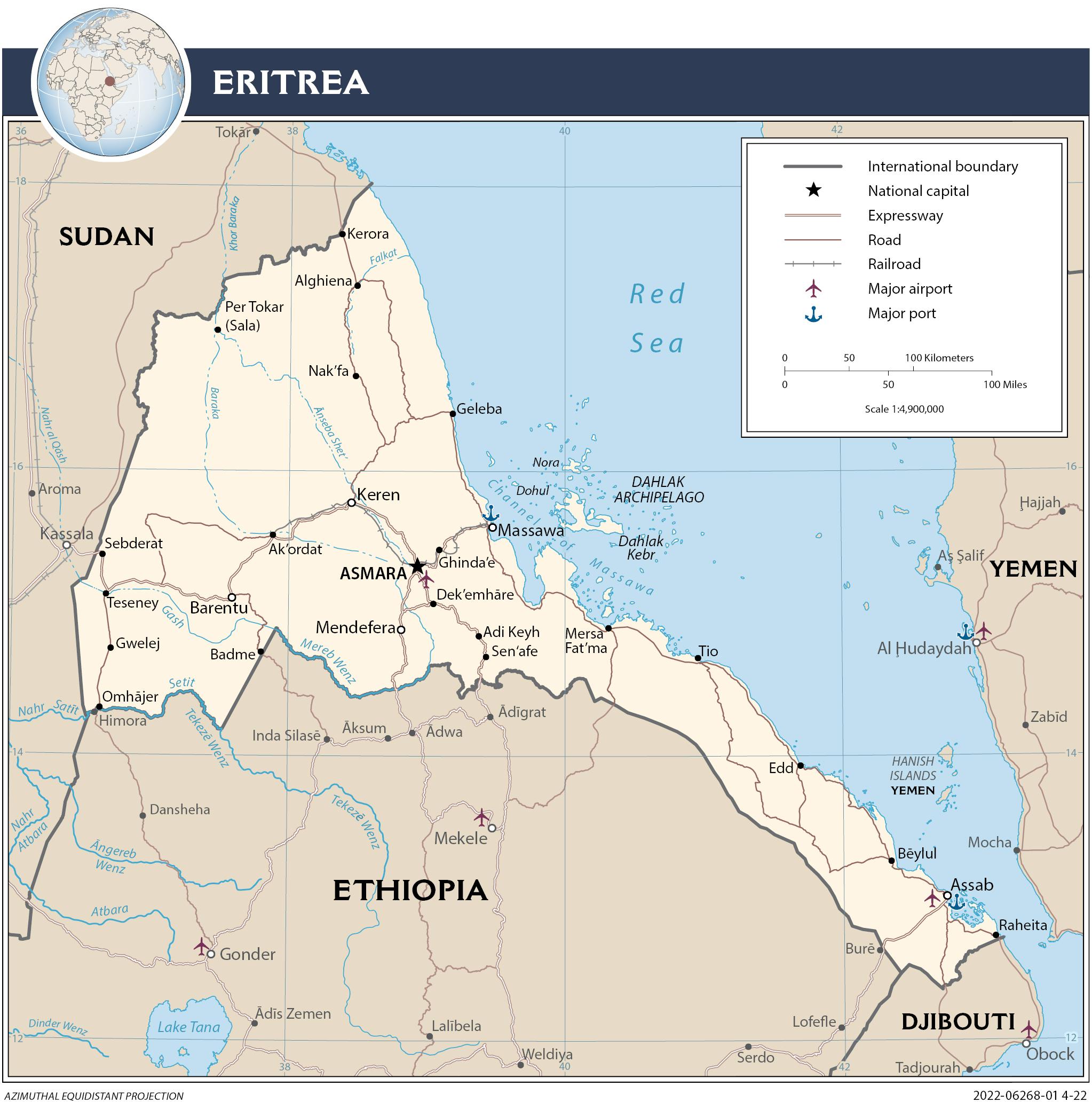
Eritrea Transportation Map
Eritrea Facts
Full Official Name: State of Eritrea
Demonym: Eritrean
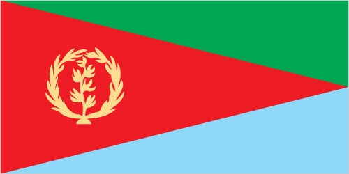
Flag:
Area
Total Area: 117,600 km²
Total Land Area: 101,000 km²
Total Water Area: 16,600 km²
Demographics
Population: 6,343,956
Population Growth Rate: 1.12% (2024 est.)
Largest City: Asmara (Population: 1,073,000)
Ethnic Groups: Tigrinya 50%, Tigre 30%, Saho 4%, Afar 4%, Kunama 4%, Bilen 3%, Hedareb/Beja 2%, Nara 2%, Rashaida 1% (2021 est.)
Languages: Tigrinya (official), Arabic (official), English (official), Tigre, Kunama, Afar, other Cushitic languages
Religions: Eritrean Orthodox, Roman Catholic, Evangelical Lutheran, Sunni Muslim
Economy
Currency: Nakfa
Real GDP at Purchasing Power Parity ($ PPP): $9.702 billion (2017 est.)
GDP per capita (PPP): $1,600 (2017 est.)
Exports Value Per Year: $624.3 million (2017 est.)
Biggest Export Partners: China 52%, UAE 33%, South Korea 9%, Japan 2%, Madagascar 2% (2022)
Imports Value Per Year: $1.127 billion (2017 est.)
Biggest Import Partners: China 34%, UAE 26%, Turkey 12%, US 7%, India 4% (2022)
Government
Type: presidential republic
Capital City: Asmara (Population: 1,073,000)
Other Facts
Time Zone: UTC+3 (EAT) (DST is not observed)
Country Code: ER
Internet TLD: .er
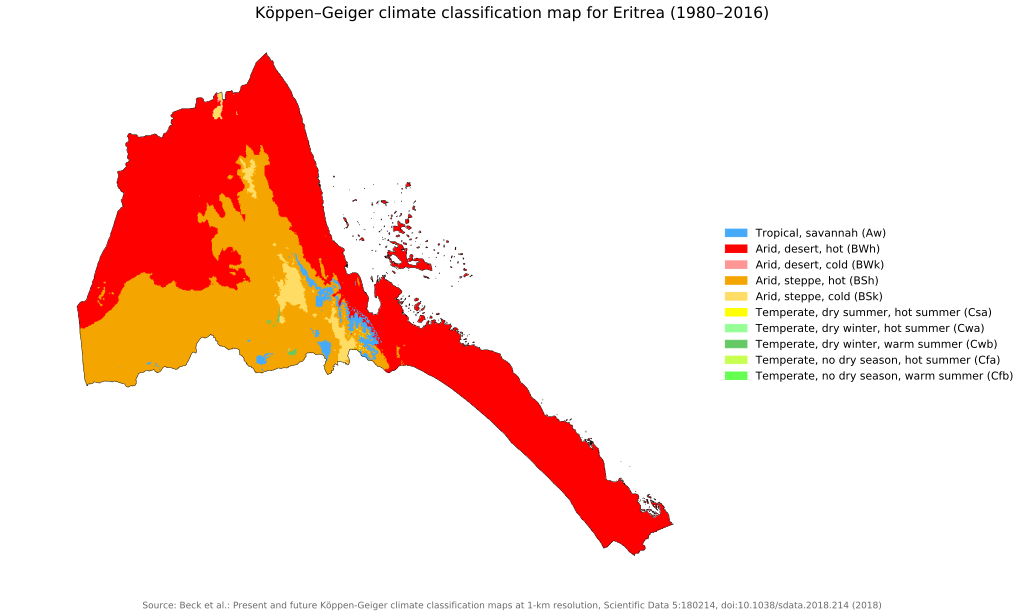
Climate Map of Eritrea
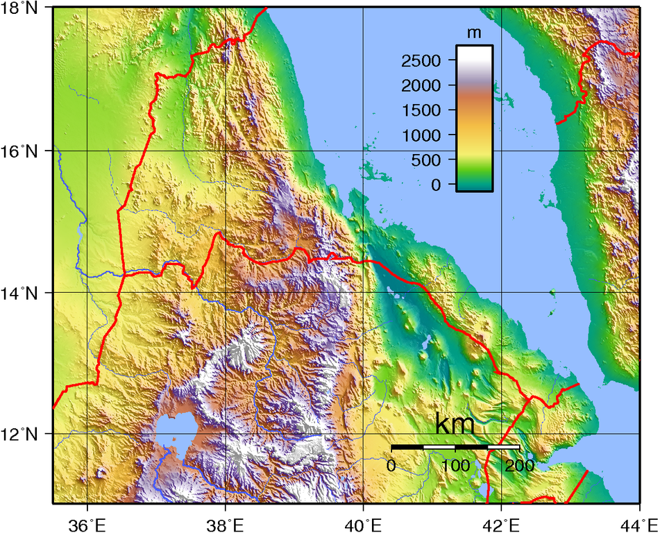
Topographic Map of Eritrea