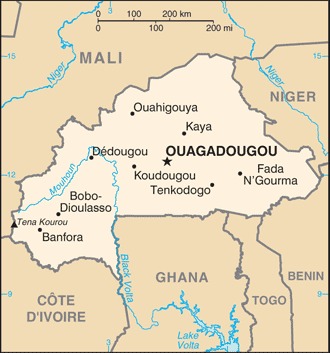
Burkina Faso Location Map
Burkina Faso Facts
Full Official Name: People’s Republic of Burkina Faso
Demonym: Burkinabè, Burkinese
Flag:
Area
Total Area: 274,200 km²
Total Land Area: 273,800 km²
Total Water Area: 400 km²
Demographics
Population: 23,042,199
Population Growth Rate: 2.4% (2024 est.)
Largest City: Ouagadougou (Population: 2,415,266)
Ethnic Groups: Mossi 53.7%, Fulani (Peuhl) 6.8%, Gurunsi 5.9%, Bissa 5.4%, Gurma 5.2%, Bobo 3.4%, Senufo 2.2%, Bissa 1.5%, Lobi 1.5%, Tuareg/Bella 0.1%, other 12.8%, foreign 0.7% (2021 est.)
Languages: Mossi 52.9%, Fula 7.8%, Gourmantche 6.8%, Dyula 5.7%, Bissa 3.3%, Gurunsi 3.2%, French (official) 2.2%, Bwamu 2%, Dagara 2%, San 1.7%, Marka 1.6%, Bobo 1.5%, Senufo 1.5%, Lobi 1.2%, other 6.6% (2019 est.)
Religions: Muslim 63.8%, Roman Catholic 20.1%, Animiste 9%, Protestant 6.2%, other 0.2%, none 0.7% (2019 est.)
Economy
Currency: West African CFA franc
Real GDP at Purchasing Power Parity ($ PPP): $57.152 billion (2023 est.)
GDP per capita (PPP): $2,500 (2023 est.)
Exports Value Per Year: $5.814 billion (2022 est.)
Biggest Export Partners: Switzerland 74%, UAE 7%, Mali 4%, Singapore 2%, Cote d’Ivoire 2% (2022)
Imports Value Per Year: $6.761 billion (2022 est.)
Biggest Import Partners: Cote d’Ivoire 16%, China 12%, Russia 7%, France 7%, Ghana 5% (2022)
Government
Type: presidential republic
Capital City: Ouagadougou (Population: 2,415,266)
Other Facts
Time Zone: UTC+00:00
Country Code: BF
Internet TLD: .bf
Climate Map of Burkina Faso

Climate: three climate zones including a hot tropical savanna with a short rainy season in the southern half, a tropical hot semi-arid steppe climate typical of the Sahel region in the northern half, and small area of hot desert in the very north of the country bordering the Sahara Desert
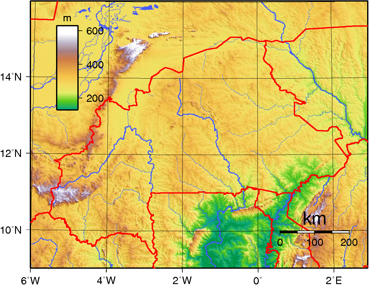
Topographic Map of Burkina Faso