Brilliant Maps

Making Sense Of The World, One Map At A Time

  • BOOK!
  • Newsletter
  • Games & Quizes
  • Map Based Polls
  • Map Tools

The Highest and Lowest Point in Every US State and County

Click To Get My 10 Best Brilliant Maps For Free:

From the summit of Denali to the floor of Death Valley, the United States spans more than 20,000 vertical feet. The tables below list the highest and lowest point in every state and in every one of the 3,144 counties and county equivalents, derived from USGS elevation data. Click any column heading to sort, and use the search box to filter the county table. Below the tables you will find a map for every state showing which county contains its highest point and which contains its lowest.
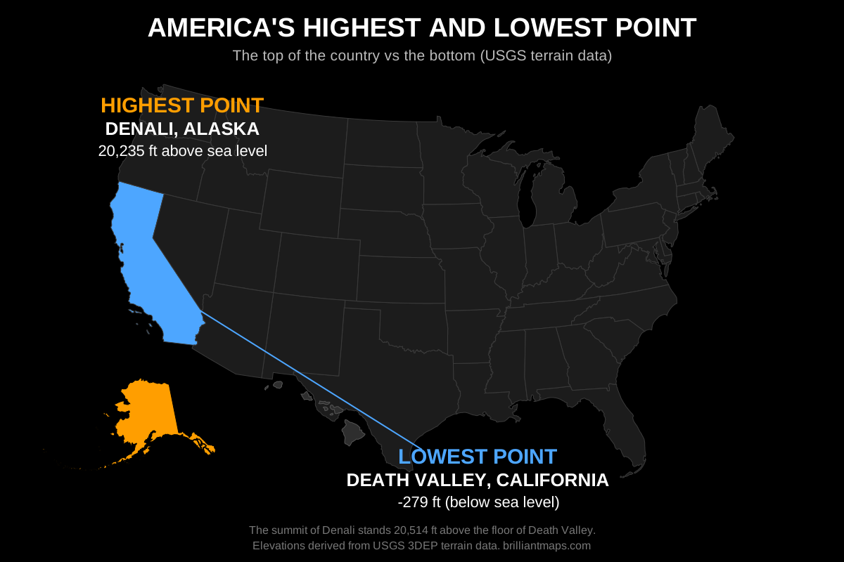
Map of the United States highlighting the highest point, Denali in Alaska, and the lowest point, Death Valley in California

The Highest and Lowest Point in Every State

Elevations are in feet and meters above sea level. The named high and low points are the officially recognized ones; the elevation figures are derived from terrain data, so they can differ slightly from surveyed values (Denali, for example, is officially 20,310 ft). Where a state's lowest elevation is the coast, several counties tie at sea level.

#StateHighest PointHighest (ft)Highest (m)Lowest PointLowest (ft)Lowest (m)

The Highest and Lowest Point in Every US County

All 3,144 counties and county equivalents. Relief is the difference between the highest and lowest point in the county, a rough measure of how mountainous it is. Counties marked with an asterisk had their minimum adjusted to remove elevation model artefacts such as open pit mines and quarries, or their maximum includes a man-made structure; see the notes at the bottom of the page. Use the search box to filter by county or state name.

#CountyStateHighest (ft)Highest (m)Lowest (ft)Lowest (m)Relief (ft)

The Highest and Lowest County in Every State

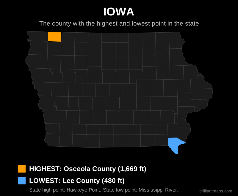
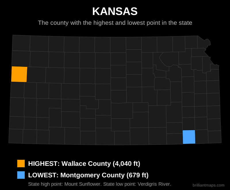
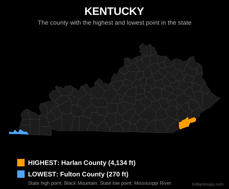
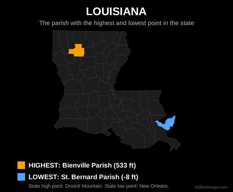
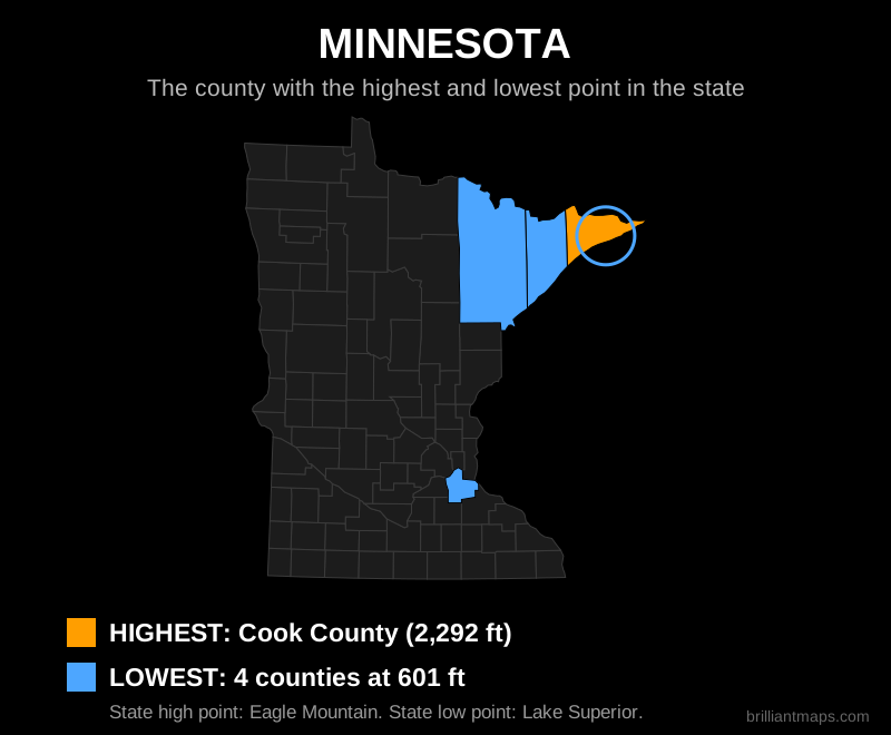
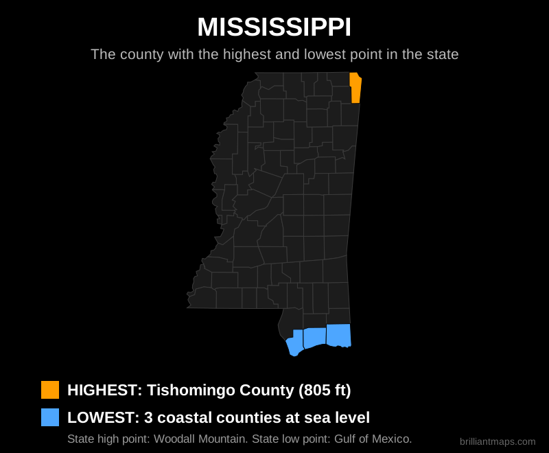
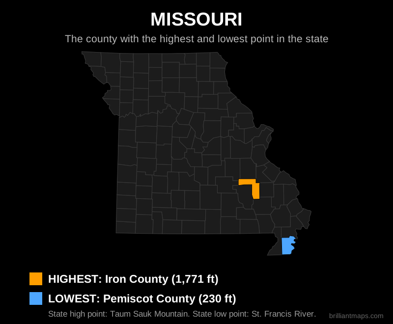
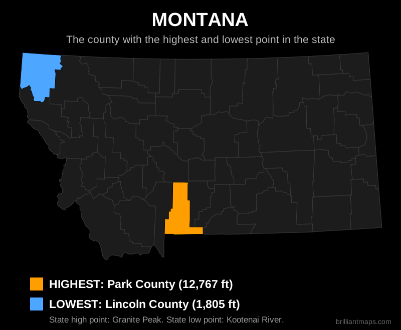
One map for each state: the county (parish in Louisiana, borough in Alaska, planning region in Connecticut) containing the state's highest point is in orange, and the county or counties containing its lowest point are in blue. Where the lowest point is the coast or a lake, every county that reaches that level is highlighted. Very small counties are circled so they are easy to spot. The District of Columbia is a single county equivalent, so it has no map.
ALAKAZARCACOCTDEFLGAHIIDILINIAKSKYLAMEMDMAMIMNMSMOMTNENVNHNJNMNYNCNDOHOKORPARISCSDTNTXUTVTVAWAWVWIWY

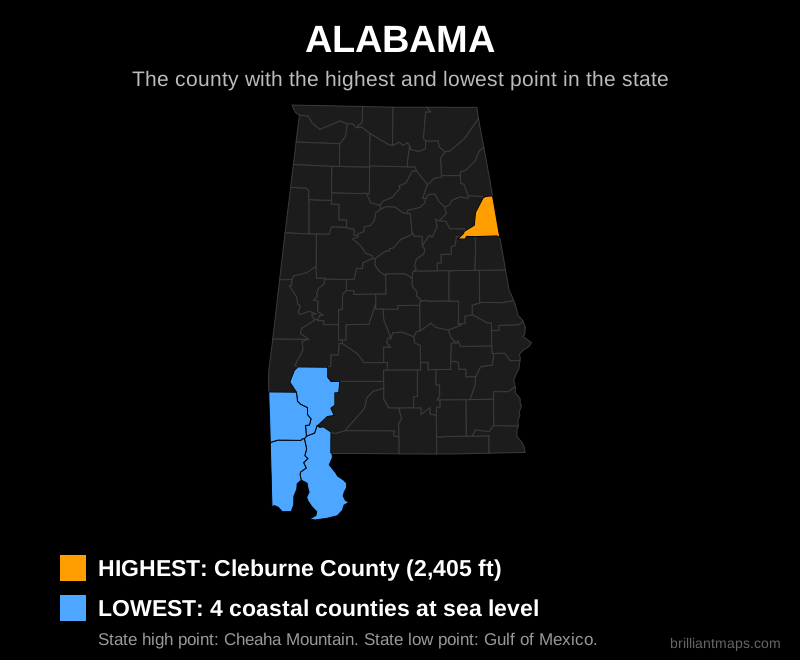
Alabama

Map of Alabama highlighting the county with the highest point and the county with the lowest point

Back to top

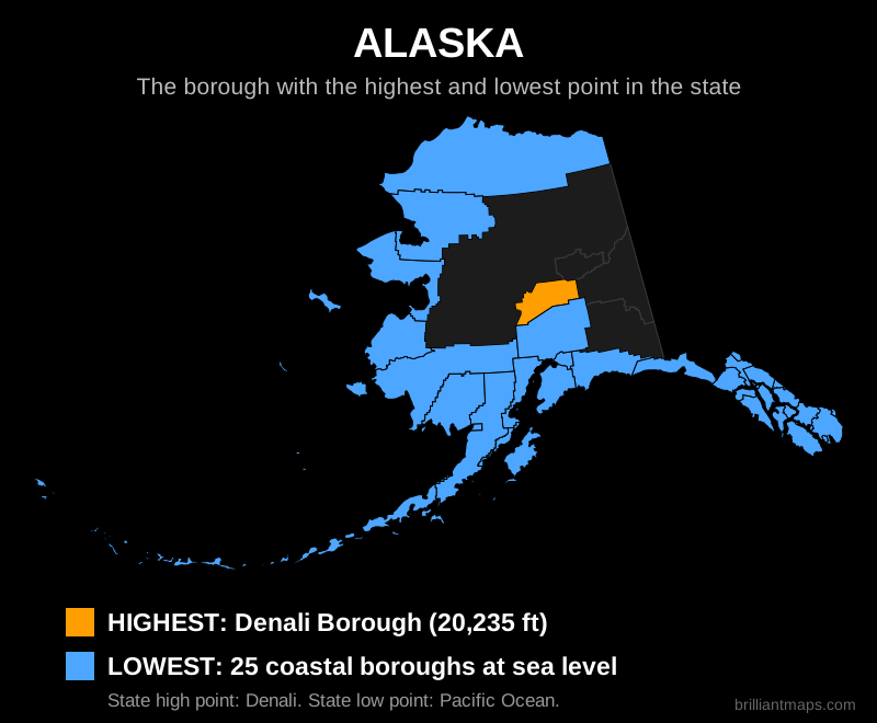
Alaska

Map of Alaska highlighting the county with the highest point and the county with the lowest point

Back to top

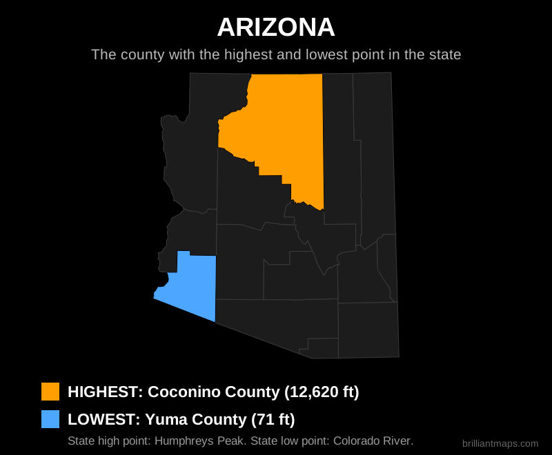
Arizona

Map of Arizona highlighting the county with the highest point and the county with the lowest point

Back to top

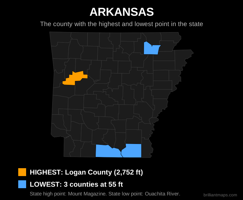
Arkansas

Map of Arkansas highlighting the county with the highest point and the county with the lowest point

Back to top

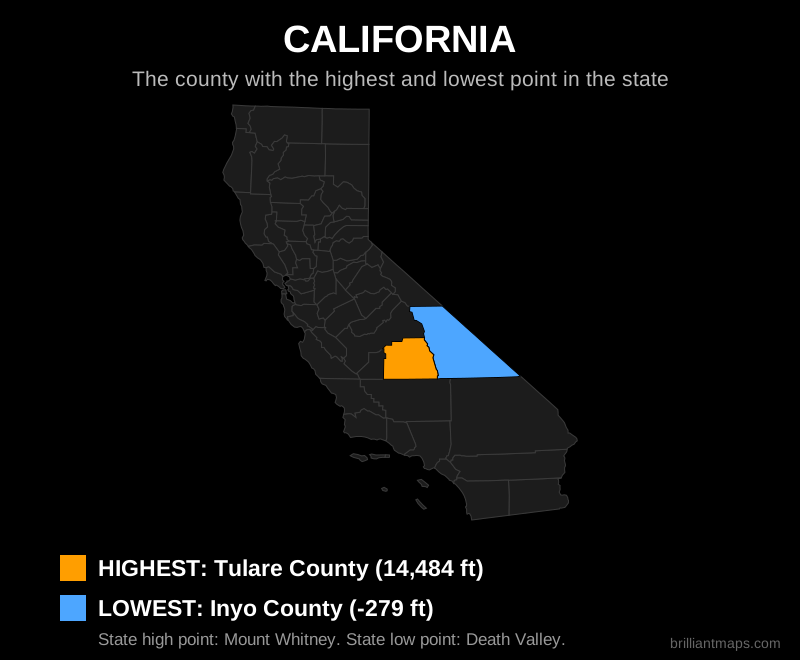
California

Map of California highlighting the county with the highest point and the county with the lowest point

Back to top

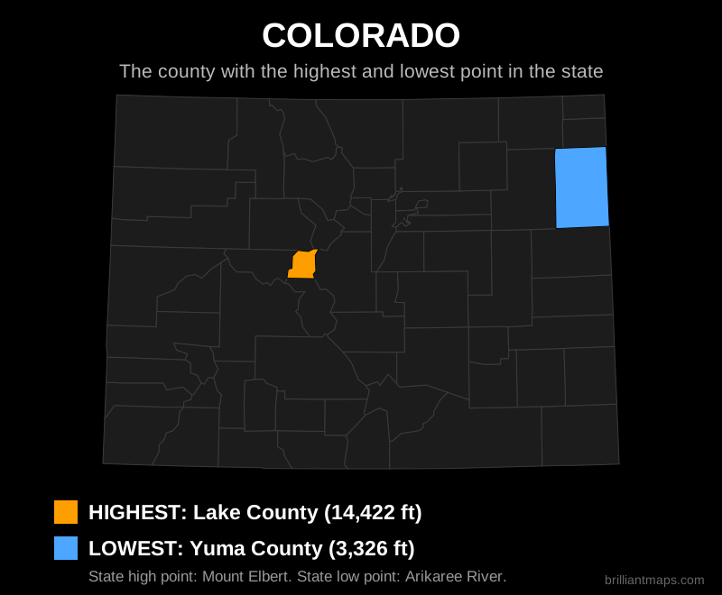
Colorado

Map of Colorado highlighting the county with the highest point and the county with the lowest point

Back to top

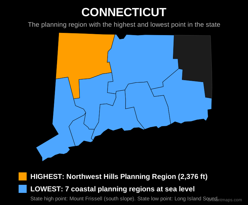
Connecticut

Map of Connecticut highlighting the county with the highest point and the county with the lowest point

Back to top

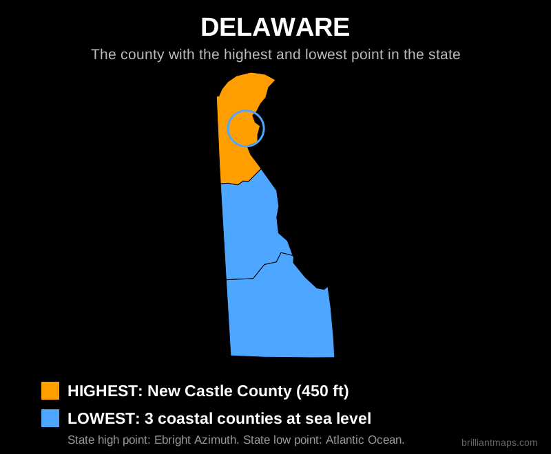
Delaware

Map of Delaware highlighting the county with the highest point and the county with the lowest point

Back to top

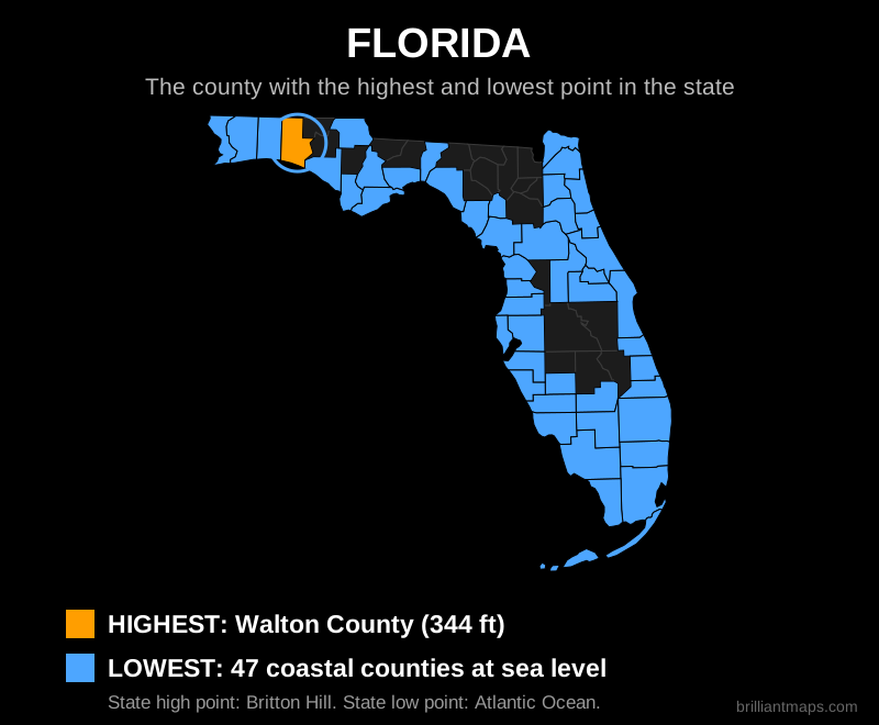
Florida

Map of Florida highlighting the county with the highest point and the county with the lowest point

Back to top

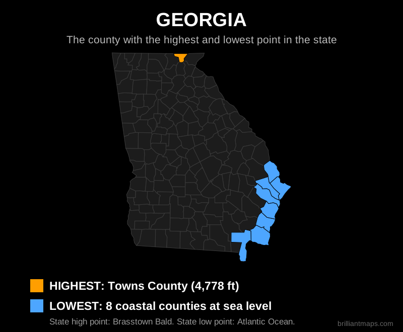
Georgia

Map of Georgia highlighting the county with the highest point and the county with the lowest point

Back to top

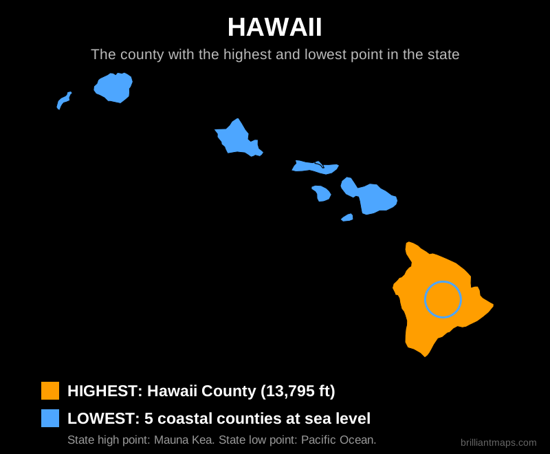
Hawaii

Map of Hawaii highlighting the county with the highest point and the county with the lowest point

Back to top

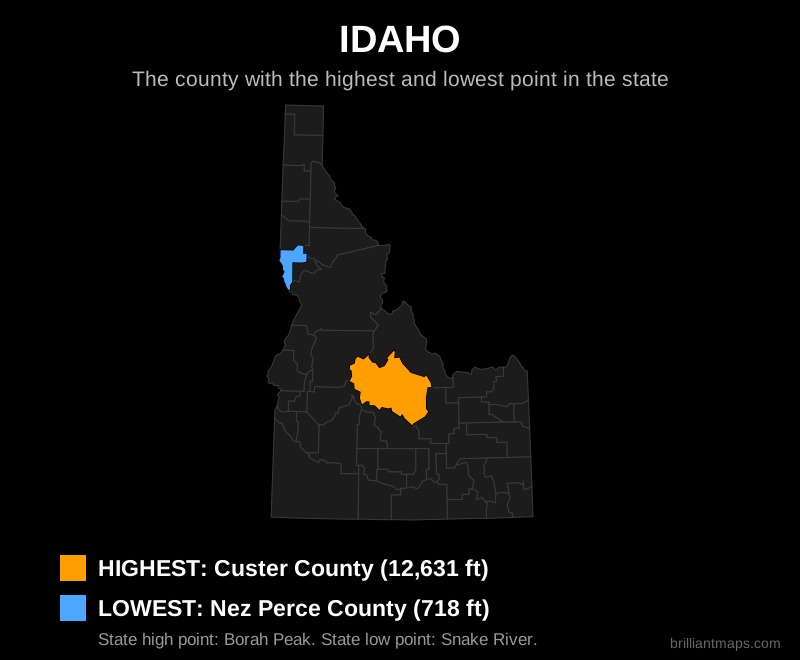
Idaho

Map of Idaho highlighting the county with the highest point and the county with the lowest point

Back to top

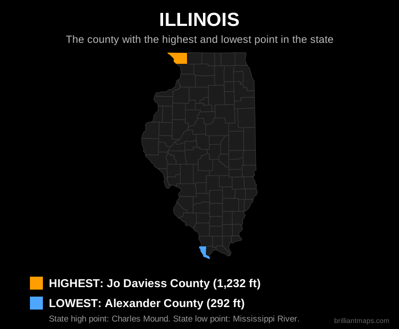
Illinois

Map of Illinois highlighting the county with the highest point and the county with the lowest point

Back to top

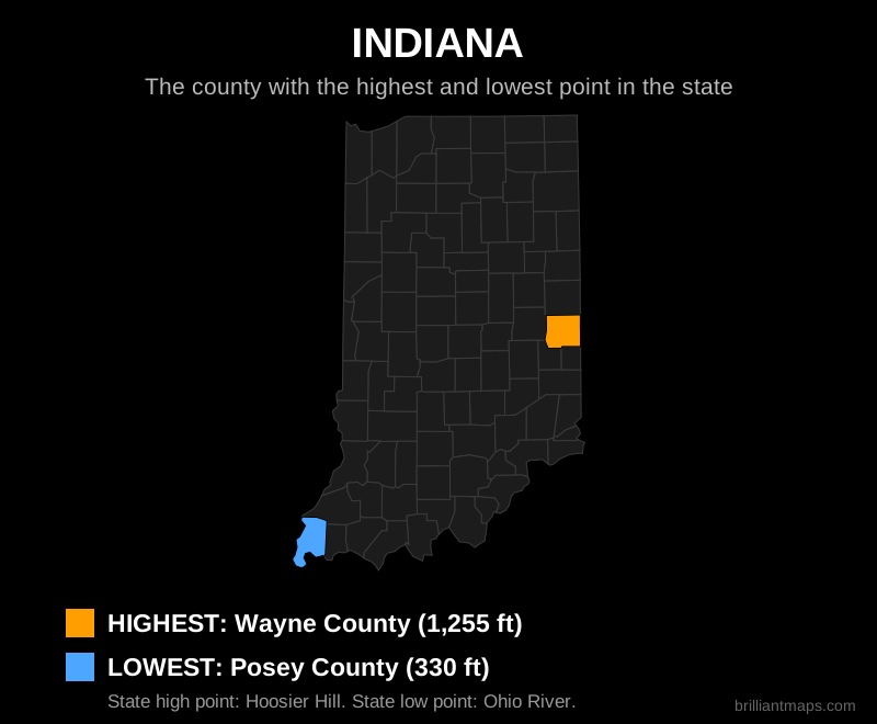
Indiana

Map of Indiana highlighting the county with the highest point and the county with the lowest point

Back to top

Iowa

Map of Iowa highlighting the county with the highest point and the county with the lowest point

Back to top

Kansas

Map of Kansas highlighting the county with the highest point and the county with the lowest point

Back to top

Kentucky

Map of Kentucky highlighting the county with the highest point and the county with the lowest point

Back to top

Louisiana

Map of Louisiana highlighting the county with the highest point and the county with the lowest point

Back to top

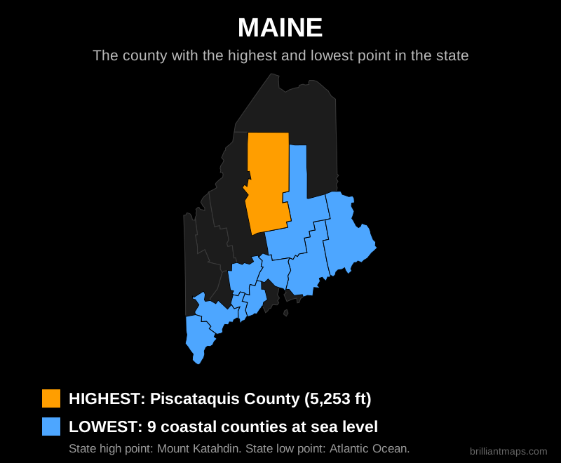
Maine

Map of Maine highlighting the county with the highest point and the county with the lowest point

Back to top

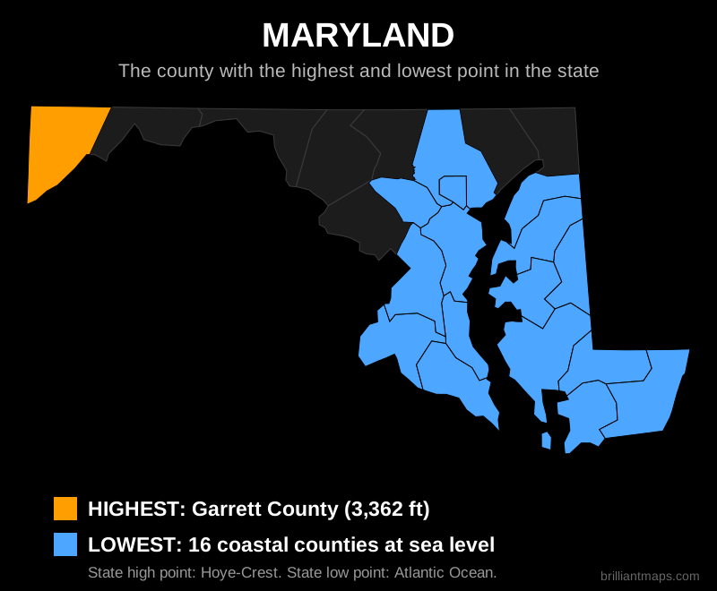
Maryland

Map of Maryland highlighting the county with the highest point and the county with the lowest point

Back to top

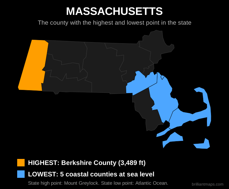
Massachusetts

Map of Massachusetts highlighting the county with the highest point and the county with the lowest point

Back to top

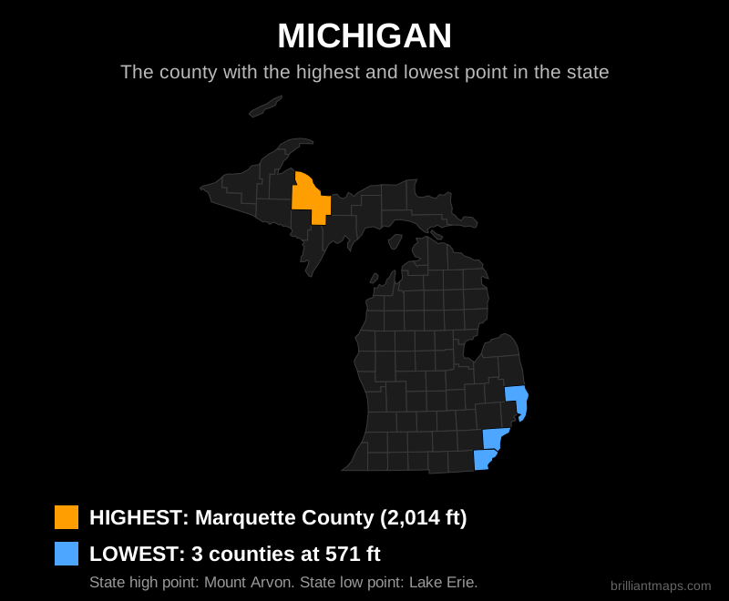
Michigan

Map of Michigan highlighting the county with the highest point and the county with the lowest point

Back to top

Minnesota

Map of Minnesota highlighting the county with the highest point and the county with the lowest point

Back to top

Mississippi

Map of Mississippi highlighting the county with the highest point and the county with the lowest point

Back to top

Missouri

Map of Missouri highlighting the county with the highest point and the county with the lowest point

Back to top

Montana

Map of Montana highlighting the county with the highest point and the county with the lowest point

Back to top

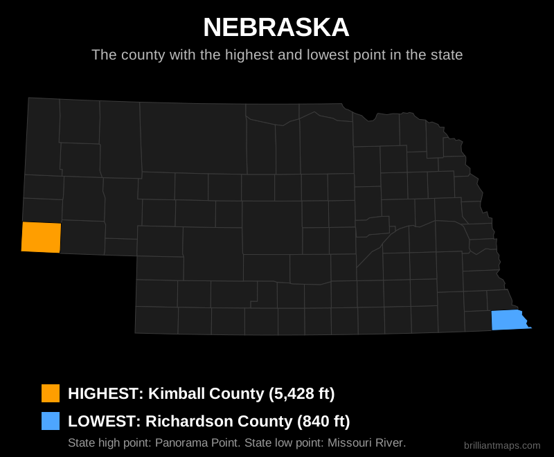
Nebraska

Map of Nebraska highlighting the county with the highest point and the county with the lowest point

Back to top

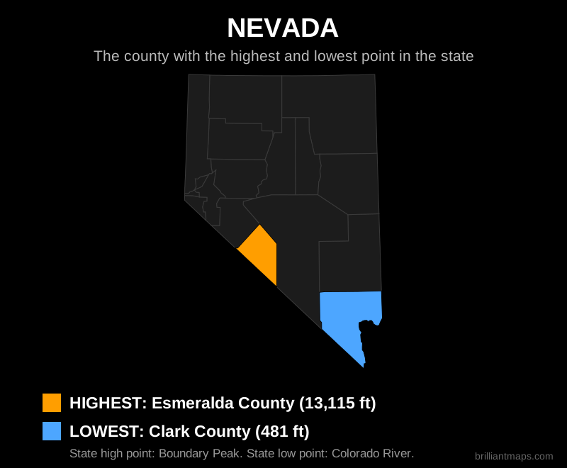
Nevada

Map of Nevada highlighting the county with the highest point and the county with the lowest point

Back to top

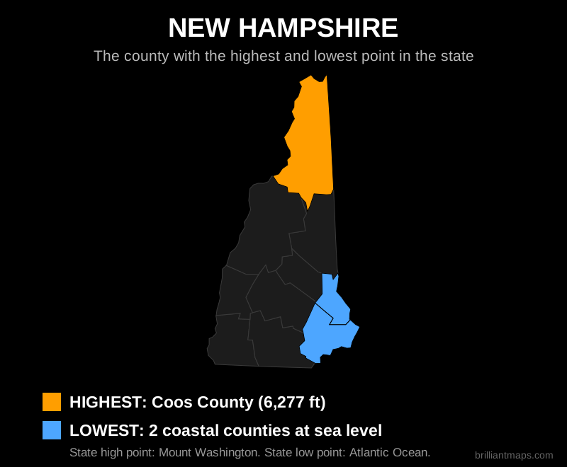
New Hampshire

Map of New Hampshire highlighting the county with the highest point and the county with the lowest point

Back to top

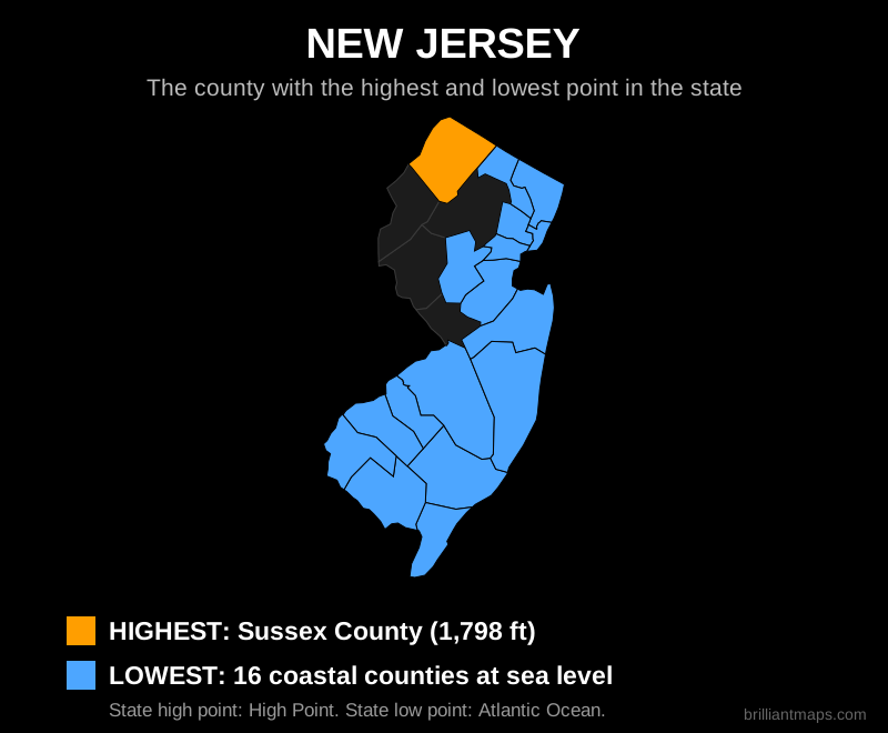
New Jersey

Map of New Jersey highlighting the county with the highest point and the county with the lowest point

Back to top

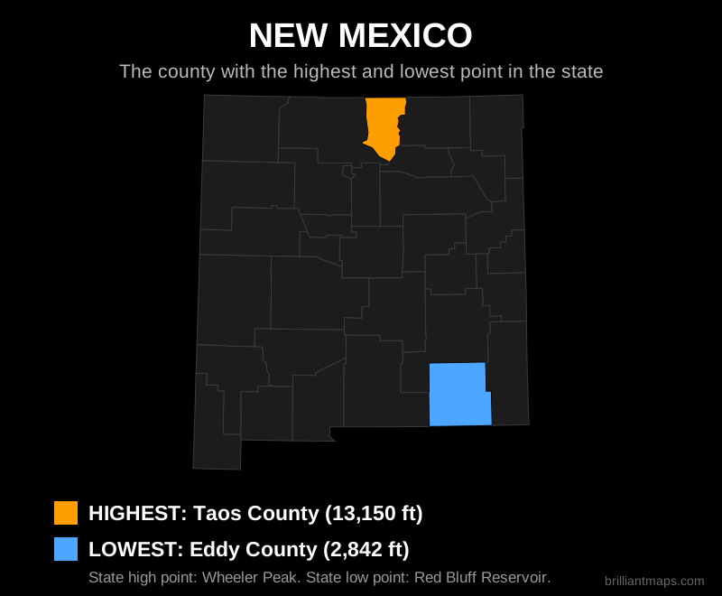
New Mexico

Map of New Mexico highlighting the county with the highest point and the county with the lowest point

Back to top

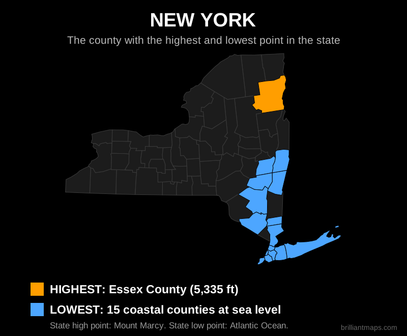
New York

Map of New York highlighting the county with the highest point and the county with the lowest point

Back to top

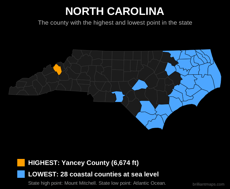
North Carolina

Map of North Carolina highlighting the county with the highest point and the county with the lowest point

Back to top

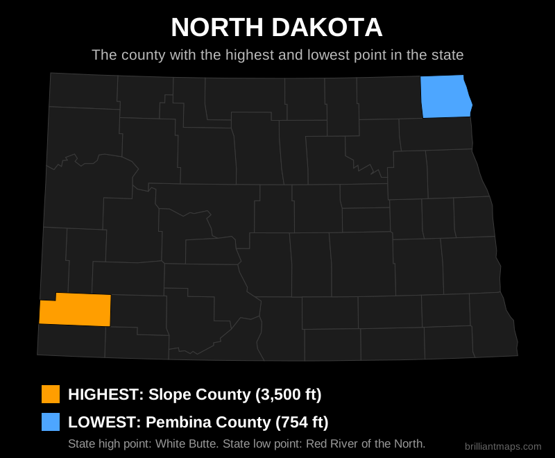
North Dakota

Map of North Dakota highlighting the county with the highest point and the county with the lowest point

Back to top

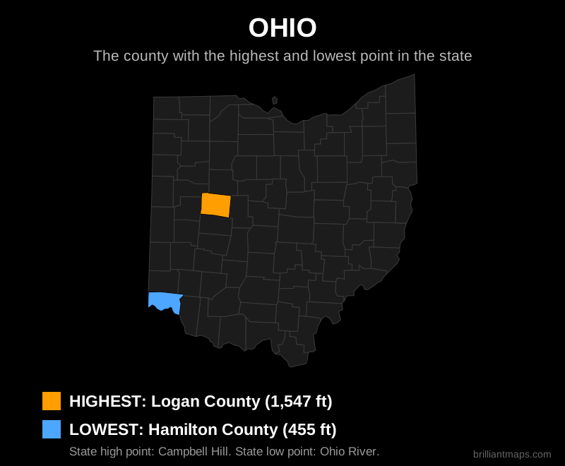
Ohio

Map of Ohio highlighting the county with the highest point and the county with the lowest point

Back to top

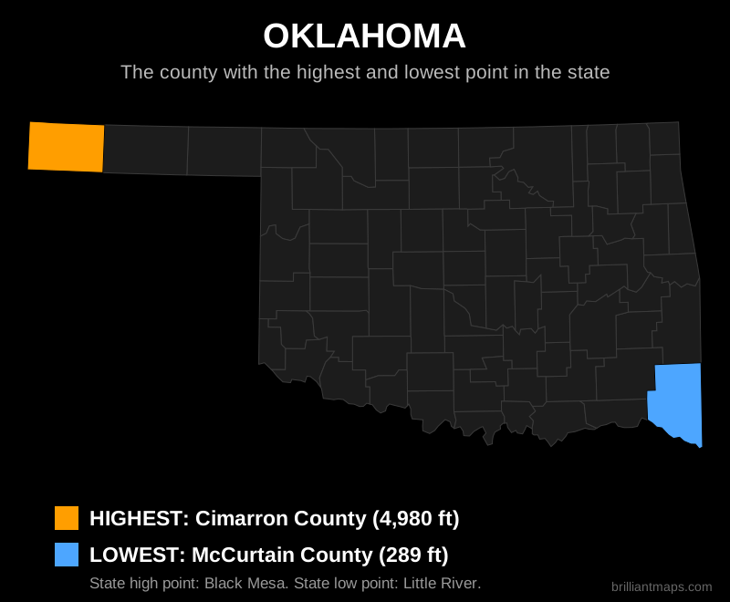
Oklahoma

Map of Oklahoma highlighting the county with the highest point and the county with the lowest point

Back to top

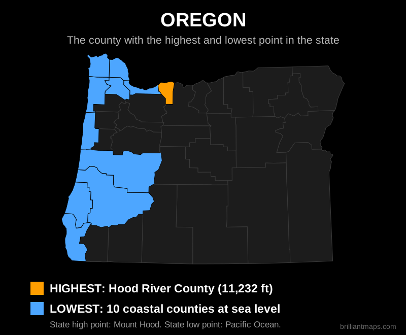
Oregon

Map of Oregon highlighting the county with the highest point and the county with the lowest point

Back to top

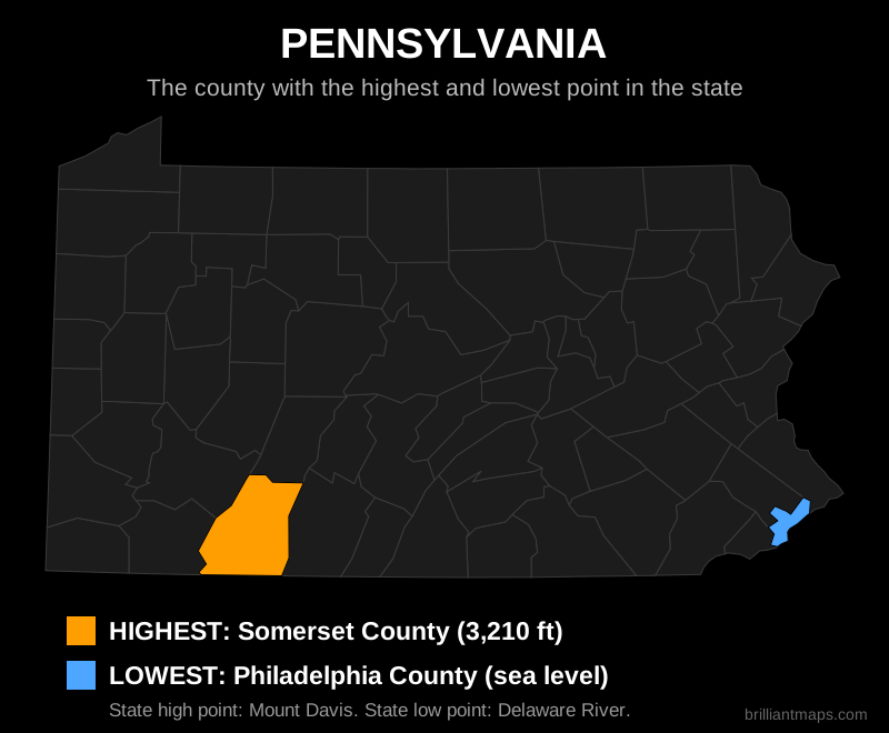
Pennsylvania

Map of Pennsylvania highlighting the county with the highest point and the county with the lowest point

Back to top

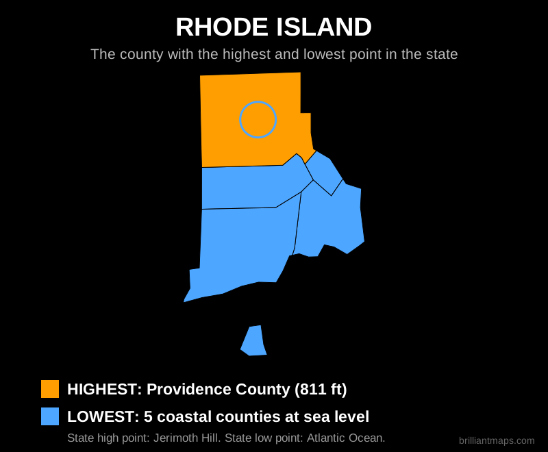
Rhode Island

Map of Rhode Island highlighting the county with the highest point and the county with the lowest point

Back to top

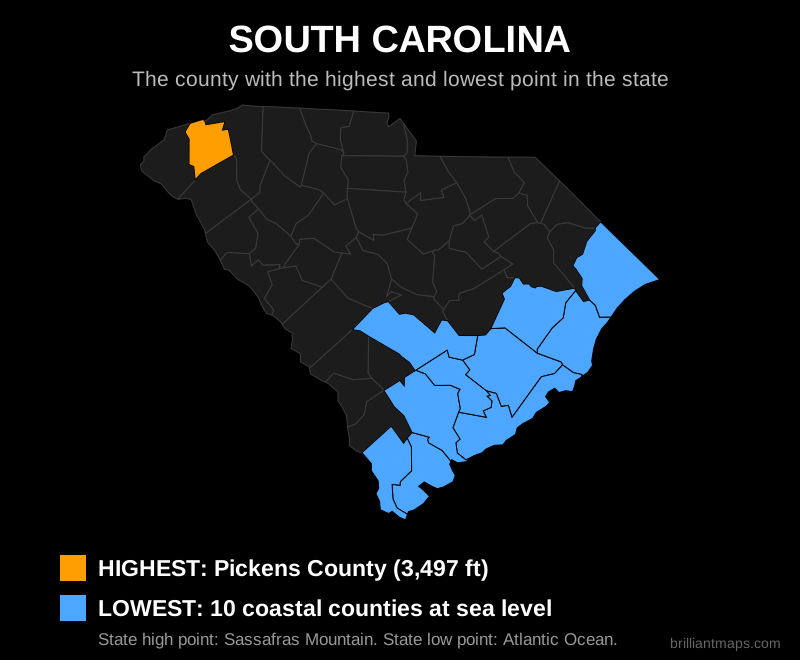
South Carolina

Map of South Carolina highlighting the county with the highest point and the county with the lowest point

Back to top

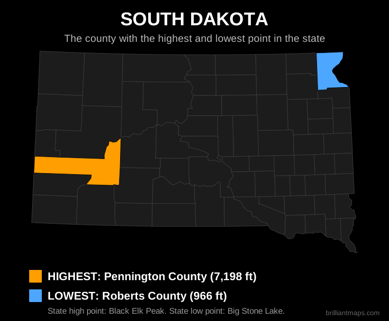
South Dakota

Map of South Dakota highlighting the county with the highest point and the county with the lowest point

Back to top

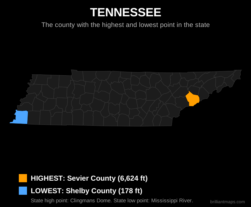
Tennessee

Map of Tennessee highlighting the county with the highest point and the county with the lowest point

Back to top

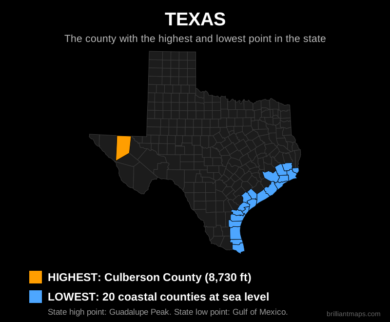
Texas

Map of Texas highlighting the county with the highest point and the county with the lowest point

Back to top

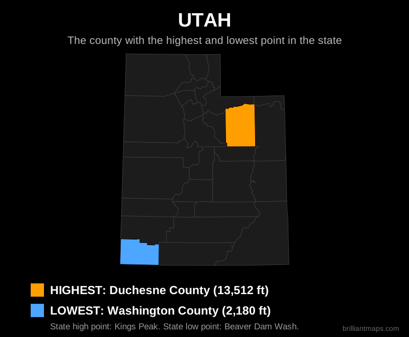
Utah

Map of Utah highlighting the county with the highest point and the county with the lowest point

Back to top

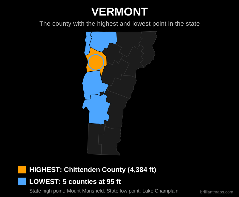
Vermont

Map of Vermont highlighting the county with the highest point and the county with the lowest point

Back to top

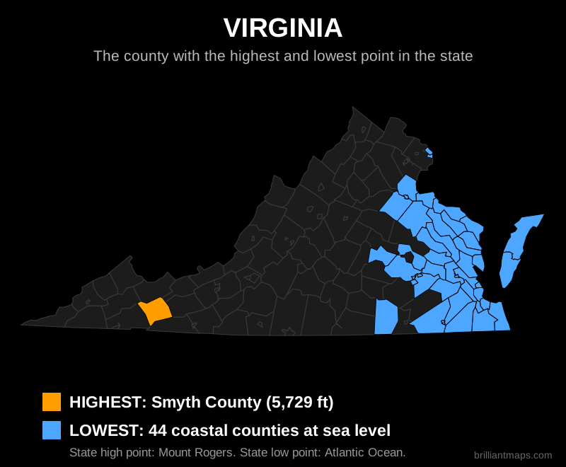
Virginia

Map of Virginia highlighting the county with the highest point and the county with the lowest point

Back to top

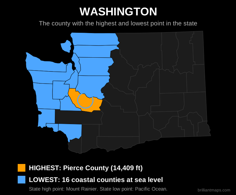
Washington

Map of Washington highlighting the county with the highest point and the county with the lowest point

Back to top

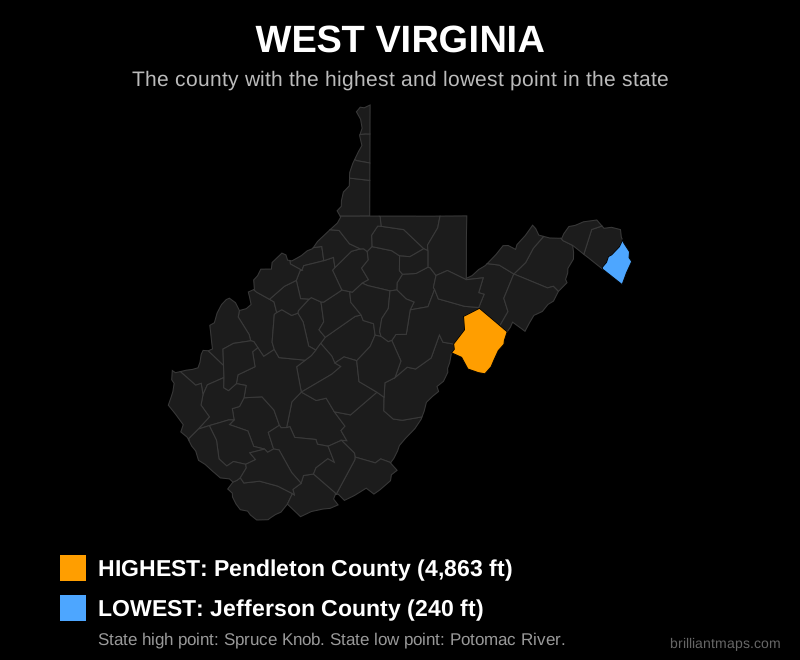
West Virginia

Map of West Virginia highlighting the county with the highest point and the county with the lowest point

Back to top

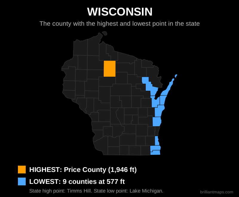
Wisconsin

Map of Wisconsin highlighting the county with the highest point and the county with the lowest point

Back to top

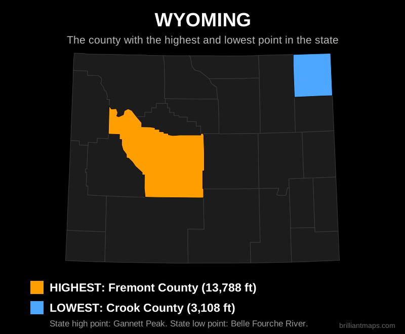
Wyoming

Map of Wyoming highlighting the county with the highest point and the county with the lowest point

Back to top

Data Sources and Notes

County elevation extremes were computed from the USGS 3D Elevation Program terrain model (1 arc-second, with IFSAR data for Alaska). Digital elevation models include some features that are not natural terrain: open pit mines, quarries and spoil heaps, lake and offshore depths, and occasional data gaps can all produce false county extremes. To correct for this, coastal below-sea-level readings were set to sea level, Great Lakes and Lake Champlain shoreline counties were floored at the lake surface, and clear mining or data artefacts were replaced using official state elevations and neighboring county values. In total 481 county minimums were adjusted; the 140 counties adjusted by more than 30 ft are marked with an asterisk in the table, and their corrected values should be treated as close estimates. Two Florida counties (Polk and Hamilton) have maximums that include phosphate mining structures taller than the state's natural high point of Britton Hill; they are marked and excluded from map selection. Genuine below-sea-level terrain in Death Valley, the Salton Sea basin and the New Orleans area is preserved. State high and low point names follow the official USGS lists. Terrain-derived elevations can differ slightly from surveyed values. This page is for general reference and educational purposes.

Product Reviews · World Atlas · Map Posters · Settlers of Catan · Risk · Game of Thrones · Coloring Books · Globes · Monopoly · Star Wars · Game of Life · Pandemic · Ticket To Ride · Drinks Cabinets
Size Comparisons · US Locations · Flight Maps · Fleet Management
Copyright © 2026 · Privacy Policy · Fair Use, Attribution & Copyright · Contact Us
Follow Us: Newsletter · Facebook · Youtube · Twitter · Threads · BlueSky · LinkedIn · Instagram · Pinterest · Flipboard