Longyearbyen is the main settlement of Svalbard, the Norwegian Arctic archipelago, at 78 degrees north the world's northernmost town of any size, founded as a coal-mining camp in 1906. See the entrance to the Svalbard Global Seed Vault on the hillside, visit Svalbard Church and the Svalbard Museum, walk up to the old miners' quarter of Nybyen, tour Svalbard Bryggeri, the northernmost brewery, and take a boat on Adventfjorden.
List of all 19 things to do in Longyearbyen and where to find them
- Svalbard Global Seed Vault Website Wikipedia
- Arctic World ArchiveGruve 3 Longyearbyen, Svalbard and Jan Mayen Website Wikipedia
- Svalbard Satellite Station Wikipedia
- Operation Gauntlet Wikipedia
- Svalbard ChurchPostboks 533, 9171 Longyearbyen Website Wikipedia
- Nybyen Wikipedia
- Operation Fritham Wikipedia
- Svalbard Bryggeri Website Wikipedia
- Adventfjorden Wikipedia
- Operation Gearbox Wikipedia
- Huset Restaurant Wikipedia
- Operation Gearbox II Wikipedia
- Adventdalen Wikipedia
- Agardhfjellet Formation Wikipedia
- Operafjellet Wikipedia
- Longyear Valley Wikipedia
- Platåberget Wikipedia
- Hotellneset Wikipedia
- Svalbard MuseumBox 521 Website Wikipedia
Official websites and travel guides
- Official Longyearbyen website: www.lokalstyre.no
- Longyearbyen travel guide: Wikivoyage
- Longyearbyen on Wikipedia
- All Longyearbyen tours and activities on Viator
Where To Stay In Longyearbyen: Interactive Longyearbyen Hotel Map
Everything is in or just outside the small town centre along the valley, with hotels from the harbour up to Nybyen; you cannot leave the settlement without a guide or rifle because of polar bears, so location matters little. Compare hotels on the map below.
Top Things To Do In Longyearbyen Today
Download The Illustrated Longyearbyen Tourist Map
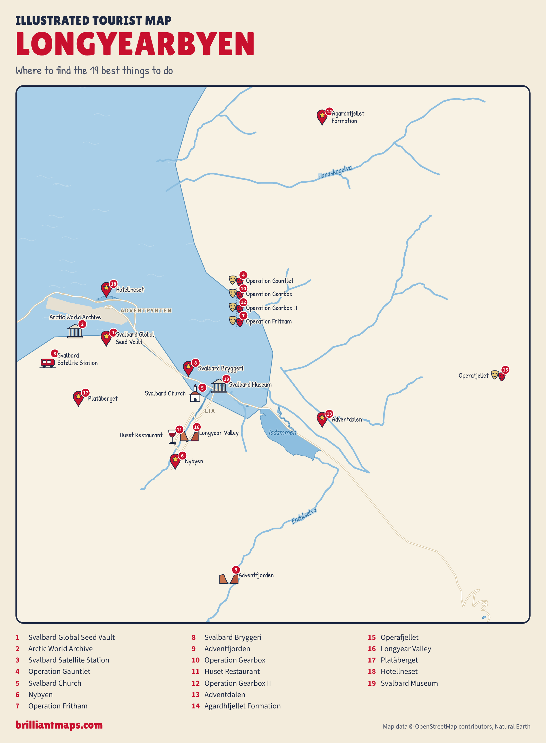
Download the Longyearbyen map (PNG)
More Tourist Maps Near Longyearbyen
Longyearbyen is part of: