Whidbey Island is a long, narrow island in Puget Sound north of Seattle, Washington, reached by bridge at the north end and by ferry from Mukilteo and Port Townsend, with farmland, beaches and a naval air station at Oak Harbor. Watch the tidal currents under the bridge at Deception Pass State Park, walk the bluff trail at Ebey's Landing National Historical Reserve and climb Admiralty Head Light.
Tap a picture for details or zoom in to explore.
Map data © OpenStreetMap, Natural Earth
List of all 12 things to do in Whidbey Island and where to find them
- Deception Pass Wikipedia
- Admiralty Inlet Wikipedia
- Hat Island, Washington Wikipedia
- Deception Pass State Park41229 State Route 20, Oak Harbor, WA 98277 Website Wikipedia
- Clinton, Washington Wikipedia
- Ebey's Landing National Historical Reserve Website Wikipedia
- Future of Flight Aviation Center & Boeing Tour Website Wikipedia
- Point Wilson Light Wikipedia
- Admiralty Head Light Wikipedia
- Japanese Gulch Wikipedia
- Mukilteo Light Wikipedia
- Captain Whidbey Inn Wikipedia
Official websites and travel guides
- Whidbey Island travel guide: Wikivoyage
- Whidbey Island on Wikipedia
- All Whidbey Island tours and activities on Viator
Where To Stay In Whidbey Island: Interactive Whidbey Island Hotel Map
Coupeville, in the middle of the island, is the most central base with historic inns on Penn Cove; Langley at the south end is handy for the Mukilteo ferry, and Oak Harbor has the most chain motels. Compare hotels on the map below.
Top Things To Do In Whidbey Island Today
Download The Illustrated Whidbey Island Tourist Map
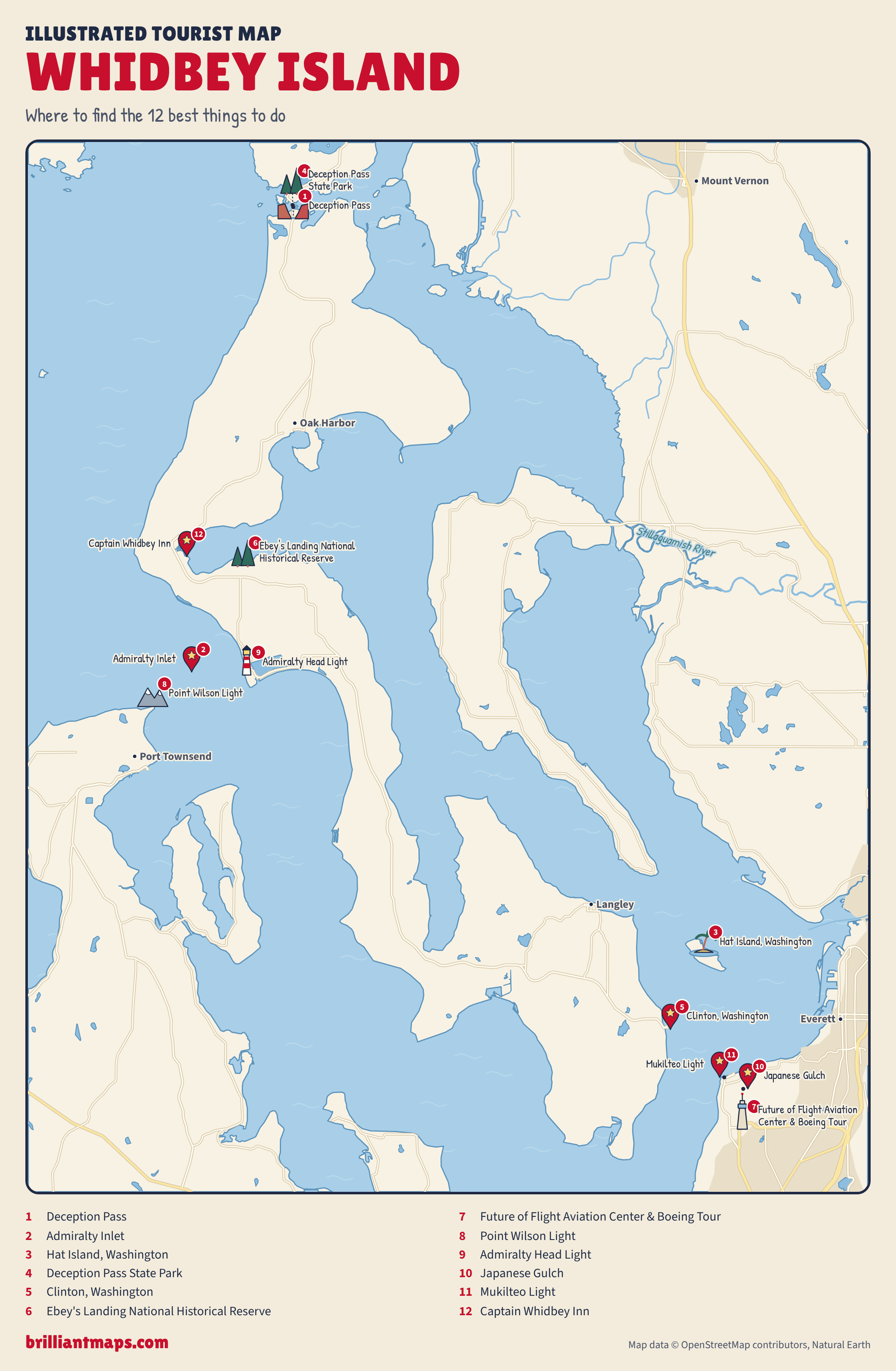
Download the Whidbey Island map (PNG)
More Tourist Maps Near Whidbey Island
Whidbey Island is part of: