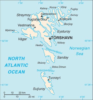
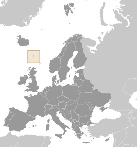
The map of The Faroe Islands above comes from the CIA World Factbook which has now been taken offline with the following statement:
One of CIA’s oldest and most recognizable intelligence publications, The World Factbook, has sunset. The World Factbook served the Intelligence Community and the general public as a longstanding, one-stop basic reference about countries and communities around the globe.
Link to the History of The World Factbook.
Where are the Faroe Islands? Location Map
Faroe Islands Facts
Full Official Name: Faeroe Islands
Demonym: Faroe Islander, Faroese
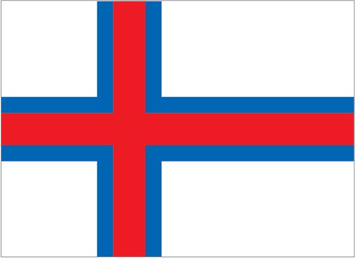
Flag:
Area
Total Area: 1,393 km²
Total Land Area: 1,393 km²
Total Water Area: 0 km²
Demographics
Population: 52,933
Population Growth Rate: 0.63% (2024 est.)
Largest City: Tórshavn (Population: 14,099)
Ethnic Groups: Faroese 83.8% (Scandinavian and Anglo-Saxon descent), Danish 8.3%, Filipino 1.2%, other Nordic 0.9%, other 4.5% (includes Polish and Romanian) (2024 est.)
Languages: Faroese 93.8% (derived from Old Norse), Danish 3.2%, other 3% (2011 est.)
Religions: Christian 87% (predominantly Evangelical Lutheran), other 0.9%, none 3.7%, unspecified 8.9% (2011 est.)
Economy
Currency: Faroese króna, Danish krone
Real GDP at Purchasing Power Parity ($ PPP): $3.798 billion (2022 est.)
GDP per capita (PPP): $71,500 (2022 est.)
Exports Value Per Year: $2.219 billion (2022 est.)
Biggest Export Partners: Faroe IslandsRussia 26.4%, UK 14.1%, Germany 8.4%, China 7.9%, Spain 6.8%, Denmark 6.2%, US 4.7%, Poland 4.4%, Norway 4.1% (2017)
Imports Value Per Year: $2.223 billion (2022 est.)
Biggest Import Partners: Denmark 33%, China 10.7%, Germany 7.6%, Poland 6.8%, Norway 6.7%, Ireland 5%, Chile 4.3% (2017)
Government
Type: parliamentary democracy (Faroese Parliament); part of the Kingdom of Denmark
Capital City: Torshavn (Population: 14,099)
Other Facts
Time Zone: UTC±00:00 (WET), UTC+01:00 (WEST)
Country Code: FO
Internet TLD: .fo
Climate: mild winters, cool summers; usually overcast; foggy, windy
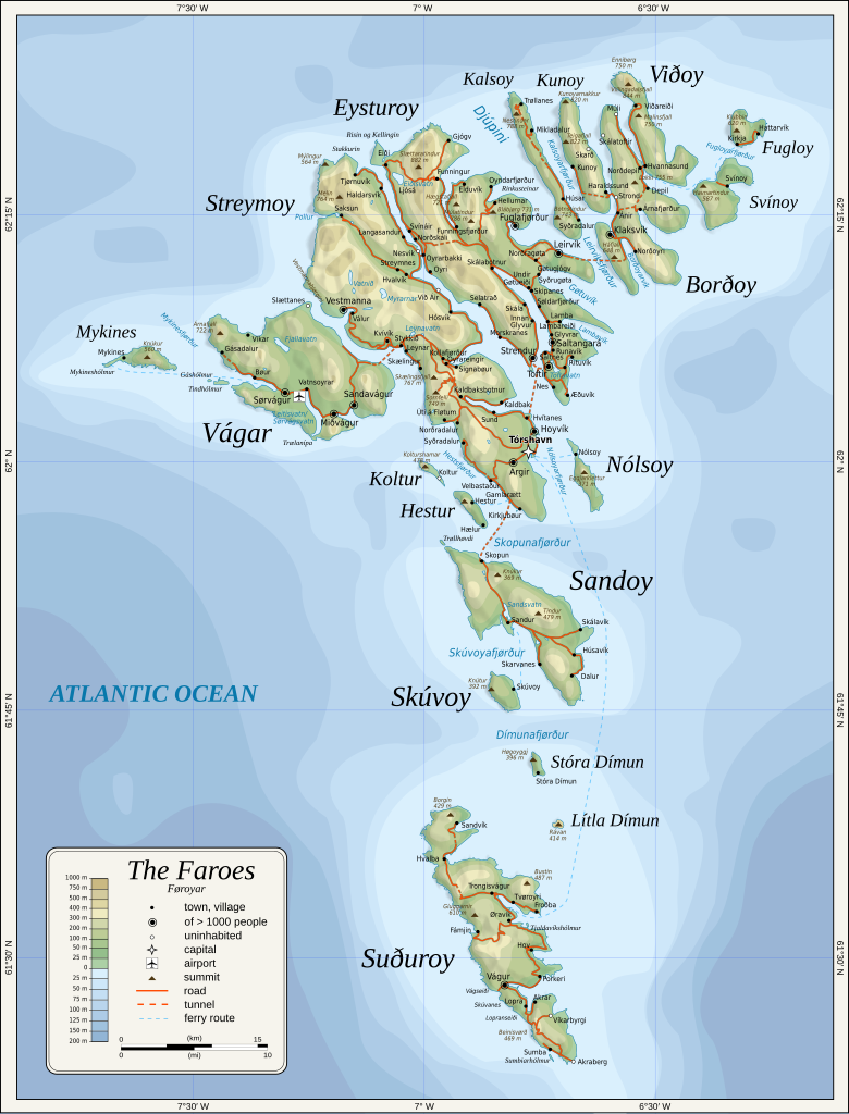
Topographic Map of Faroe Islands