Brilliant Maps

Making Sense Of The World, One Map At A Time

  • BOOK!
  • Newsletter
  • Games & Quizes
  • Map Based Polls
  • Map Tools

The Length and Width of Every US State

Click To Get My 10 Best Brilliant Maps For Free:

How wide is Texas? How long is California? The table below gives the width and length of every US state in miles and kilometers. Width is the greatest east-west distance between a state's westernmost and easternmost points, and length is the greatest north-south distance between its southernmost and northernmost points, both measured as straight-line (great circle) distances computed from official US Census Bureau boundary files. Click any column heading to sort, and scroll down for a measurement map of each state. Note that other published figures sometimes use different definitions, such as the longest diagonal, so numbers can differ slightly between sources.
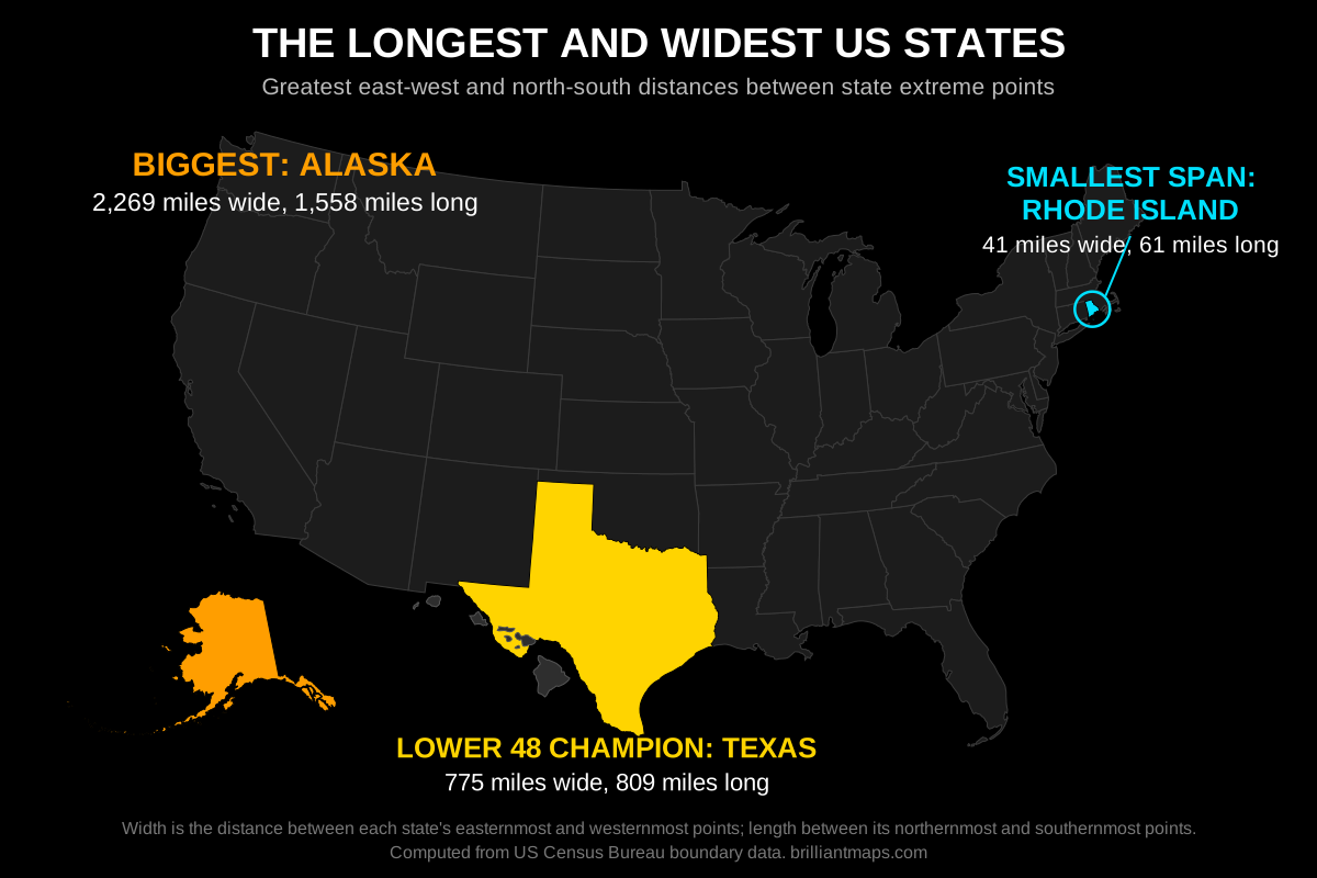
Map of the United States highlighting the largest state Alaska, the largest lower 48 state Texas, and the smallest state Rhode Island with their widths and lengths

Every US State by Width and Length

Width is east-west, length is north-south. Distances include islands, which is why Hawaii and states with offshore islands measure larger than their main landmass alone.

#StateWidth (mi)Width (km)Length (mi)Length (km)

Measurement Maps for Every State

One map per state showing its east-west width and north-south length. The District of Columbia (12 miles wide, 14 miles long) is not a state, so it has no map.
ALAKAZARCACOCTDEFLGAHIIDILINIAKSKYLAMEMDMAMIMNMSMOMTNENVNHNJNMNYNCNDOHOKORPARISCSDTNTXUTVTVAWAWVWIWY

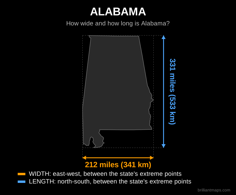
Alabama

Map of Alabama showing its width and length in miles and kilometers

Back to top

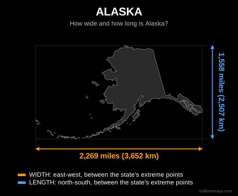
Alaska

Map of Alaska showing its width and length in miles and kilometers

Back to top

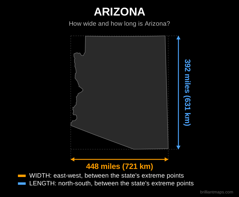
Arizona

Map of Arizona showing its width and length in miles and kilometers

Back to top

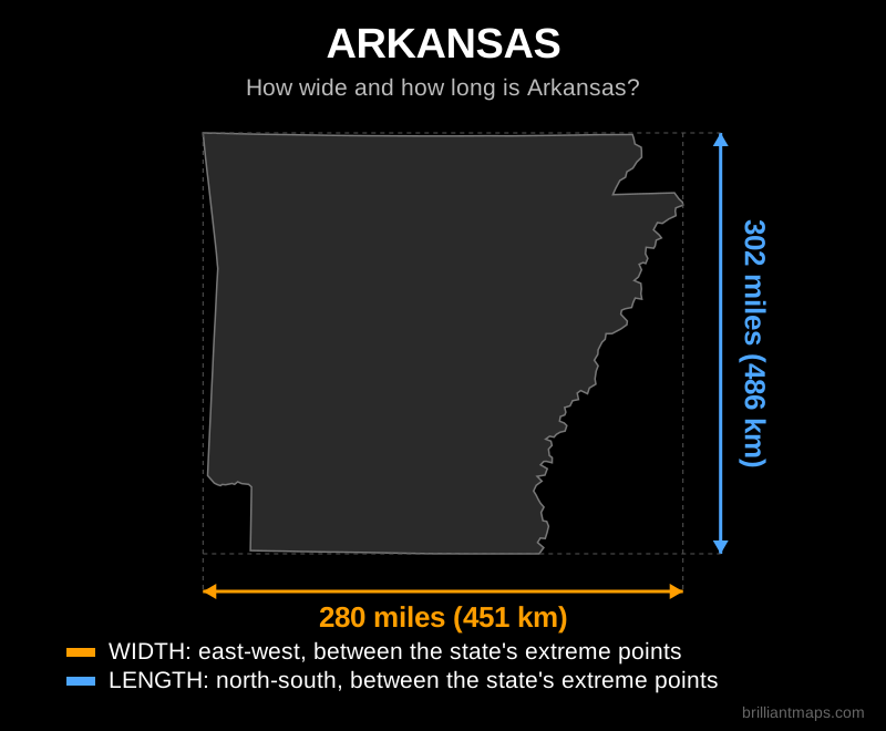
Arkansas

Map of Arkansas showing its width and length in miles and kilometers

Back to top

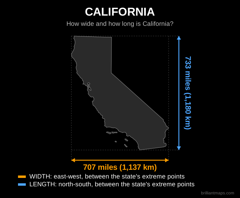
California

Map of California showing its width and length in miles and kilometers

Back to top

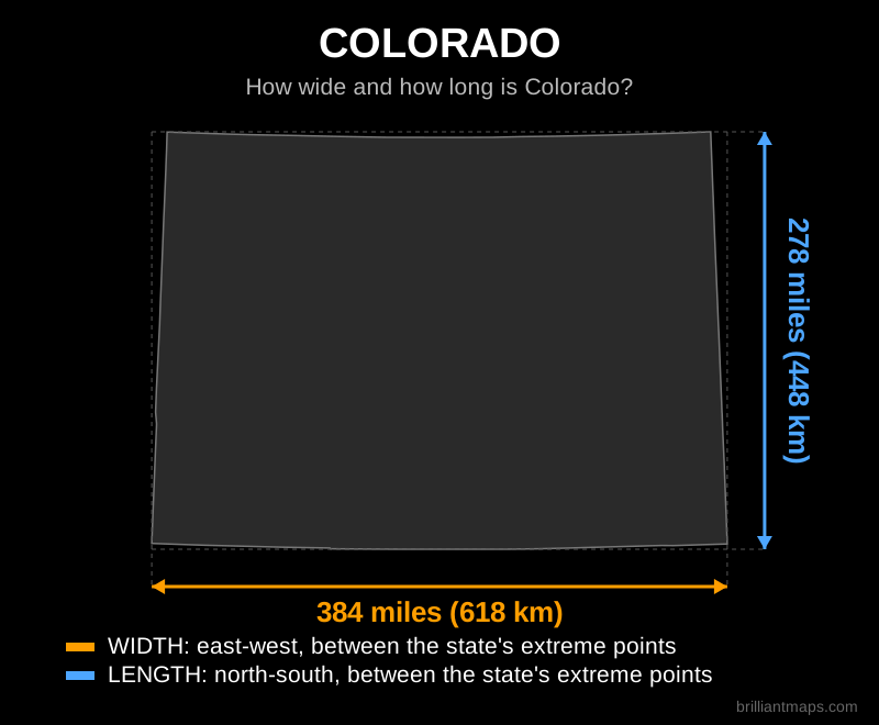
Colorado

Map of Colorado showing its width and length in miles and kilometers

Back to top

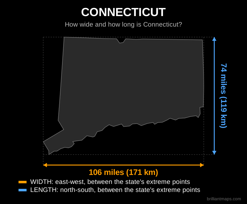
Connecticut

Map of Connecticut showing its width and length in miles and kilometers

Back to top

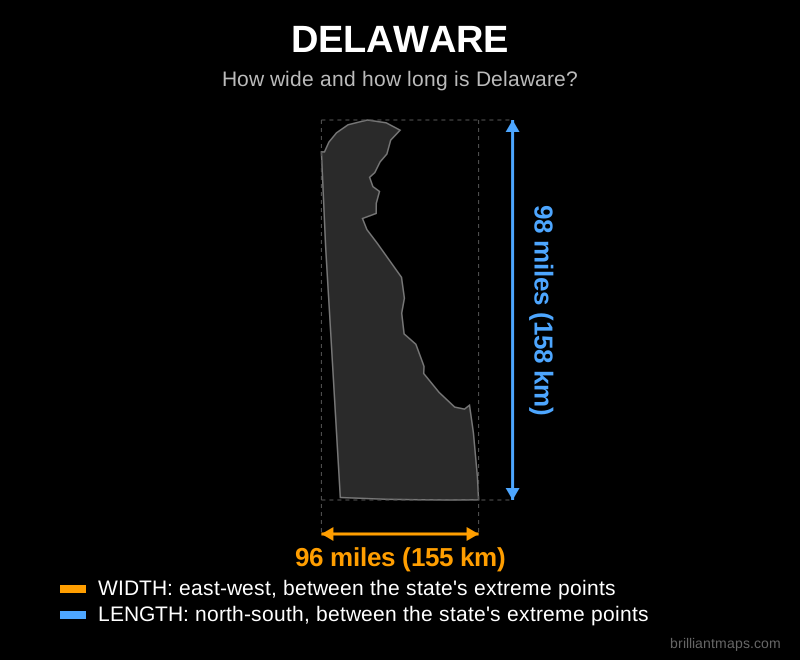
Delaware

Map of Delaware showing its width and length in miles and kilometers

Back to top

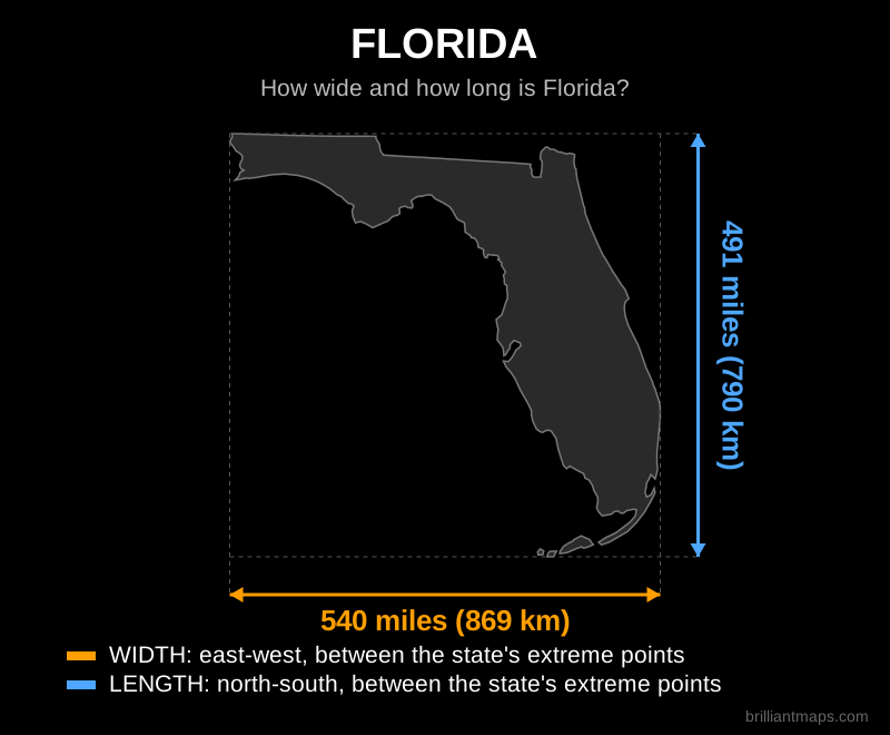
Florida

Map of Florida showing its width and length in miles and kilometers

Back to top

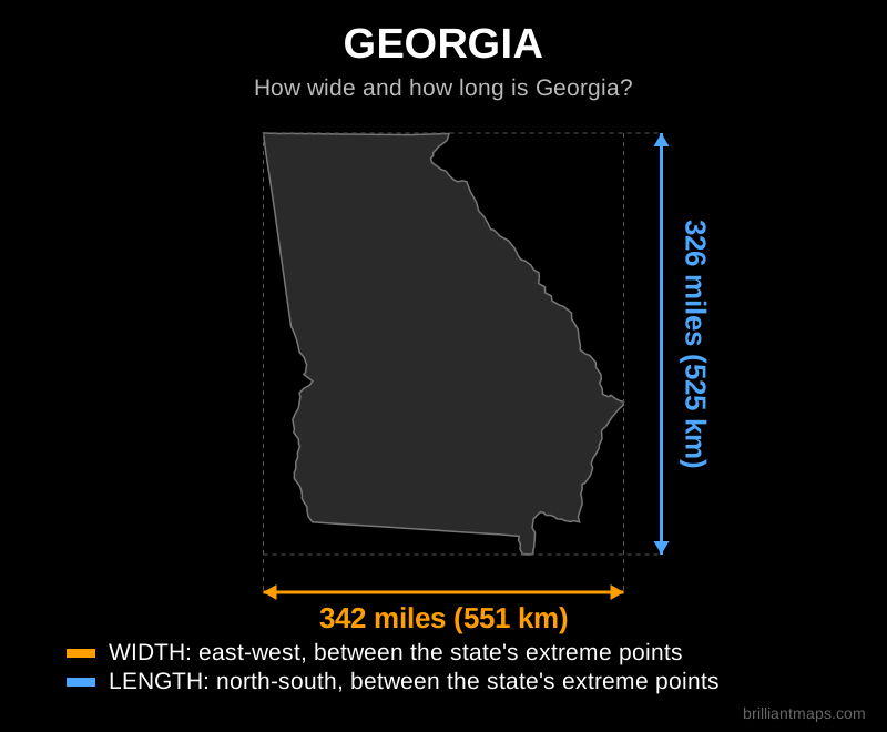
Georgia

Map of Georgia showing its width and length in miles and kilometers

Back to top

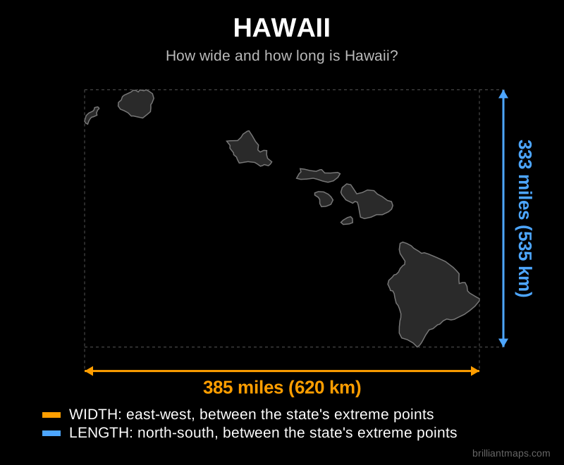
Hawaii

Map of Hawaii showing its width and length in miles and kilometers

Back to top

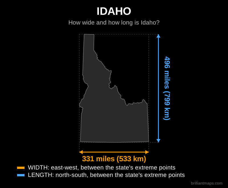
Idaho

Map of Idaho showing its width and length in miles and kilometers

Back to top

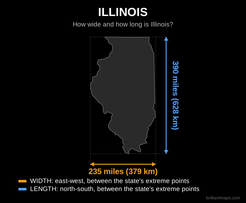
Illinois

Map of Illinois showing its width and length in miles and kilometers

Back to top

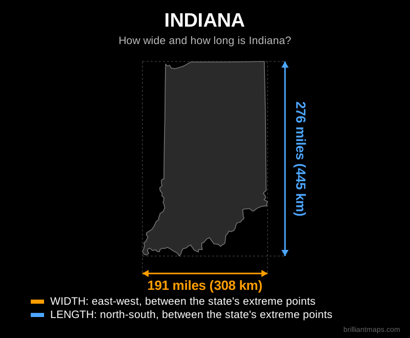
Indiana

Map of Indiana showing its width and length in miles and kilometers

Back to top

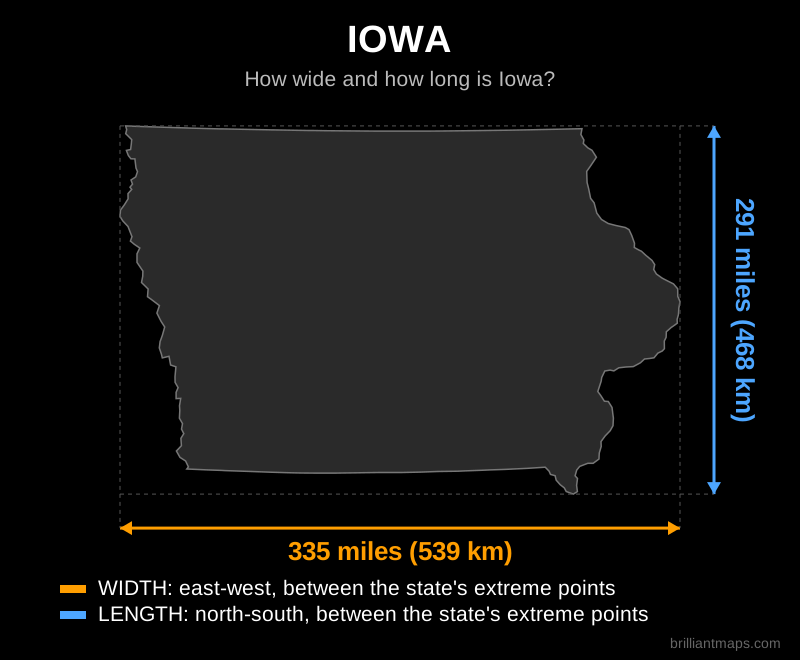
Iowa

Map of Iowa showing its width and length in miles and kilometers

Back to top

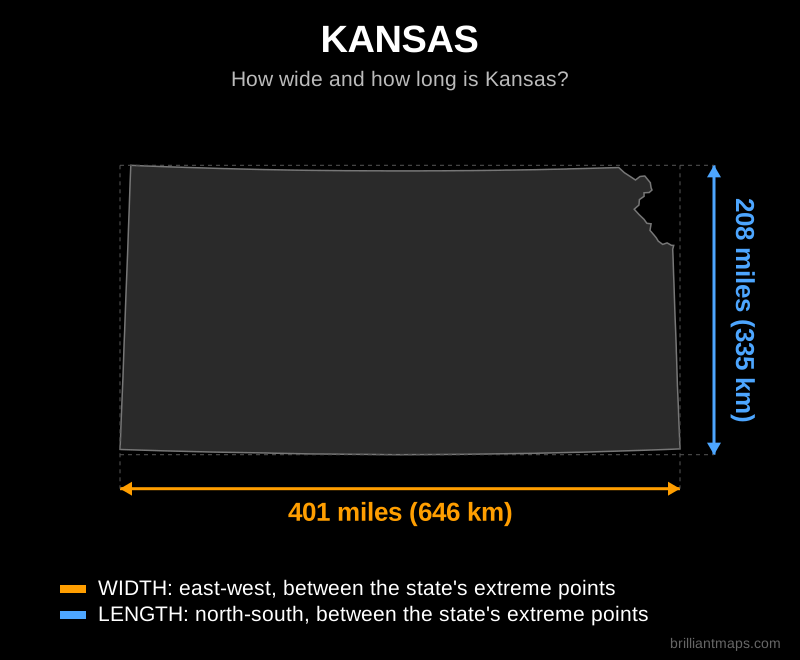
Kansas

Map of Kansas showing its width and length in miles and kilometers

Back to top

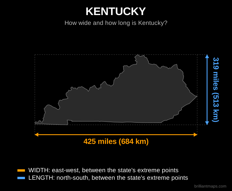
Kentucky

Map of Kentucky showing its width and length in miles and kilometers

Back to top

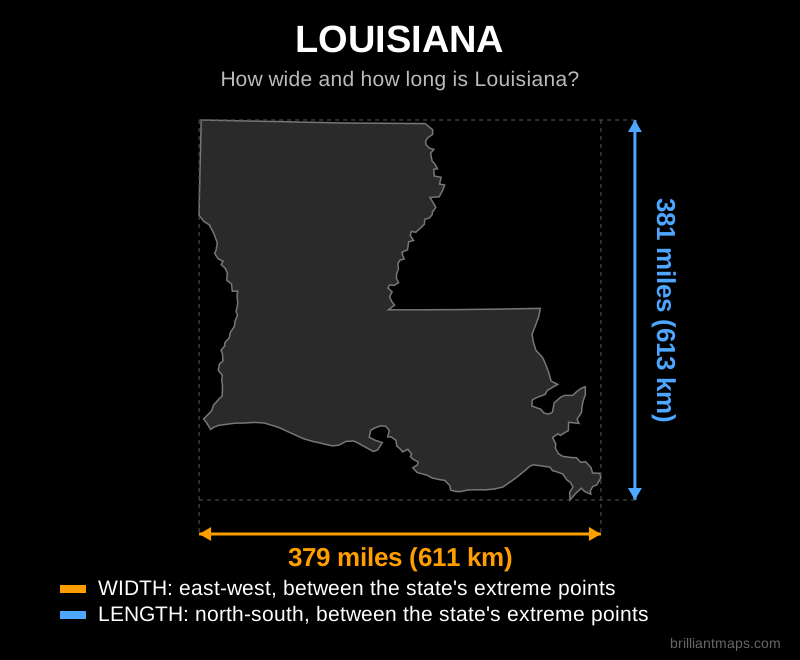
Louisiana

Map of Louisiana showing its width and length in miles and kilometers

Back to top

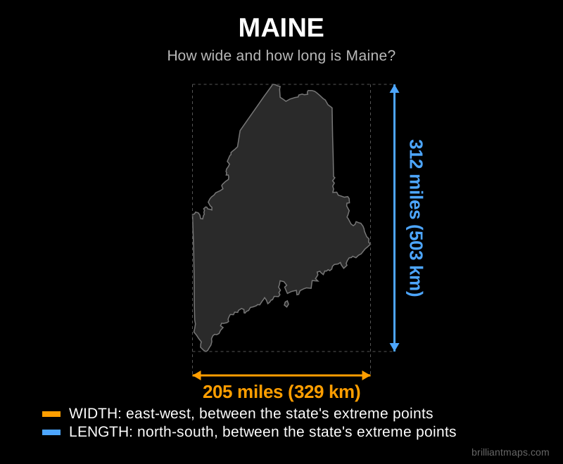
Maine

Map of Maine showing its width and length in miles and kilometers

Back to top

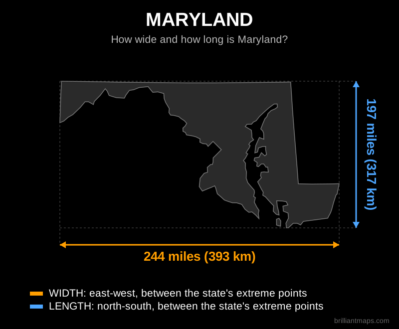
Maryland

Map of Maryland showing its width and length in miles and kilometers

Back to top

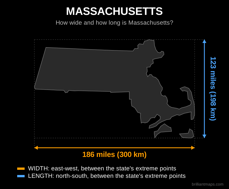
Massachusetts

Map of Massachusetts showing its width and length in miles and kilometers

Back to top

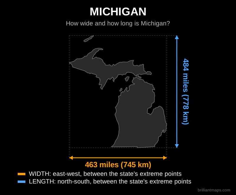
Michigan

Map of Michigan showing its width and length in miles and kilometers

Back to top

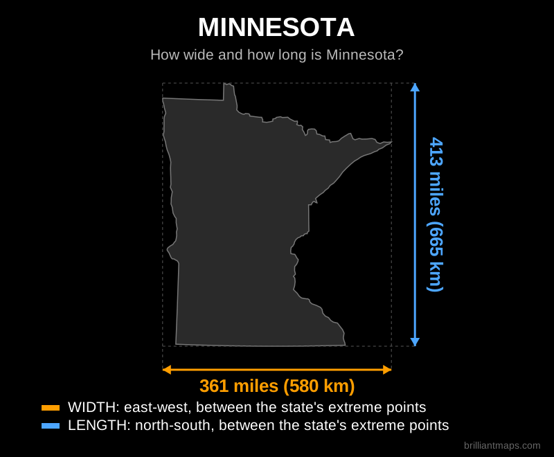
Minnesota

Map of Minnesota showing its width and length in miles and kilometers

Back to top

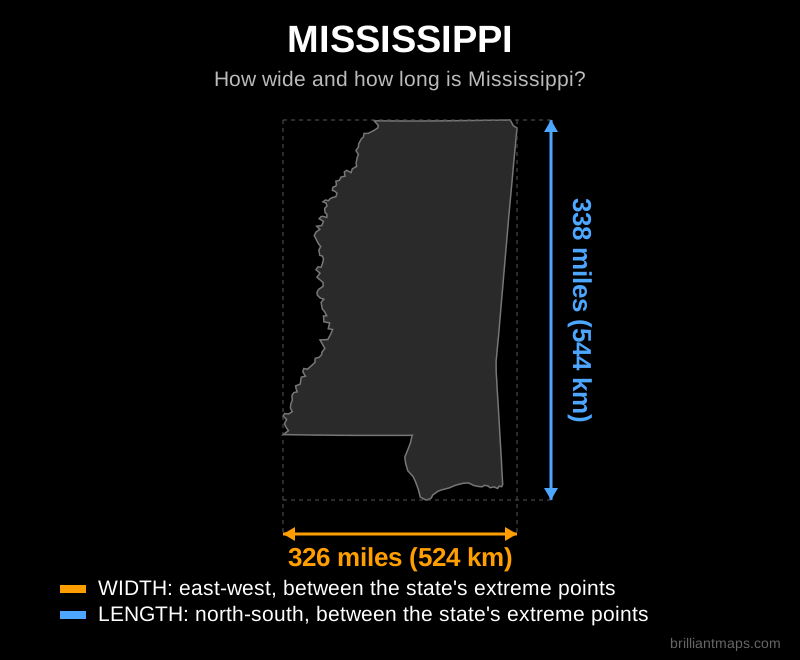
Mississippi

Map of Mississippi showing its width and length in miles and kilometers

Back to top

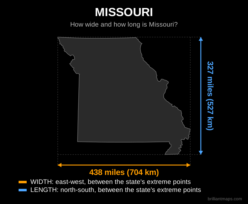
Missouri

Map of Missouri showing its width and length in miles and kilometers

Back to top

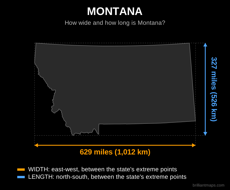
Montana

Map of Montana showing its width and length in miles and kilometers

Back to top

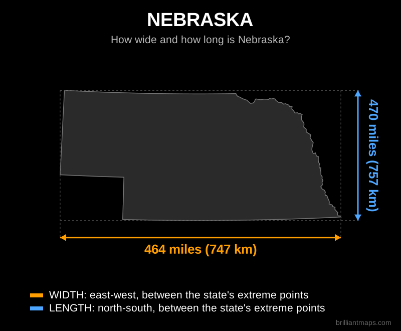
Nebraska

Map of Nebraska showing its width and length in miles and kilometers

Back to top

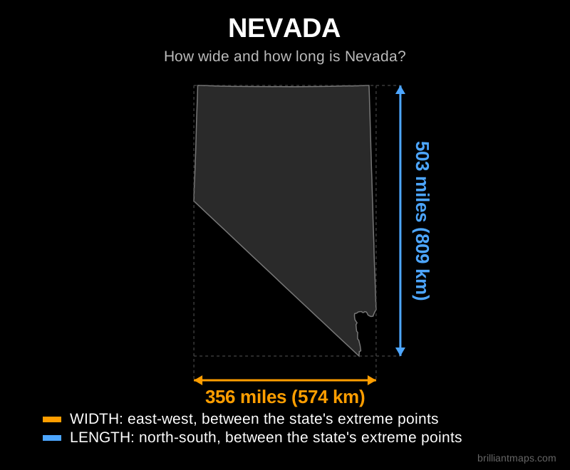
Nevada

Map of Nevada showing its width and length in miles and kilometers

Back to top

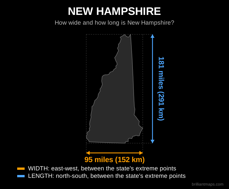
New Hampshire

Map of New Hampshire showing its width and length in miles and kilometers

Back to top

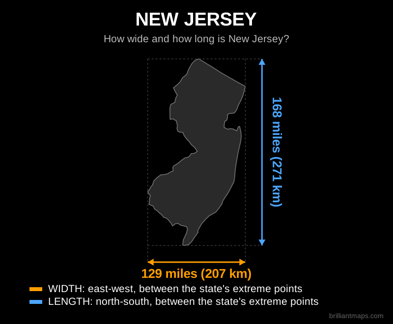
New Jersey

Map of New Jersey showing its width and length in miles and kilometers

Back to top

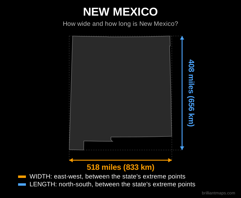
New Mexico

Map of New Mexico showing its width and length in miles and kilometers

Back to top

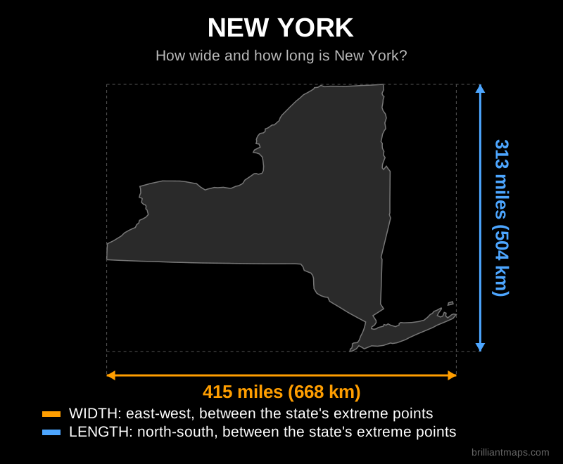
New York

Map of New York showing its width and length in miles and kilometers

Back to top

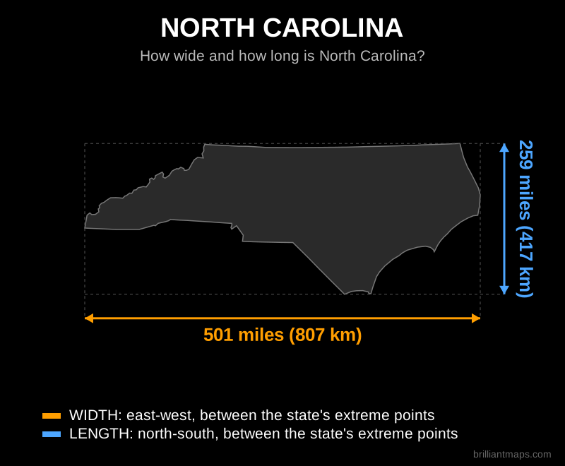
North Carolina

Map of North Carolina showing its width and length in miles and kilometers

Back to top

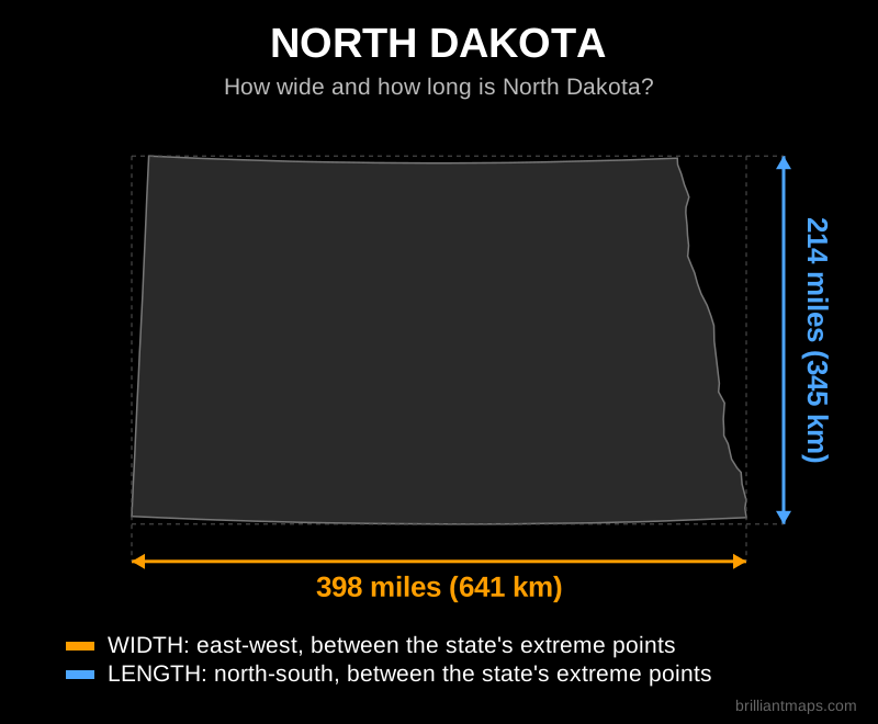
North Dakota

Map of North Dakota showing its width and length in miles and kilometers

Back to top

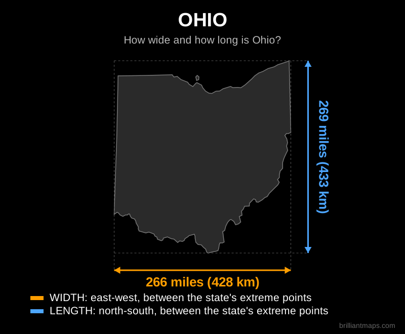
Ohio

Map of Ohio showing its width and length in miles and kilometers

Back to top

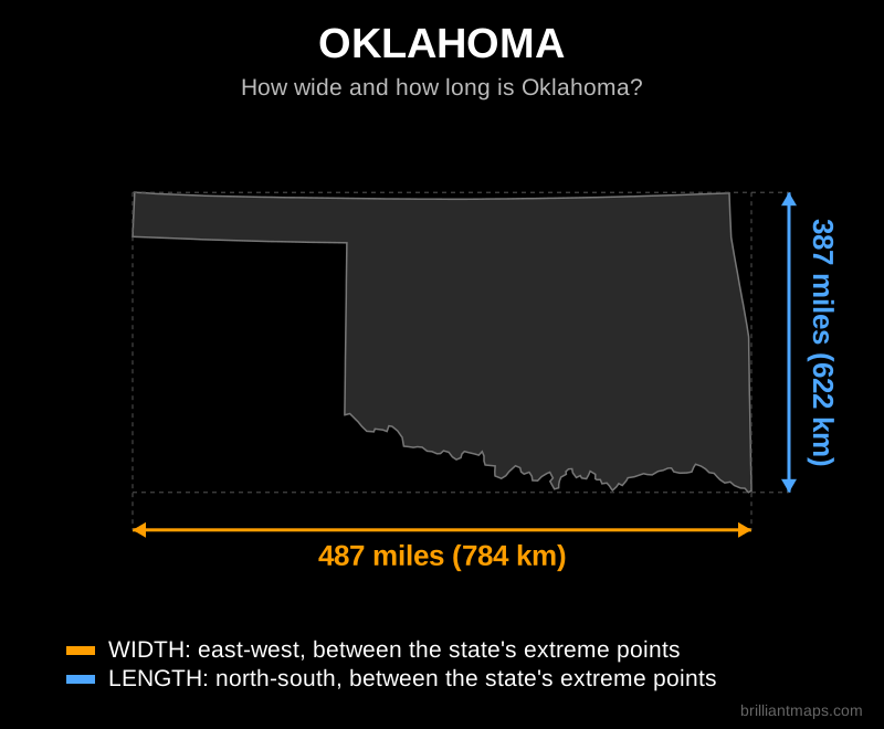
Oklahoma

Map of Oklahoma showing its width and length in miles and kilometers

Back to top

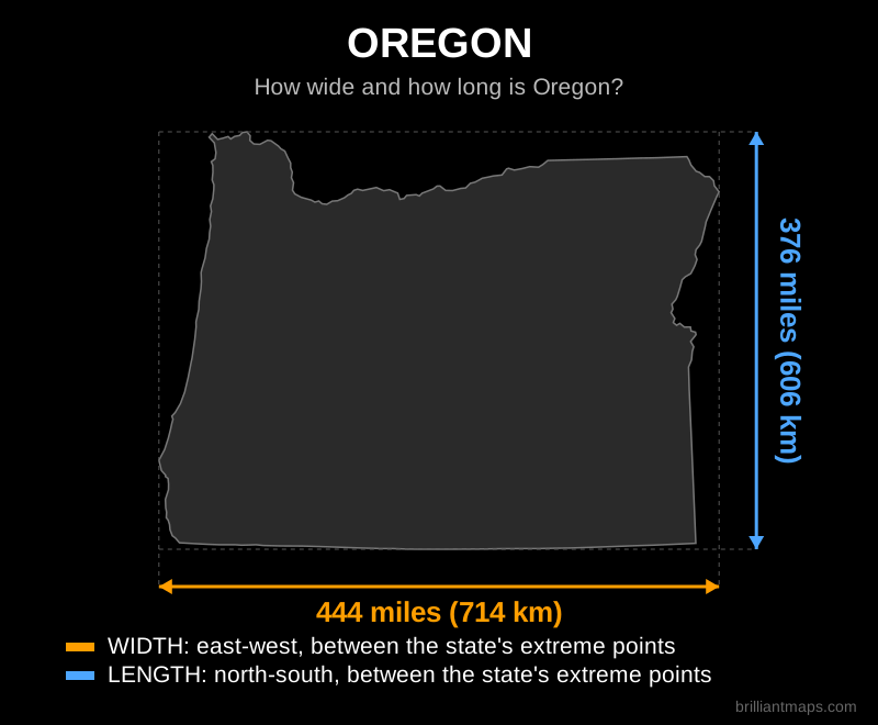
Oregon

Map of Oregon showing its width and length in miles and kilometers

Back to top

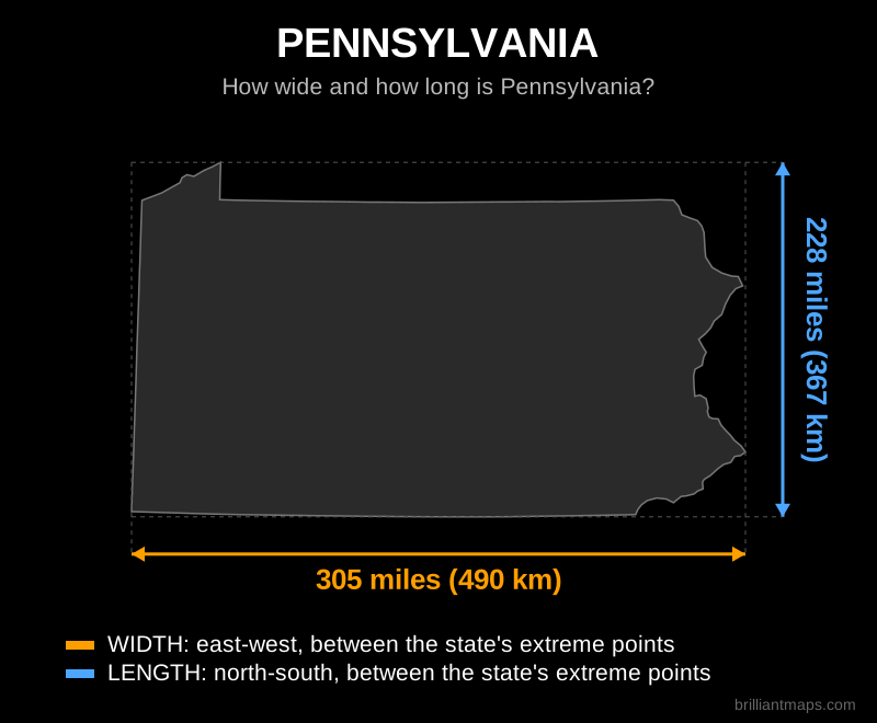
Pennsylvania

Map of Pennsylvania showing its width and length in miles and kilometers

Back to top

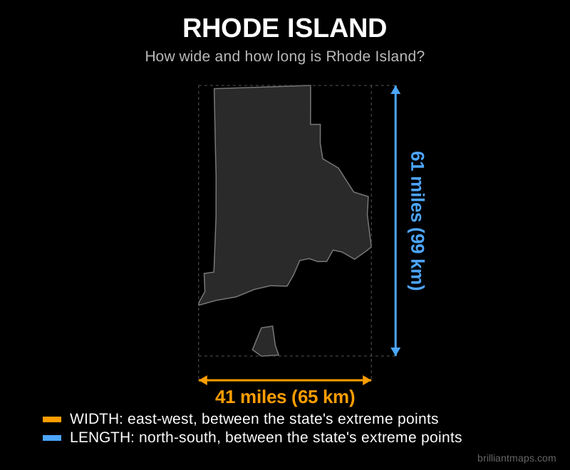
Rhode Island

Map of Rhode Island showing its width and length in miles and kilometers

Back to top

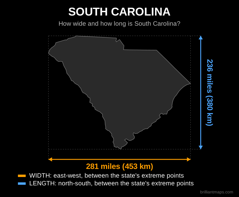
South Carolina

Map of South Carolina showing its width and length in miles and kilometers

Back to top

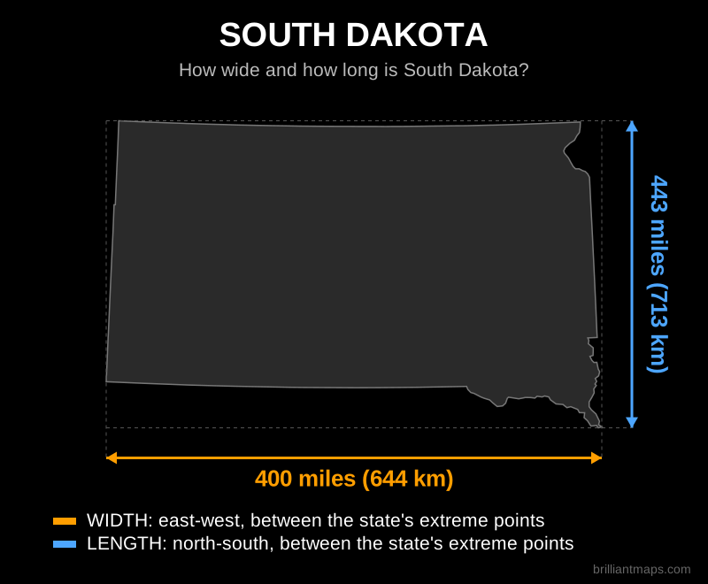
South Dakota

Map of South Dakota showing its width and length in miles and kilometers

Back to top

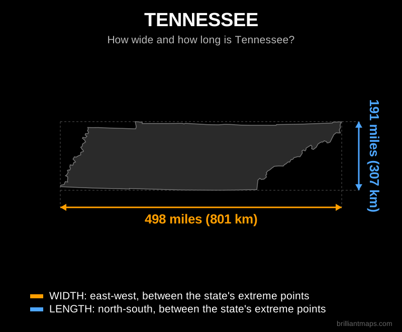
Tennessee

Map of Tennessee showing its width and length in miles and kilometers

Back to top

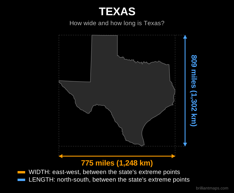
Texas

Map of Texas showing its width and length in miles and kilometers

Back to top

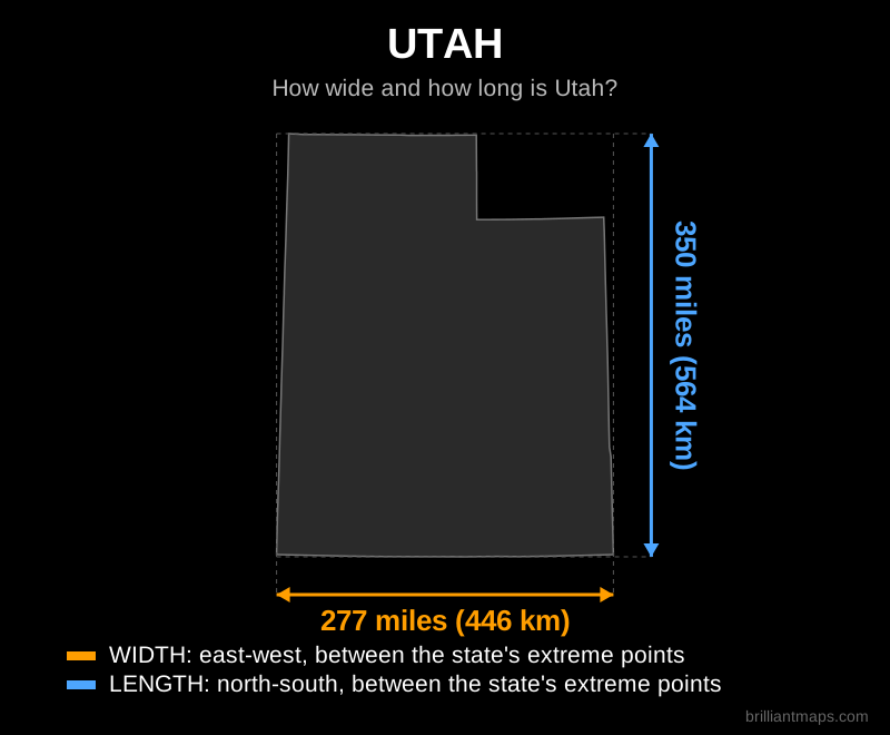
Utah

Map of Utah showing its width and length in miles and kilometers

Back to top

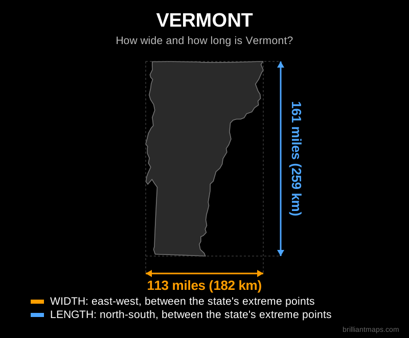
Vermont

Map of Vermont showing its width and length in miles and kilometers

Back to top

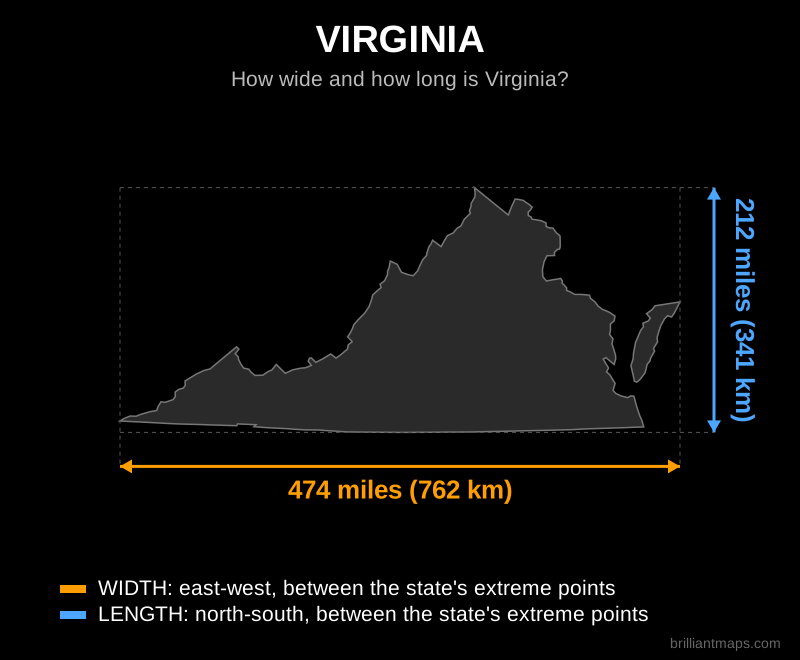
Virginia

Map of Virginia showing its width and length in miles and kilometers

Back to top

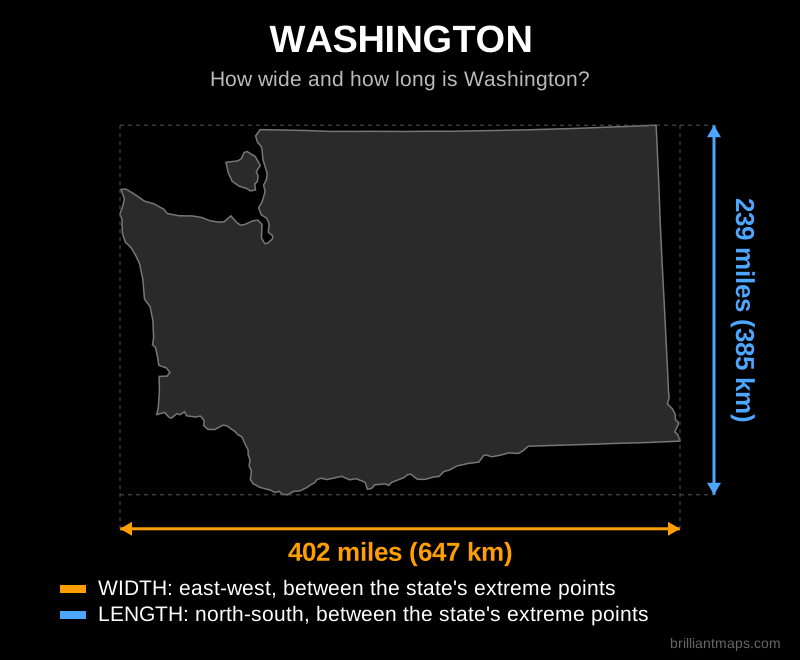
Washington

Map of Washington showing its width and length in miles and kilometers

Back to top

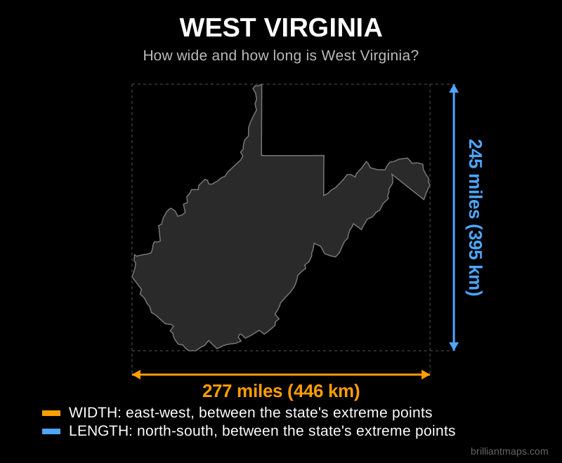
West Virginia

Map of West Virginia showing its width and length in miles and kilometers

Back to top

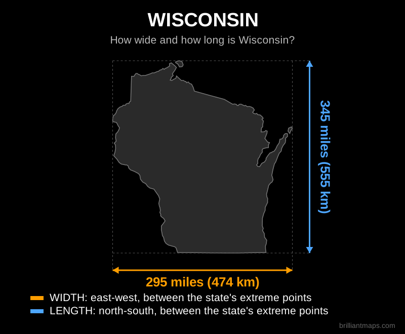
Wisconsin

Map of Wisconsin showing its width and length in miles and kilometers

Back to top

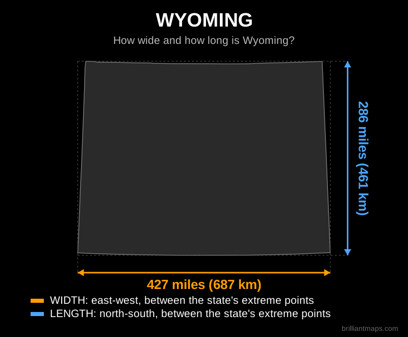
Wyoming

Map of Wyoming showing its width and length in miles and kilometers

Back to top

Data Sources and Notes

Dimensions were computed from the US Census Bureau cartographic boundary files (2024 edition). For each state, width is the great circle distance between its westernmost and easternmost boundary points and length is the great circle distance between its southernmost and northernmost boundary points, including islands. Because the boundary files are generalized for mapping, distances are accurate to within a few miles. This page is for general reference and educational purposes.

Product Reviews · World Atlas · Map Posters · Settlers of Catan · Risk · Game of Thrones · Coloring Books · Globes · Monopoly · Star Wars · Game of Life · Pandemic · Ticket To Ride · Drinks Cabinets
Size Comparisons · US Locations · Flight Maps · Fleet Management
Copyright © 2026 · Privacy Policy · Fair Use, Attribution & Copyright · Contact Us
Follow Us: Newsletter · Facebook · Youtube · Twitter · Threads · BlueSky · LinkedIn · Instagram · Pinterest · Flipboard