Thunder Bay is a city on the northwestern shore of Lake Superior in Ontario, Canada, formed in 1970 from the twin cities of Port Arthur and Fort William and once the world's largest grain-handling port. Visit Fort William Historical Park, a recreated fur-trading post, drive up Mount McKay, see the Finnish Labour Temple and the Kaministiquia River, and explore the Lake Superior National Marine Conservation Area.
Tap a picture for details or zoom in to explore.
Map data © OpenStreetMap, Natural Earth
List of all 15 things to do in Thunder Bay and where to find them
- Mount McKay Wikipedia
- Fort William First Nation Website Wikipedia
- Kaministiquia River Wikipedia
- Fort William Gardens Website Wikipedia
- Fort William Historical Park Website Wikipedia
- Fort Kaministiquia Wikipedia
- Finnish Labour Temple314 Bay Street Website Wikipedia
- Jackknife Bascule Bridge Wikipedia
- Nor'Wester Mountains Wikipedia
- Thunder Bay Public Library285 Red River Road, Thunder Bay, Ontario, P7B 1A9 Website Wikipedia
- Lake Superior National Marine Conservation Area Website Wikipedia
- Canada Games Complex Wikipedia
- Downtown Fort William Wikipedia
- Lac des Mille Lacs First Nation Website Wikipedia
- Chippewa Park Wikipedia
Official websites and travel guides
- Official Thunder Bay website: www.thunderbay.ca
- Thunder Bay travel guide: Wikivoyage
- Thunder Bay on Wikipedia
- All Thunder Bay tours and activities on Viator
Where To Stay In Thunder Bay: Interactive Thunder Bay Hotel Map
The waterfront district around Prince Arthur's Landing and Red River Road in the north core has the newer hotels, marina and restaurants; Fort William's south core and the Arthur Street strip have more motels. Compare hotels on the map below.
Top Things To Do In Thunder Bay Today
Download The Illustrated Thunder Bay Tourist Map
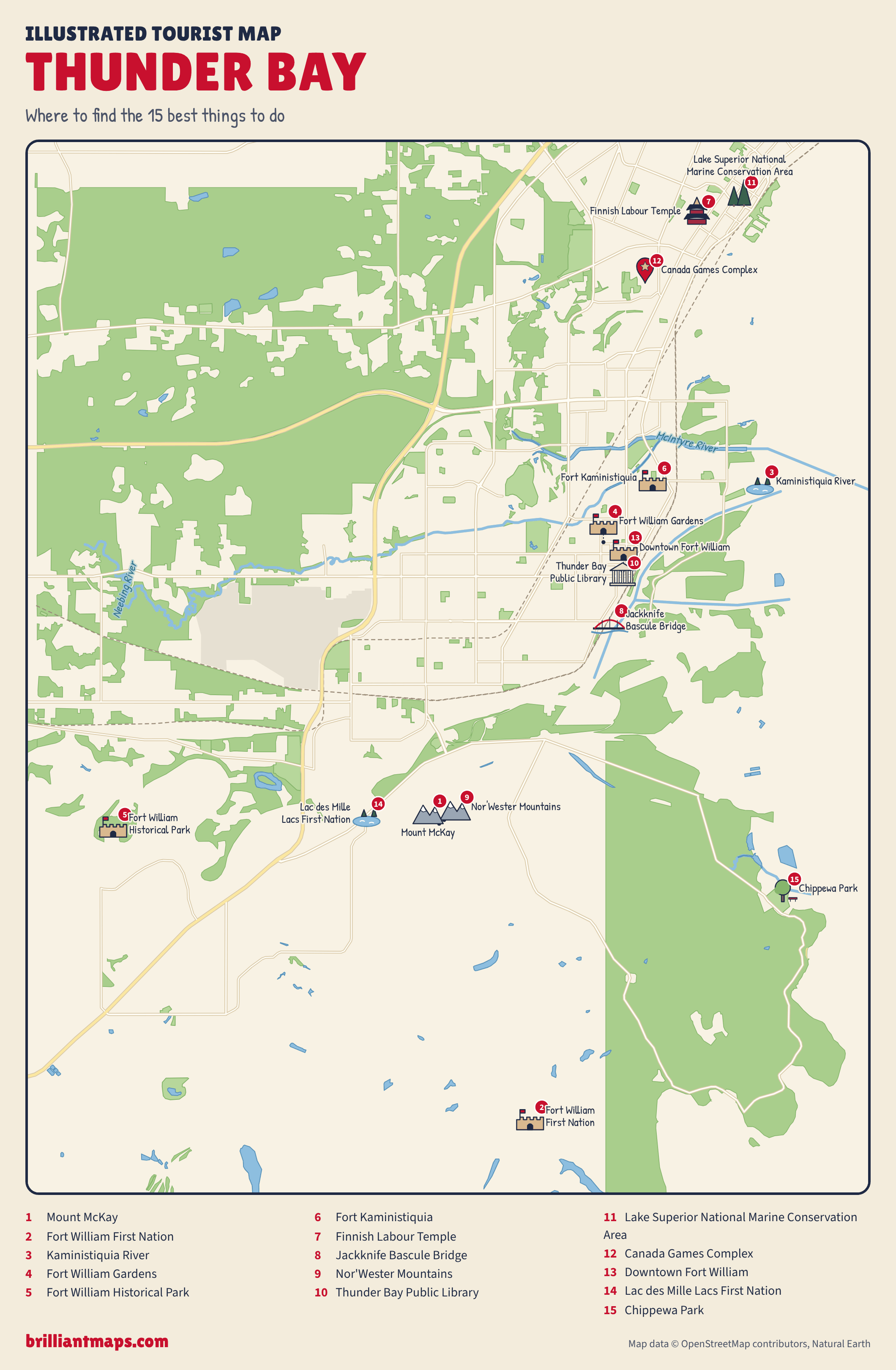
Download the Thunder Bay map (PNG)
More Tourist Maps Near Thunder Bay
Thunder Bay is part of: