Mpumalanga is a province in northeastern South Africa whose name means 'the place where the sun rises', stretching from the highveld down the Drakensberg escarpment to the lowveld and the southern half of Kruger National Park. Drive the Panorama Route to the Blyde River Canyon Nature Reserve, see Bourke's Luck Potholes, God's Window and Mac Mac Falls, base yourself in the town of Graskop and cross into Kruger.
Tap a picture for details or zoom in to explore.
Map data © OpenStreetMap, Natural Earth
List of all 9 things to do in Mpumalanga and where to find them
- Blyde River Canyon Nature Reserve Tickets and tours on Viator Wikipedia
- Bourke's Luck Potholes Tickets and tours on Viator
- Mac Mac Falls Tickets and tours on Viator Wikipedia
- Graskop Wikipedia
- Belfast Wikipedia
- Dwyka Group Wikipedia
- Mariepskop Wikipedia
- Blyderivierpoort Dam Wikipedia
- Mpumalanga Panorama Route Not shown on the map Tickets and tours on Viator Wikipedia
Official websites and travel guides
- Official Mpumalanga website: www.mpumalanga.gov.za
- Mpumalanga travel guide: Wikivoyage
- Mpumalanga on Wikipedia
- All Mpumalanga tours and activities on Viator
Where To Stay In Mpumalanga: Interactive Mpumalanga Hotel Map
Graskop and Sabie are the best bases for the Panorama Route, with guesthouses and pancake cafes; Hazyview and White River sit just outside Kruger's southern gates, and Nelspruit (Mbombela) has the airport. Compare hotels on the map below.
Top Things To Do In Mpumalanga Today
Download The Illustrated Mpumalanga Tourist Map
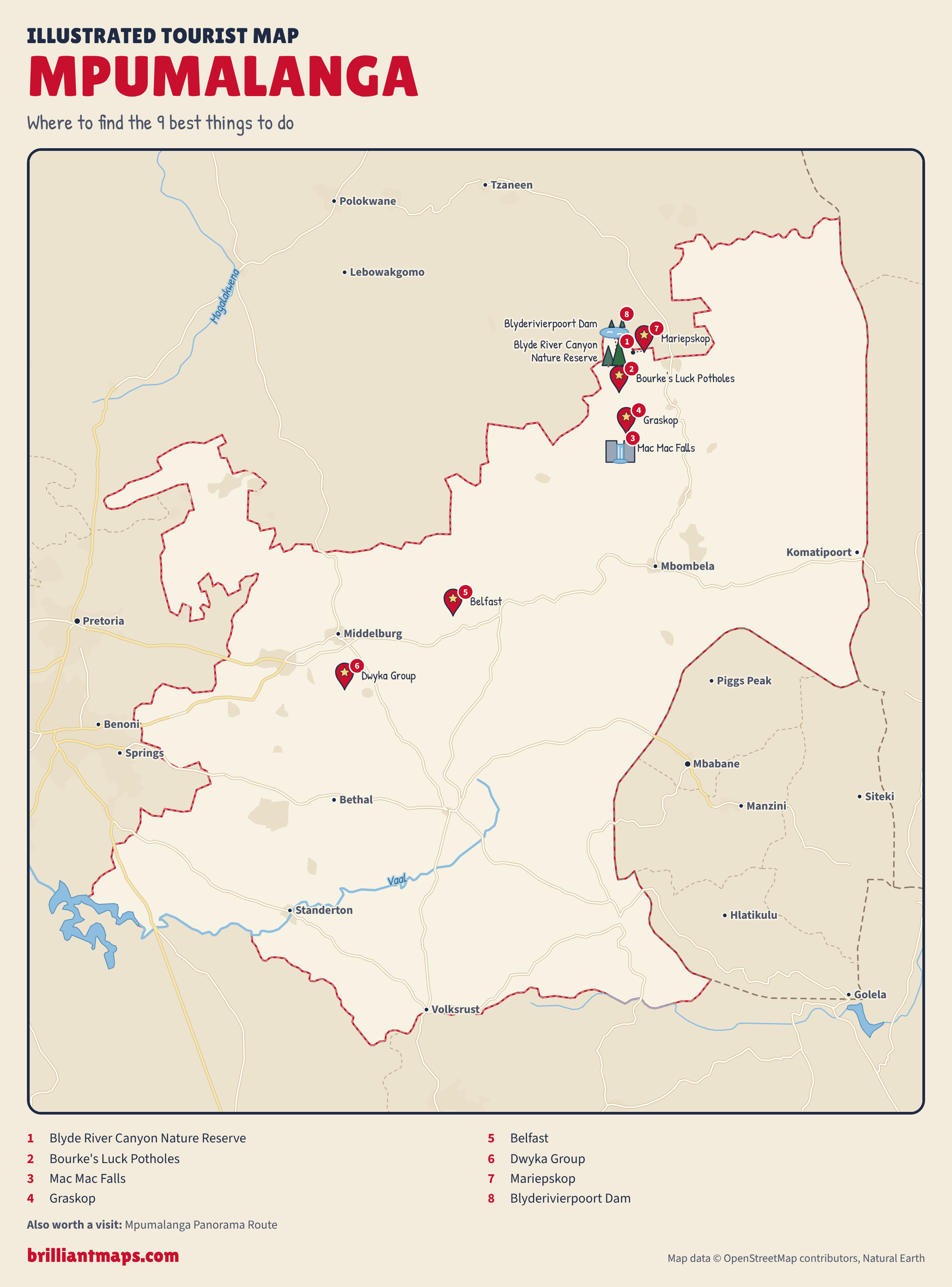
Download the Mpumalanga map (PNG)
More Tourist Maps Near Mpumalanga
Mpumalanga is part of: