Bruny Island lies off southeast Tasmania, Australia, reached by car ferry from Kettering across the D'Entrecasteaux Channel, two islands joined by a narrow isthmus called The Neck. Climb the 1838 Cape Bruny Lighthouse, walk the coastal tracks of South Bruny National Park, climb The Neck lookout to see penguins at dusk, and snorkel or kayak in the Tinderbox Marine Reserve.
Tap a picture for details or zoom in to explore.
Map data © OpenStreetMap, Natural Earth
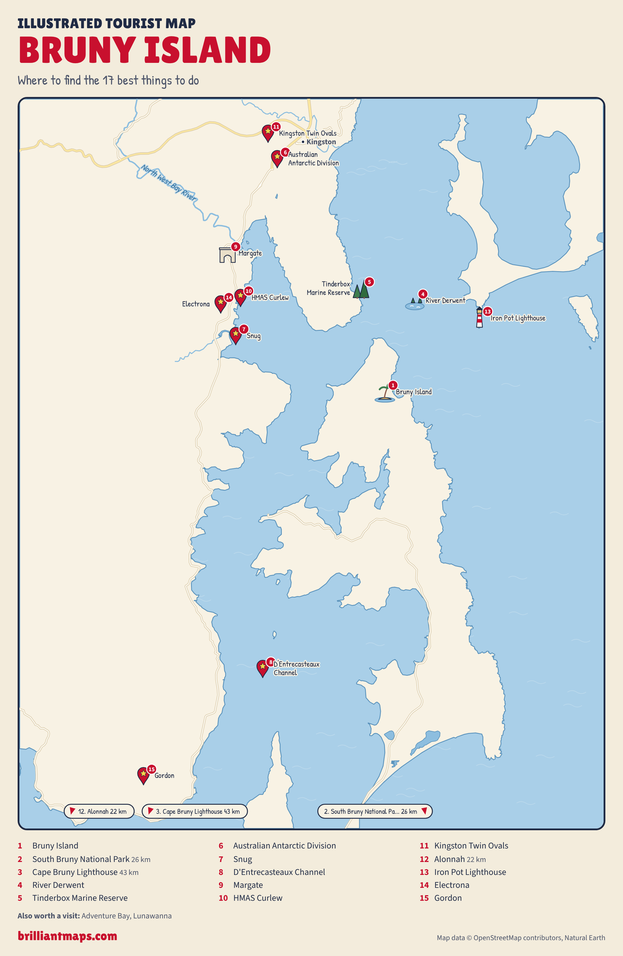
List of all 17 things to do in Bruny Island and where to find them
- Bruny Island North Bruny, Tasmania, 7150, Australia Website Tickets and tours on Viator Wikipedia
- South Bruny National Park Fluted Cape Track, South Bruny, 7150 Website Tickets and tours on Viator Wikipedia
- Cape Bruny Lighthouse 1750 Lighthouse Road, South Bruny TAS 7150 Tickets and tours on Viator
- River Derwent Tickets and tours on Viator Wikipedia
- Tinderbox Marine Reserve Tinderbox, Hobart, Tasmania, Australia Tickets and tours on Viator
- Australian Antarctic Division Website Wikipedia
- Snug Wikipedia
- D'Entrecasteaux Channel Wikipedia
- Margate Wikipedia
- HMAS Curlew Wikipedia
- Kingston Twin Ovals Wikipedia
- Alonnah Wikipedia
- Iron Pot Lighthouse Wikipedia
- Electrona Wikipedia
- Gordon Wikipedia
- Adventure BayNot shown on the map Wikipedia
- LunawannaNot shown on the map Wikipedia
Official websites and travel guides
- Official Bruny Island website: www.brunyisland.org.au
- Bruny Island travel guide: Wikivoyage
- Bruny Island on Wikipedia
- All Bruny Island tours and activities on Viator
Where To Stay In Bruny Island: Interactive Bruny Island Hotel Map
Adventure Bay on South Bruny has most of the island's cabins, cottages and the eco-cruise departure point; Alonnah and Dennes Point are quieter, and Kettering on the mainland suits an early ferry. Compare hotels on the map below.
Top Things To Do In Bruny Island Today
Download The Illustrated Bruny Island Tourist Map
Download the Bruny Island map (PNG)
More Tourist Maps Near Bruny Island
Bruny Island is part of: