The map above shows New Brunswick and South Australia side by side at exactly the same scale, using equal-area projections, so their true relative sizes are preserved.
New Brunswick vs South Australia Geography
Land area
- New Brunswick has a land area of 27,587 square miles (71,450 km²), while South Australia has 380,048 square miles (984,321 km²).
- South Australia's land area is 13.8 times larger than New Brunswick's.
Total area
- New Brunswick: 28,150 square miles (72,908 km²) vs South Australia: 380,048 square miles (984,321 km²), including inland and coastal water.
- South Australia's total area is 13.5 times larger than New Brunswick's.
Length
- New Brunswick is 241 miles (388 km) long from north to south; South Australia is 1,078 miles (1,735 km).
- South Australia's north-south length is 4.5 times (347%) longer than New Brunswick's.
Width
- New Brunswick spans 264 miles (424 km) east to west; South Australia spans 825 miles (1,328 km).
- South Australia's east-west width is 3.1 times (213%) wider than New Brunswick's.
Highest point
- New Brunswick's highest point is Mount Carleton at 2,680 feet (817 m); South Australia's is Mount Woodroffe at 4,708 feet (1,435 m).
- Mount Woodroffe is 2,028 feet higher than Mount Carleton.
Lowest point
- New Brunswick's lowest point is Atlantic Ocean at 0 feet; South Australia's is Lake Eyre at -49 feet.
- South Australia's lowest point is 49 feet lower.
New Brunswick vs South Australia Population and History
Population
- New Brunswick has a population of 867,383 (2026), while South Australia has 1,908,182 (2025).
- South Australia's population is 2.2 times (120%) larger than New Brunswick's.
Population density
- New Brunswick: 31.4 people per square mile vs South Australia: 5.0.
- New Brunswick's population density is 6.3 times (528%) higher than South Australia's.
Largest metro area
- New Brunswick's largest metropolitan area is Moncton CMA (157,717 people) vs South Australia's Greater Adelaide (1,491,015).
- Greater Adelaide's population is 9.5 times (845%) larger than Moncton CMA's.
History
- New Brunswick: Joined Confederation on July 1, 1867, as one of the four founding provinces.
- South Australia: Became an Australian state at Federation on January 1, 1901; founded as a colony in 1836.
- In its current form, New Brunswick is the older of the two by 34 years.
New Brunswick vs South Australia Economy
GDP
- New Brunswick's GDP is $35.3 billion (2024) vs South Australia's $100.2 billion.
- South Australia's economic output is 2.8 times (184%) larger than New Brunswick's.
GDP per capita
- New Brunswick: $41,088 per person vs South Australia: $52,511.
- South Australia's GDP per capita is 1.3 times (28%) higher than New Brunswick's.
Official Websites
New Brunswick official website · South Australia official website
Download the New Brunswick vs South Australia Size Comparison Map for free
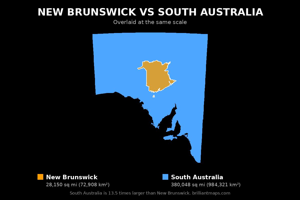
To download the map, right-click the image above (or press and hold on a phone or tablet) and choose Save image as. The map is free to use anywhere, including on your own website or in print, as long as you credit it with a link back to this page or to BrilliantMaps.com.
More Size Comparisons
All New Brunswick size comparisons · All South Australia size comparisons
Area, elevation and boundary figures come from official national statistics and US Census Bureau and Natural Earth boundary data; US state population, economic, county and tax figures come from the US Census Bureau, the Bureau of Economic Analysis and the Tax Foundation. Figures are rounded and for general reference.