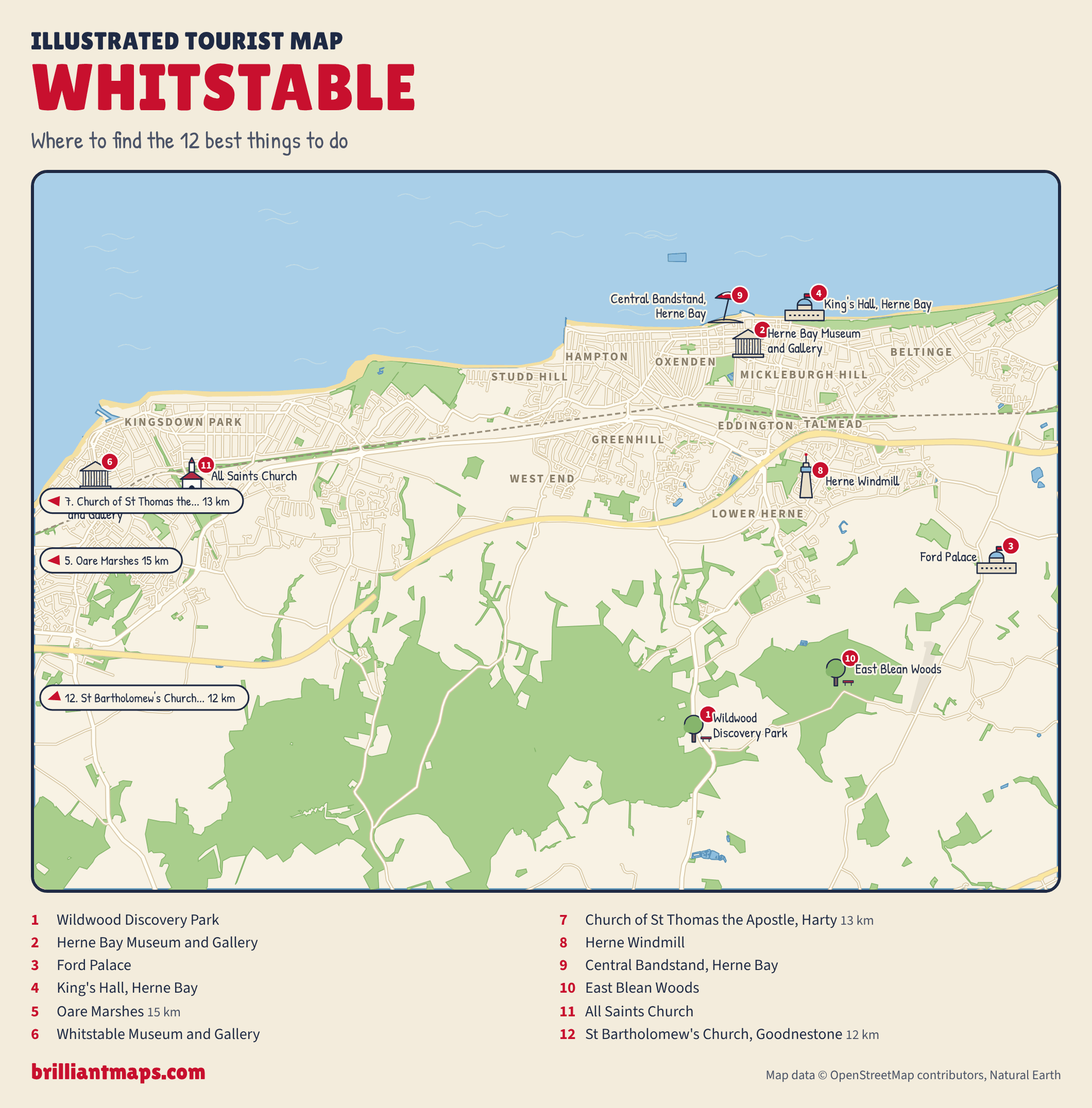
Whitstable is a seaside town on the north Kent coast, known for oysters harvested here since Roman times, weatherboard cottages, beach huts and a working harbour built in 1832 for the Canterbury and Whitstable Railway. Eat oysters on the shingle by the harbour, visit the Whitstable Museum and Gallery and All Saints Church, watch birds at Oare Marshes, and head inland to Wildwood Discovery Park and East Blean Woods.
Tap a picture for details or zoom in to explore.
Map data © OpenStreetMap, Natural Earth
List of all 12 things to do in Whitstable and where to find them
- Wildwood Discovery Park Website Wikipedia
- Herne Bay Museum and Gallery12 William Street, Herne Bay CT6 5EJ Website Wikipedia
- Ford Palace Wikipedia
- King's Hall, Herne Bay Website Wikipedia
- Oare Marshes Wikipedia
- Whitstable Museum and GalleryOxford Street, Whitstable CT5 1DB Website Wikipedia
- Church of St Thomas the Apostle, Harty Wikipedia
- Herne Windmill Wikipedia
- Central Bandstand, Herne Bay Website Wikipedia
- East Blean Woods Wikipedia
- All Saints Church Wikipedia
- St Bartholomew's Church, Goodnestone Website Wikipedia
Official websites and travel guides
- Whitstable travel guide: Wikivoyage
- Whitstable on Wikipedia
- All Whitstable tours and activities on Viator
Where To Stay In Whitstable: Interactive Whitstable Hotel Map
Stay in the town centre around Harbour Street and the seafront for the restaurants, pubs and beach on foot; neighbouring Herne Bay has cheaper rooms, and Canterbury is twenty minutes away by road or rail. Compare hotels on the map below.
Top Things To Do In Whitstable Today
Download The Illustrated Whitstable Tourist Map
Download the Whitstable map (PNG)
More Tourist Maps Near Whitstable
Whitstable is part of: