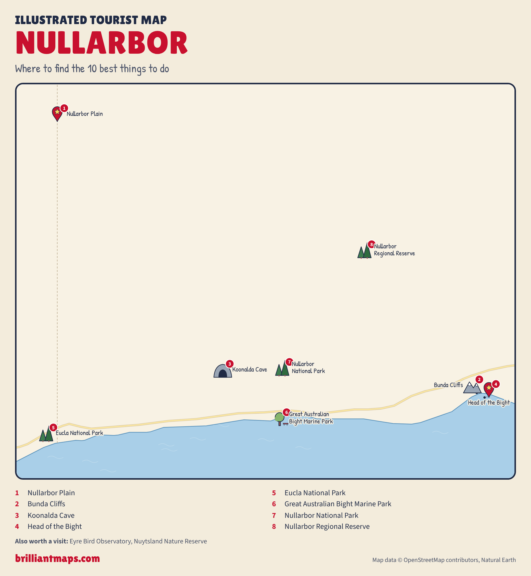
The Nullarbor is a vast treeless limestone plain stretching about 1,100 km along the Great Australian Bight between South Australia and Western Australia, crossed by the Eyre Highway and the world's longest dead-straight stretch of railway. Drive the Nullarbor Plain along the Eyre Highway, stop at the Head of Bight to watch southern right whales between June and October, look over the Bunda Cliffs and refuel at the Nullarbor Roadhouse.
List of all 10 things to do in Nullarbor and where to find them
- Nullarbor Plain Wikipedia
- Bunda Cliffs Wikipedia
- Koonalda Cave Wikipedia
- Head of the Bight Wikipedia
- Eucla National Park Website Wikipedia
- Great Australian Bight Marine Park Wikipedia
- Nullarbor National Park Website Wikipedia
- Nullarbor Regional Reserve Wikipedia
- Eyre Bird Observatory45km SE of Cocklebiddy Roadhouse, CocklebiddyNot shown on the map Website Wikipedia
- Nuytsland Nature ReserveNot shown on the map Wikipedia
Official websites and travel guides
Where To Stay In Nullarbor: Interactive Nullarbor Hotel Map
Accommodation is limited to roadhouse motels and campsites spaced along the Eyre Highway, including Nullarbor Roadhouse, Border Village and Eucla; Ceduna in the east and Norseman in the west are the nearest towns. Compare hotels on the map below.
Top Things To Do In Nullarbor Today
Download The Illustrated Nullarbor Tourist Map
Download the Nullarbor map (PNG)
More Tourist Maps Near Nullarbor
Nullarbor is part of: