Brilliant Maps

Making Sense Of The World, One Map At A Time

  • BOOK!
  • Newsletter
  • Tourist Maps
  • Quizzes
  • Polls
  • Tools

Interactive Moreton Island Tourist Map: Find The 15 Best Things To Do

Last Updated: November 11, 2026

Click To Get My 10 Best Brilliant Maps For Free:

Moreton Island is a large sand island at the mouth of Moreton Bay off Brisbane, Queensland, Australia, reached by a 75-minute ferry and almost entirely national park, with no sealed roads and dunes rising to 285 metres at Mount Tempest. Snorkel the Tangalooma Wrecks, feed wild dolphins at Tangalooma, toboggan the sand at The Desert, climb Mount Tempest, visit Cape Moreton Lighthouse, Queensland's oldest, and swim at Blue Lagoon.

Brisbane RiverBulimba CreekBrisbaneClevelandRedcliffe14. Fort Cowan Cowan14Fort Cowan Cowan6. Houghton Highway6Houghton Highway2. Hornibrook Bridge2Hornibrook Bridge11. Electoral district of Sandgate11Electoral districtof Sandgate13. Ice World Boondall13Ice World Boondall15. Bishop Island15Bishop Island9. Brisbane International Cruise Terminal9Brisbane InternationalCruise Terminal7. Bulwer Island Refinery7Bulwer Island Refinery3. Fort Lytton3Fort Lytton12. Fort Lytton National Park12Fort LyttonNational Park5. Point Lookout5Point Lookout8. Brown Lake8Brown Lake10. Dunwich Benevolent Asylum10DunwichBenevolent Asylum4. Dunwich4Dunwich1. North Stradbroke Island1North StradbrokeIsland
Tap a picture for details or zoom in to explore.
Map data © OpenStreetMap, Natural Earth

List of all 15 things to do in Moreton Island and where to find them

  1. North Stradbroke Island Wikipedia
  2. Hornibrook Bridge Wikipedia
  3. Fort Lytton Wikipedia
  4. Dunwich Wikipedia
  5. Point Lookout Wikipedia
  6. Houghton Highway Wikipedia
  7. Bulwer Island Refinery Wikipedia
  8. Brown Lake Wikipedia
  9. Brisbane International Cruise Terminal Wikipedia
  10. Dunwich Benevolent Asylum Wikipedia
  11. Electoral district of Sandgate Wikipedia
  12. Fort Lytton National Park Website Wikipedia
  13. Ice World Boondall Wikipedia
  14. Fort Cowan Cowan Wikipedia
  15. Bishop Island Wikipedia

Official websites and travel guides

  • Moreton Island travel guide: Wikivoyage
  • Moreton Island on Wikipedia
  • All Moreton Island tours and activities on Viator

Where To Stay In Moreton Island: Interactive Moreton Island Hotel Map

Tangalooma Island Resort on the west coast is the only resort and has most of the beds; Bulwer, Cowan Cowan and Kooringal have holiday houses, and the national park has beach campsites for 4WD visitors. Compare hotels on the map below.

Top Things To Do In Moreton Island Today

Download The Illustrated Moreton Island Tourist Map
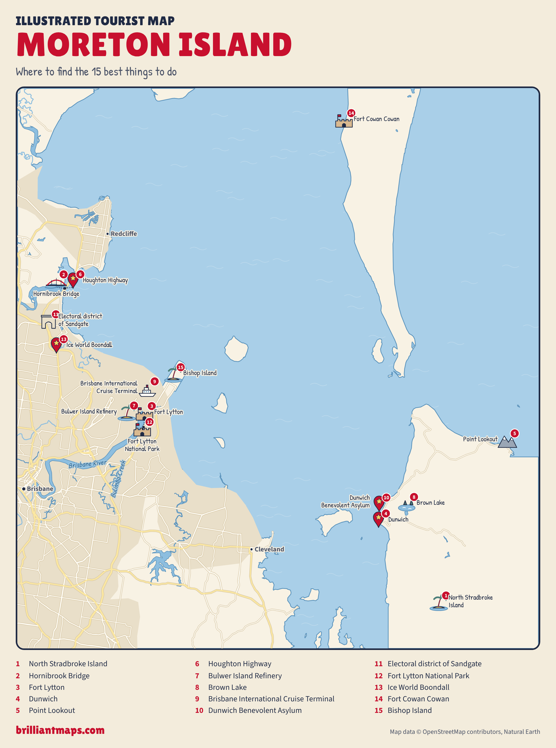
Illustrated Moreton Island Tourist Map: Where To Find The 15 Best Things To Do

Download the Moreton Island map (PNG)

More Tourist Maps Near Moreton Island

Moreton Island is part of:

  • Queensland Tourist Map
  • Australia Tourist Map


Product Reviews · World Atlas · Map Posters · Settlers of Catan · Risk · Game of Thrones · Coloring Books · Globes · Monopoly · Star Wars · Game of Life · Pandemic · Ticket To Ride · Drinks Cabinets
Size Comparisons · US Locations · Flight Maps · Fleet Management
Copyright © 2026 · Privacy Policy · Fair Use, Attribution & Copyright · Contact Us
Follow Us: Newsletter · Facebook · Youtube · Twitter · Threads · BlueSky · LinkedIn · Instagram · Pinterest · Flipboard