Manitoulin Island in Lake Huron, Ontario, is the world's largest freshwater island, reached by swing bridge at Little Current or by ferry from Tobermory, with lakes of its own and several Anishinaabe First Nations communities. Swim at Bridal Veil Falls near Kagawong, boat or fish on Lake Manitou and Lake Mindemoya, see Ojibwe art at M'Chigeeng First Nation and hike the Cup and Saucer Trail.
Tap a picture for details or zoom in to explore.
Map data © OpenStreetMap, Natural Earth
List of all 8 things to do in Manitoulin Island and where to find them
- Treasure Island Wikipedia
- Lake Manitou Wikipedia
- Lake Mindemoya Wikipedia
- M'Chigeeng First Nation Website Wikipedia
- Bridal Veil Falls Wikipedia
- Lake Kagawong Wikipedia
- Central Manitoulin Website Wikipedia
- Billings Website Wikipedia
Official websites and travel guides
- Manitoulin Island travel guide: Wikivoyage
- Manitoulin Island on Wikipedia
- All Manitoulin Island tours and activities on Viator
Where To Stay In Manitoulin Island: Interactive Manitoulin Island Hotel Map
Little Current, where the bridge arrives, has the most motels and services; Providence Bay on the south shore has the island's best sand beach, and Manitowaning and Kagawong are quiet alternatives. Find hotels on the map below.
Top Things To Do In Manitoulin Island Today
Download The Illustrated Manitoulin Island Tourist Map
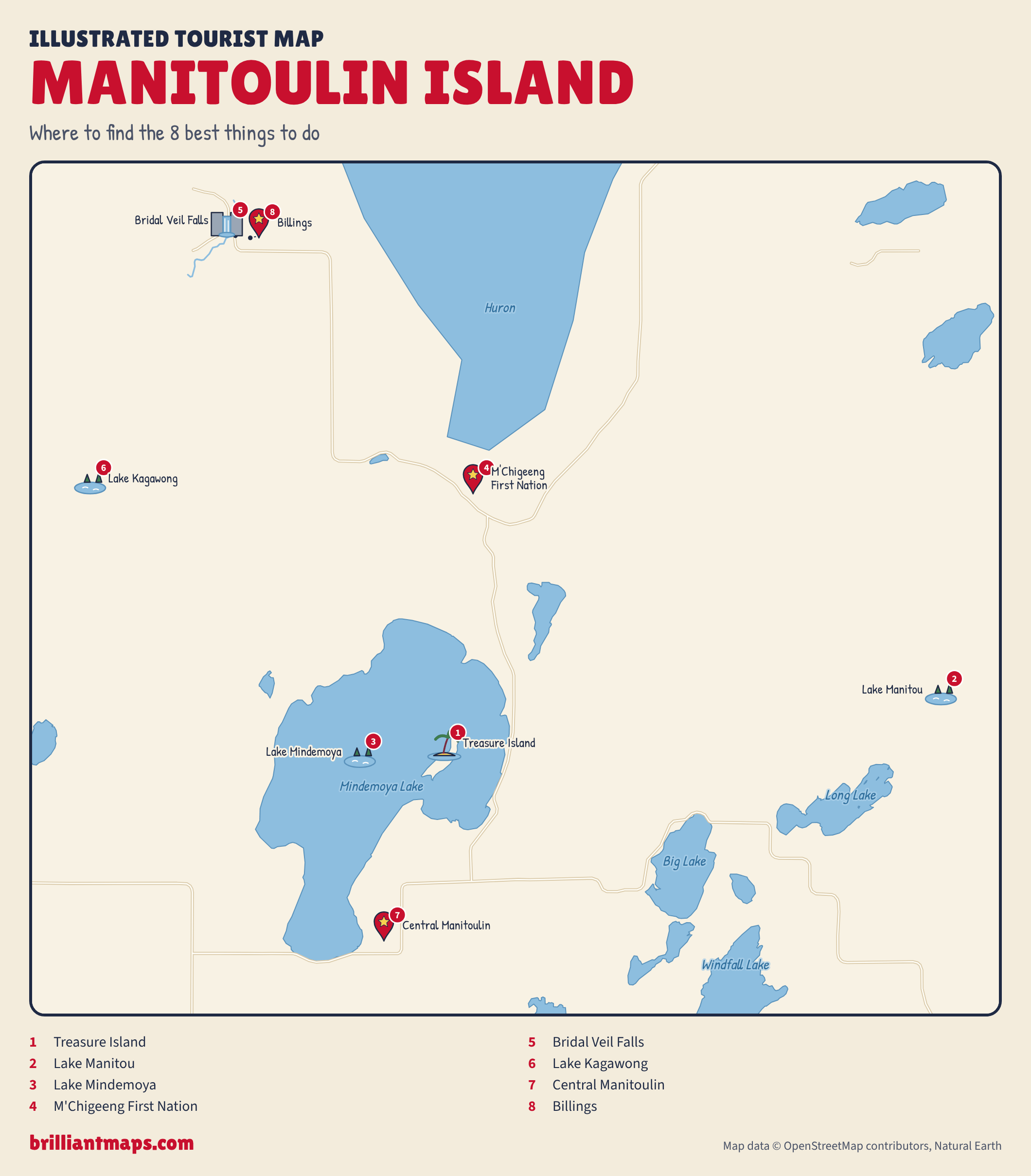
Download the Manitoulin Island map (PNG)
More Tourist Maps Near Manitoulin Island
Manitoulin Island is part of: