Brilliant Maps

Making Sense Of The World, One Map At A Time

  • BOOK!
  • Newsletter
  • Tourist Maps
  • Quizzes
  • Polls
  • Tools

Interactive Dandenong Ranges Tourist Map: Find The 23 Best Things To Do

Last Updated: November 10, 2026

Click To Get My 10 Best Brilliant Maps For Free:

The Dandenong Ranges are low forested hills about 35 km east of Melbourne in Victoria, Australia, rising to 633 metres at Mount Dandenong and known for mountain ash forest, tree ferns, gardens and tearooms. Ride the Puffing Billy Railway from Belgrave, climb the 1000 Steps at Upper Ferntree Gully, see the view from SkyHigh on Mount Dandenong, visit William Ricketts Sanctuary and drive on to Healesville Sanctuary.

13. Christmas Hills13Christmas Hills4. Healesville4Healesville5. Healesville Sanctuary5Healesville Sanctuary8. Coranderrk8Coranderrk1. Rochford Wines1Rochford Wines2. Dominique Portet Winery2DominiquePortet Winery21. Bend of Islands21Bend of Islands7. Coldstream7Coldstream22. Gruyere22Gruyere20. Lillydale Lake20Lillydale Lake19. Dandenong Ranges National Park19Dandenong RangesNational Park10. Silvan10Silvan9. Mount Dandenong9Mount Dandenong6. Sassafras6Sassafras16. Burnham Beeches, Sherbooke16Burnham Beeches,Sherbooke11. Monbulk11Monbulk18. Kallista18Kallista15. Sherbrooke Forest15Sherbrooke Forest3. Puffing Billy Railway3Puffing Billy Railway17. Gembrook railway line17Gembrook railway line12. Cardinia Reservoir (20 km away)12. Cardinia Reservoir 20 km14. Maroondah Dam (24 km away)14. Maroondah Dam 24 km
Tap a picture for details or zoom in to explore.
Map data © OpenStreetMap, Natural Earth

List of all 23 things to do in Dandenong Ranges and where to find them

  1. Rochford Wines ★ 4.6 (1,918 reviews) Tickets and tours on Viator
  2. Dominique Portet Winery ★ 4.9 (542 reviews) Tickets and tours on Viator
  3. Puffing Billy Railway Website Wikipedia
  4. Healesville Wikipedia
  5. Healesville Sanctuary Website Wikipedia
  6. Sassafras Wikipedia
  7. Coldstream Wikipedia
  8. Coranderrk19 Barak Lane, Healesville VIC 3777 Wikipedia
  9. Mount Dandenong Wikipedia
  10. Silvan Wikipedia
  11. Monbulk Wikipedia
  12. Cardinia Reservoir Wikipedia
  13. Christmas Hills Wikipedia
  14. Maroondah Dam Wikipedia
  15. Sherbrooke Forest Wikipedia
  16. Burnham Beeches, Sherbooke Wikipedia
  17. Gembrook railway line Wikipedia
  18. Kallista Wikipedia
  19. Dandenong Ranges National Park Website Wikipedia
  20. Lillydale Lake Wikipedia
  21. Bend of Islands Wikipedia
  22. Gruyere Wikipedia
  23. Hoddles CreekNot shown on the map Wikipedia

Official websites and travel guides

  • Dandenong Ranges travel guide: Wikivoyage
  • Dandenong Ranges on Wikipedia
  • All Dandenong Ranges tours and activities on Viator

Where To Stay In Dandenong Ranges: Interactive Dandenong Ranges Hotel Map

Olinda and Sassafras are the central hill villages with guesthouses, gardens and cafes; Belgrave and Upper Ferntree Gully are on the suburban train line, and Healesville suits the Yarra Valley wineries. Find hotels on the map below.

Top Things To Do In Dandenong Ranges Today

Download The Illustrated Dandenong Ranges Tourist Map
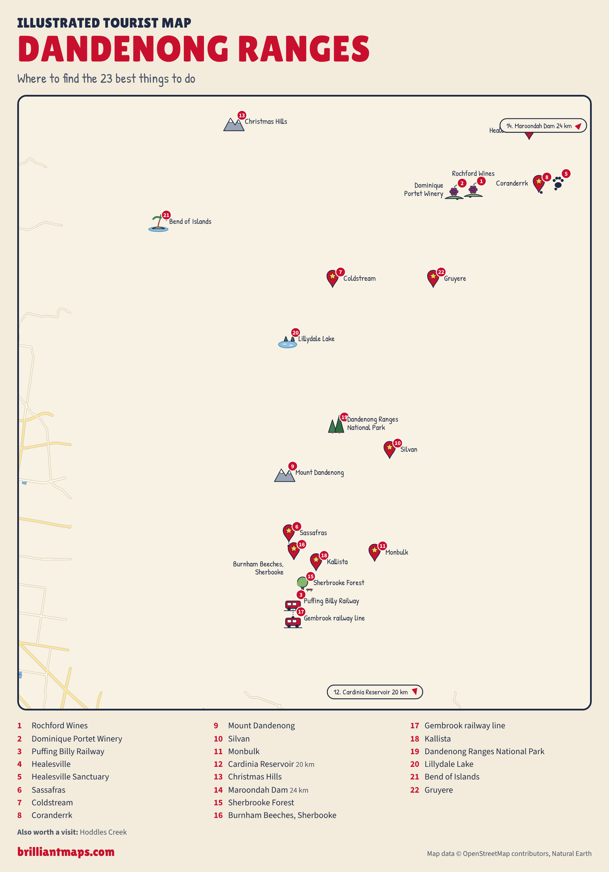
Illustrated Dandenong Ranges Tourist Map: Where To Find The 23 Best Things To Do

Download the Dandenong Ranges map (PNG)

More Tourist Maps Near Dandenong Ranges

Dandenong Ranges is part of:

  • Victoria, Australia Tourist Map
  • Australia Tourist Map


Product Reviews · World Atlas · Map Posters · Settlers of Catan · Risk · Game of Thrones · Coloring Books · Globes · Monopoly · Star Wars · Game of Life · Pandemic · Ticket To Ride · Drinks Cabinets
Size Comparisons · US Locations · Flight Maps · Fleet Management
Copyright © 2026 · Privacy Policy · Fair Use, Attribution & Copyright · Contact Us
Follow Us: Newsletter · Facebook · Youtube · Twitter · Threads · BlueSky · LinkedIn · Instagram · Pinterest · Flipboard