
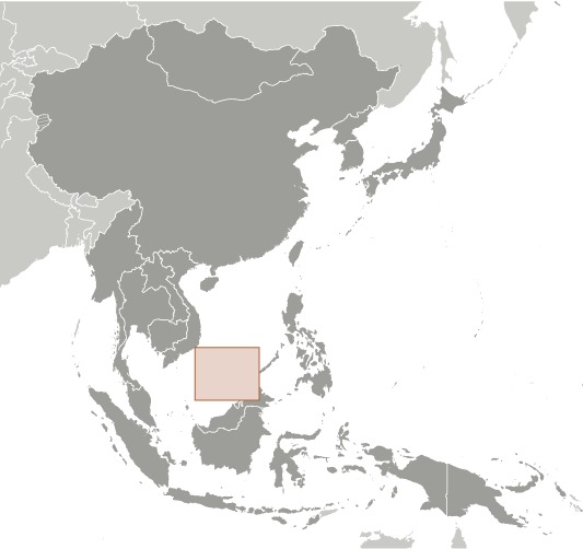
Spratly Islands Location Map
Spratly Islands Facts
Full Official Name: Spratly Islands
Demonym: N/A
Flag:

Area
Total Area: 5 km²
Total Land Area: 5 km²
Total Water Area: 0 km²
Demographics
Population: no indigenous inhabitants
Population Growth Rate: N/A
Largest City: N/A (Population: N/A)
Ethnic Groups: N/A
Languages: N/A
Religions: N/A
Economy
Currency: N/A
Real GDP at Purchasing Power Parity ($ PPP): N/A
GDP per capita (PPP): N/A
Exports Value Per Year: N/A
Biggest Export Partners: N/A
Imports Value Per Year: N/A
Biggest Import Partners: N/A
Government
Type: N/A
Capital City: N/A (Population: N/A)
Other Facts
Time Zone: UTC+8
Country Code: N/A
Internet TLD: N/A
Climate Map of Spratly Islands
Climate: tropical
Topographic Map of Spratly Islands