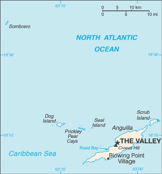
The map of Anguilla above comes from the CIA World Factbook which has now been taken offline with the following statement:
One of CIA’s oldest and most recognizable intelligence publications, The World Factbook, has sunset. The World Factbook served the Intelligence Community and the general public as a longstanding, one-stop basic reference about countries and communities around the globe.
Link to the History of The World Factbook.
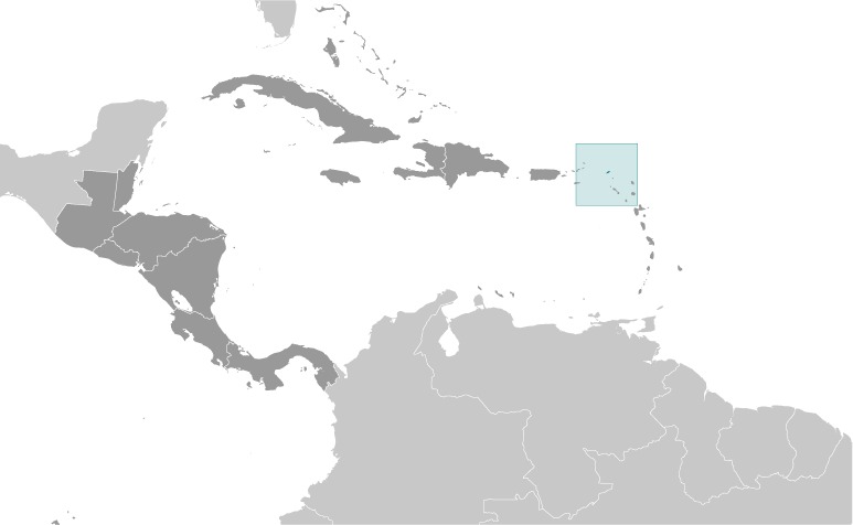
Where Is Anguilla? Location Map
Anguilla Sea Borders
- British Virgin Islands (sea): 462 km (287 miles)
- Antigua and Barbuda (sea): 344 km (214 miles)
- Saint Martin (sea): 102 km (63.4 miles)
- Saint Barthelemy (sea): 57 km (35.4 miles)
- Netherlands (sea): 27 km (16.8 miles)
- Coastline: 61 km (37.9 miles)
Anguilla Facts
Full Official Name: Anguilla
Demonym: Anguillan
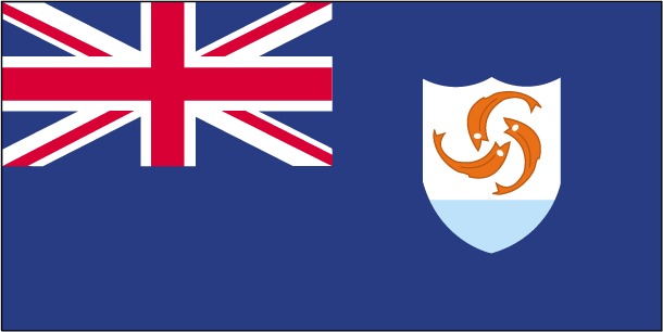
Flag:
Area
Total Area: 91 km²
Total Land Area: 91 km²
Total Water Area: 0 km²
Demographics
Population: 19,416
Population Growth Rate: 1.74% (2024 est.)
Largest City: The Valley (Population: 3,269)
Ethnic Groups: African/Black 85.3%, Hispanic 4.9%, mixed 3.8%, White 3.2%, East Indian/Indian 1%, other 1.6%, unspecified 0.3% (2011 est.)
Languages: English (official)
Religions: Protestant 73.2% (includes Anglican 22.7%, Methodist 19.4%, Pentecostal 10.5%, Seventh Day Adventist 8.3%, Baptist 7.1%, Church of God 4.9%, Presbyterian 0.2%, Brethren 0.1%), Roman Catholic 6.8%, Jehovah’s Witness 1.1%, other Christian 10.9%, other 3.2%, unspecified 0.3%, none 4.5% (2011 est.)
Economy
Currency: Eastern Caribbean dollar
Real GDP at Purchasing Power Parity ($ PPP): N/A
GDP per capita (PPP): N/A
Exports Value Per Year: $7.9 million (2017 est.)
Biggest Export Partners: Chile 74%, Hungary 7%, Kyrgyzstan 3%, US 2%, Netherlands 2% (2022)
Imports Value Per Year: $186.2 million (2017 est.)
Biggest Import Partners: Chile 48%, US 27%, Botswana 18%, Canada 1%, Japan 1% (2022)
Government
Type: parliamentary democracy (House of Assembly); self-governing overseas territory of the UK
Capital City: The Valley (Population: 3,269)
Other Facts
Time Zone: UTC–4 (AST)
Country Code: AI
Internet TLD: .ai
Climate: tropical; moderated by northeast trade winds