
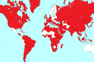
The map above clearly shows that Westeros, from the Game of Thrones TV series and the Song of Ice and Fire book series, is nothing more than Britain placed on top of an inverted Ireland.
However, looks can be deceiving since there are some pretty key differences between Westeros and the British Isles. Here are just a few:
According to the Game of Thrones Wiki: ” George R.R. Martin has stated in interviews that the continent is roughly the size of South America.” If true that means Weteros is around 17.8 million km2 vs the British Isles 0.3 million km2, making Westeros 60 times larger.
A Wiki of Ice & Fire states that the “The Wall is a massive wall over 700 feet high and is made of ice, stretching 300 miles.” On the other hand Wikipedia states that: “Hadrian’s Wall was 80 Roman miles or 117.5 km (73.0 mi) long… [and some sections were] 5 to 6 metres (16 to 20 feet) high.” Thus, the Wall in Westeros is at least 4 times longer than the real Hadrian’s Wall and around 35 times taller.
In terms of population, the British Isles today have just under 70 million people and over two dozen cities with more than 200,000 people, whereas the population of Westeros numbers in the millions with only 5 cities in the hundreds of thousands.
Ireland is about the furthest thing from a desert, unlike Dorne.
Finally, Scotland may or may not be filled with wildlings and white walkers.
For another perspective, this map compares how big Westeros is relative to Europe and Africa:

For more Game of Thrones see:
- George R. R. Martin’s A Game of Thrones 5-Book Boxed Set (Song of Ice and Fire series)
- Game of Thrones: A Pop-Up Guide to Westeros
- The World of Ice & Fire: The Untold History of Westeros and the Game of Thrones
- Game of Thrones Map of Weste Wall Poster
Can you think of any more parallels between Westeros and either Britain or Ireland? Leave your comments in the comment section below:

Joshua says
I thought the same thing because The Wall reminded me so much of Hadrian’s Wall
Henry Chinaski says
Even if there are differences, the similarities are pretty interesting. Britain just needs to be bigger. Otherwise, the similarities to dark ages Britain/Eurasia are pretty cool.
Arayma says
He actually stated that Hadrian’s Wall inspired him, dunno what the big fuss is all about.
Sheila C. says
Isn’t Tolkien’s Middle-earth England smashed together with Ireland and with Mordor where the North Sea should be? It seems a popular shape. 😉
CharlestheBold says
I have another theory. Westeros is England/Scotland with east and west reversed. and on a larger scale. Cornwall and Wales extend eastward. King’s Landing has been put in “Wales” and Cornwall has been renamed “Dorne”.
Your theory of Ireland doesn’t account for the peninsulas.
Ann says
George RR Martin stated it was Ireland flipped. By the wat there is no such place as the British Isles. Like calling somewhere the USSR. That dmpire aint no more.
Stephen says
Actually the British Isles is a geographical term and it is still very much here…. I live in them. The USSR is a political construct and hence is no more. It is the same with Great Britain, many people think it is named due to a feeling of importance but actually it is an old term to differentiate the landmass from Brittany in France.
Johno says
Yes there is. The British Isles describes the geographical feature, not a political entity.
https://en.m.wikipedia.org/wiki/British_Isles
MrSunnybones says
Its a pretty contested term though given the history of Ireland and Britain and that the government of one the two Islands doesnt actually recognise it.
(from your link) .
In Ireland, the term “British Isles” is controversial,[8][16] and there are objections to its usage.[17] The Government of Ireland does not officially recognise the term,[18] and its embassy in London discourages its use.[19] Britain and Ireland is used as an alternative description,[17][20][21] and Atlantic Archipelago has also seen limited use in academia.[22][23][24][25]
Basically even though its technically a geographical term , its impossible to separate from politics and history ..so maybe dont use it? 😉
LjSpike says
Westeros could just be England (distorted a bit), for example the Isle of Man is in a bay in the same location as where the Iron Islands are. Its then just scaled up hugely.
The Wall is in a position more suited to being Antonines wall (albeit, again scaled up and made hugely more dramatic).
The narrow sea is then the English Channel with France being Essos. Moat Cailin is where I expect Hadrian’s wall would be.
Zero11s . says
retarded map as the Earth is Flat
Alvar Fañez says
I am jusst finishing a trip in Ireland and connections awit GoT are thousands… To name a few:
Irish and Raeghar harps.
There is a Hound, giants, and childtrms of the forrest both in irish mothology and GoT
Ireland, in its latine ethimology means “the land of winter”
The Ulster has a red hand on its banner, cut of the hand of a lord by himself to win a boat competition, ehen this iriah province was left without king. The first to put a hand on the sand of the beach would win.
Arya stark walks in bravos selling oysters and mussels just like Molly Malone, a girl who at night worked as a hooker, but who did not in fact existed: No one!
Craws are everywhere in the countriside!!
Finally, all seven kigndoms must unite against a foreign invider. Does that sound familiar when talking about Ireland?
Dave says
No
James Stewart says
books are inspired by French history from the Middle ages and the fighting families that fought over and conquered not only France but many other neighbouring countries including England and north Italy. Kings landing is clearly a southern French city. The North is the British Isles and Scandinavia , the southern areas, the Mediterranean, the eastern continent, everything Asian. Go read about the Plantagenets, Valois and Capets; the Augsburg bankers, etc
jimbo uk says
Oh pleeeease, the map with a stretch can look like virtually anything and anywhere, and no matter what the inspiration for the wall, ‘hadrians wall’ an inspiration or not, could not be more different.
Holly says
You are right about various inversions and the wall. However there are a multitude of other foreign and cryptic influences thrown into the details. The name Dorne must come from the ancient name of Dorsaete, which is now Dorset, and the Pensinsula bears a great resemblance to Devon and Cornwall. Cornwall was once known as West Wales. Our beaches and dunes are covered in adders (sand snakes). But the author says the fictional country is blended with Welsh, Spanish and Lebanese influences. Seeing as Cornwall has ancient connections through the meditteranean with the tin trade, ruled by the Phoenicians (Jews) we inherited tanned skin and dark hair. Cornwall is closely related to Wales, the languages are interlinked. The iscles of Scilly grew the UKs first Narcissi, and were also mined, Narcissus of course are proud and rather fancy themselves. It won’t be an accident they are an emblem in Wales, along with the red dragon, which is also on Somerset’s flags. Heraldic symbism gives a lot away, ifyou look into the mysteries and history of tge British Isles. This map is enlightening. Notice Katness at the top?
A stannary is also a tin mining district in Devon or Cornwall. Cornish violets are an old tradition, and probably a coincidence but violets are a lesbian symbol.
Of course Essos is just like the Orient. Maybe Qarth comes from Qatar? Bravos seems based on the Colossus of Rhodes.
Mac says
This is wrong, it’s an inverted Ireland(with Cornwall tacked on) with an INVERTED Britain on top. The North(Stark country) is clearly a sort of squashed and distorted Scotland. The Hadrians wall bit still applies. The white walkers are obviously the English who defeated and conquered the Irish and Cornish(Westeros). The Lannister’s territory corresponds almost exactly with the province of Leinster, the Arryn’s territory corresponds to the Iverni(later Érainn), the Targaryens are the Tara Ard Rí(High Kings), Tully is an Irish name from Tulach, think Tullamore, Tyrell roughly corresponds Tyrconnell.
Bon says
Why is there always some fucking idiot who thinks he knows it all… it make believe story you stupid moron
Mac says
Talking to yourself again Bon Bon, I suppose that’s why your mad.
learning says
The name parallels are interesting!
However, (spoiler alert) since the wights eventually lose, I think they’re more similar to Celts in that they’re an ancient and powerful enemy who periodically try to take over but are eventually squashed. In fact, the wights were created by the children of the forest, the original inhabitants of Westeros.
Bert Sheen says
The seven kingdoms of England in the dark ages
Northumbria
WESSEX
ESSEX
Sussex
MERCIA
East Anglia
Kent
The writers themselves say that British history is the biggest influence. Especially the war of the Roses. House of Lancaster (Lannister) v the House of York (Starks).
Wessex was the largest kingdom in England before conquering all the others. Hence Westoros.
Kenneth Jack says
I thought I heard Jaime Lannister refer to England in series 7. Whilst in the map room with Cersai ? However, my hearing isn’t what it was, and the cast occasionally mumbled.
Scott Dolman says
I heard that too, which is what started this search.
Travis says
I could have sworn George R.R. Martin said the initial drawing of Westeros was Africa flipped upside down, not the UK and an inverted Ireland.
Observer says
Dorne is very obviously the giant foot from Monty Python.
learning says
If you flip the British Isles horizontally, Great Britain resembles Westeros and Ireland resembles western Essos. Irish Sea resembles Narrow Sea. London is King’s Landing and Isle of Sheppey is Dragonstone. Wales is the Vale. Put Isle of Man on the other side and it’s the Iron Islands (Man is named after Manannán, Sea God).
Western Essos has a European-like culture (hence Ireland) unlike the rest of Essos. Extend Ireland on the other side with a large desert inhabited by Asian-like people. Replace Southern England (~Dorne) with Middle Easterners.
Hadrian’s Wall is the division between the independent North and the six kingdoms, although they remain sister nations like England and Scotland.
Connect Iceland to northern Scotland – it already has the volcanoes and giants.