
While WW1 ended nearly a century ago, its scars can still be found across Northern France and Belgium. Zone Rouge (French for Red Zone) is perhaps the ultimate example of this.
Making Sense Of The World, One Map At A Time
While WW1 ended nearly a century ago, its scars can still be found across Northern France and Belgium. Zone Rouge (French for Red Zone) is perhaps the ultimate example of this.

Maps are brilliant, but wouldn’t it be nice to get one that’s personal to you?
That’s the idea behind J.Peters Fine Mapping Co. Joshua Peters founded the company to offer bespoke, hand-drawn maps to people. Above you can see his relatively minimalist hand-drawn map of London and below you can see his map of Edinburgh along with close-ups of his London map.
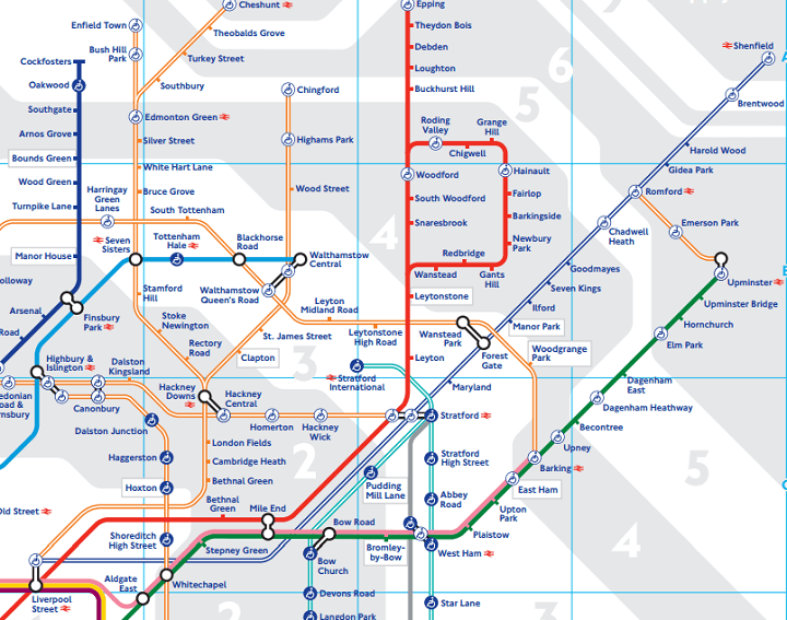
London’s tube map, arguably the most famous transportation map in the world, has just been updated for 2015. The reason is that Transport of London (TFL), which makes the map, has added some new services.
For those not living in London, TFL are the government body responsible for a large part of the transportation system of London. In addition to running London Underground they also run:

With newly released figures showing that net immigration to the UK increased to a near record 318,000 people last year, it may seem to some that the UK is overcrowded.
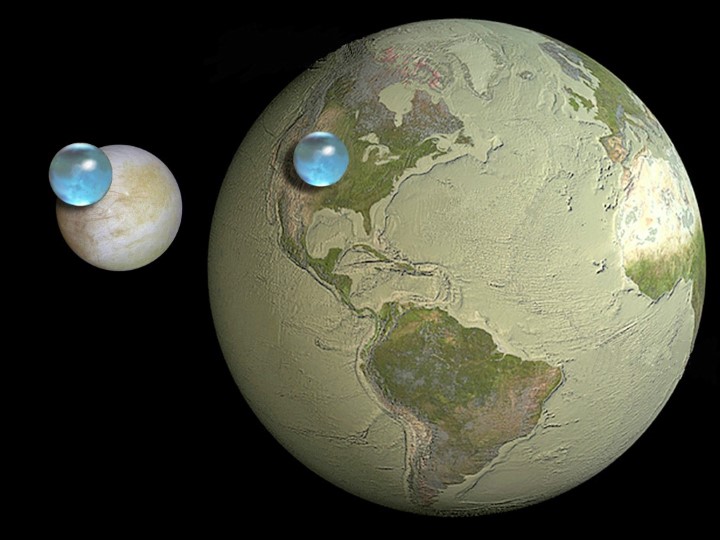
Most of us tend to think of Earth as being the sole planet in the solar system with water. Water exists on Mars, but almost exclusively as ice.
For the time being, Earth remains the lone planet in the universe to have stable bodies of liquid water on its surface. However, it may not be the celestial body with the most water or even the most liquid water within our own solar system.
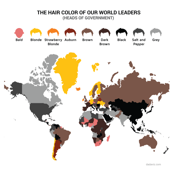
The map above created by @JodySieradzki For @dadaviz shows the hair colour of world leaders. And just to be clear this means heads of government (e.g. Prime Minsters or the US President) and not Heads of State (e.g. Queen Elizabeth II or Presidents in many other countries).
A few interesting things to note:

Using data from the US Census Bureau, the map above resizes each US state and territory based on population. If you don’t spend your time looking at population statistics there are likely a few surprises:

The map above shows all countries that have sent animals into space based on data from Wikipedia. There are quite a few surprising countries both on and off the list.
Animals include everything from fruit flies to monkeys. Reddit user walkalong compiled the complete list by country:

The map above shows the entire ‘Known World’ from Game of Thrones including Westeros and Essos in a Google map style.

The UK election may be over, but Canadians are still set to go to the polls on October 19th, 2015 to decide the fate of their own Conservative government. When they do, voters in the Territory of Nunavut will be voting in the world’s largest electoral district.
Just how big is it?